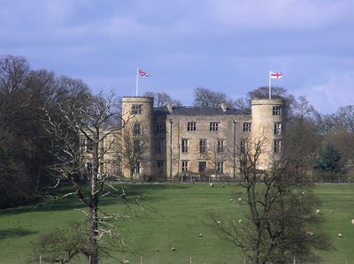
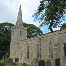
Walworth Castle, Grade I listed castle in Walworth, England
Walworth Castle is a three-story country house built from limestone rubble with five bays and topped by two round towers clad in Welsh slate. The structure displays the solid proportions typical of Tudor architecture from its period.
Construction began around 1600 when architect Thomas Holt designed the building for Thomas Jenison on the site of a 12th-century manor house. The castle's creation reflected efforts by local families to establish their presence through updated fortified residences.
The name comes from Anglo-Norman origins meaning "walk settlement". Today the castle serves as a gathering place where visitors experience Tudor-era architecture within a functioning hospitality setting.
The castle stands roughly 5 miles from Darlington and operates as a hotel with rooms distributed between the original structure and a separate adjacent building. Visitors will find accommodation split between the historic main building and newer extension spaces.
During World War II, Major Rollin Holmes oversaw the castle's conversion into a detention facility housing roughly 200 German and Italian officers. This wartime chapter remains a lesser-known aspect of the building's past that shaped its timeline.
Location: Walworth
Inception: 1600
Architects: Thomas Holt
Architectural style: Tudor architecture
GPS coordinates: 54.55763,-1.64897
Latest update: December 8, 2025 19:42
Piercebridge Roman Fort
2.9 km
Piercebridge Roman Bridge
2.8 km
Ulnaby
408 m
Thornton Hall
1.5 km
Raby Hunt Inn
2.8 km
Piercebridge Roman Fort
3 km
Church of St Edwin
2.9 km
Church of St Mary
2.9 km
Dovecote And Single Storey Range To South Of Parkside Farmhouse
500 m
Haybarn And Attached Shed South Of Parkside Farmhouse
471 m
George Hotel
3.1 km
Carlbury Bridge
2.7 km
Piercebridge Bridge
3.1 km
The Bridge House
3 km
Barn To North Of North Farm Farmhouse
1.1 km
Ice House To East Of Quarry End
958 m
Ivy House
2.9 km
Milepost South Of Carlbury Hall
2.6 km
Milepost In Front Of Number 12 (Cedar Ridge)
4 km
28, The Green
2.9 km
Round barrow 340m east of Cliffe Hall known as Betty Watson's Hill
3.3 km
2, The Green
2.9 km
Wall, Gate Piers, Overthrow And Lantern To West Of Church Of St Mary
2.9 km
Threshing Barn And Gin Gang East Of Walworth Grange Farmhouse
994 m
Medieval Chapel Ruins On Roman Foundations In Rear Garden Of Bath House, Tees View
3 km
Milepost At High Coniscliffe Bridge
3 km
The Old Hall
2.7 km
Dovecote 45 Metres East Of Manor House
3.7 kmVisited this place? Tap the stars to rate it and share your experience / photos with the community! Try now! You can cancel it anytime.
Discover hidden gems everywhere you go!
From secret cafés to breathtaking viewpoints, skip the crowded tourist spots and find places that match your style. Our app makes it easy with voice search, smart filtering, route optimization, and insider tips from travelers worldwide. Download now for the complete mobile experience.
A unique approach to discovering new places❞
— Le Figaro
All the places worth exploring❞
— France Info
A tailor-made excursion in just a few clicks❞
— 20 Minutes