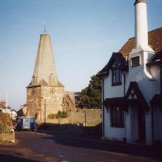
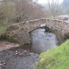
Porlock Weir, Ancient harbor settlement in Somerset West and Taunton, England
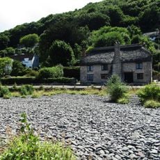
Porlock Weir is a harbor settlement on the coast of Somerset West and Taunton where sailboats and fishing boats anchor in the port. Tides control access to the maritime facilities throughout the day.
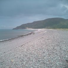
Records show Danish raids on this port in the 9th century, and in 1052 Harold Godwinson arrived with nine ships from Ireland. The place served as an important maritime stopping point over centuries.
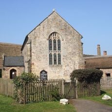
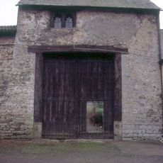
The settlement preserves 17th-century trading structures, including the Grade II listed Gibraltar Cottages that reflect local building customs of that era. These older buildings continue to shape how the place looks today.
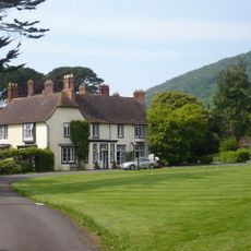
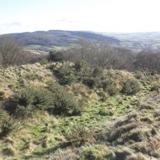
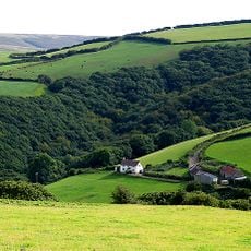
The settlement sits in a cove surrounded by steep cliffs, so take care when exploring the hillside paths around it. The best time to visit is during drier months when the paths are safer to walk.
In 1899, local residents hauled a heavy lifeboat over the steep hills using horses to reach calmer waters at sea. This feat shows how vital rescuing people at sea was to the community.
Location: Somerset West and Taunton
GPS coordinates: 51.21960,-3.62915
Latest update: December 6, 2025 16:04
Somerset preserves a broad range of historical sites away from the main visitor routes. The region shows medieval abbeys such as Muchelney and Cleeve, Norman castles like Stogursey and Nunney, Elizabethan manor houses including Cothay Manor and Lytes Cary, and prehistoric stone bridges such as Tarr...
Culbone Church
2.1 km
Church of St Dubricius, Porlock
2.7 km
Holnicote Estate
4.9 km
Porlock Stone Circle
3.8 km
Coleridge Way
3.7 km
Porlock Bay
1.7 km
Robber's Bridge
4.5 km
Stoke Pero Church
4.7 km
Bury Castle
5.5 km
Hawkcombe Woods
3.2 km
Dovery Manor Museum
2.8 km
West Somerset Rural Life Museum and Victorian School
4.3 km
Lynch Chapel of Ease
3.7 km
The Ship Inn
2.4 km
Horner packhorse bridge
4.2 km
Stables And Linhay Abutting West Lynch Farmhouse Returned To South
3.7 km
Westbourne Cottage
5.7 km
Stone circle, Porlock Common
3.8 km
Beach Cottage
285 m
Allerford packhorse bridge
4.3 km
West Luccombe packhorse bridge
4 km
Gatehouse and Gatehouse Cottage, Holnicote Estate
5 km
Barn And Round House At West Lynch Farm Park
3.7 km
West Lynch House, Dwarf Wall And Railings Returned To House As Curved Walls
3.8 km
The Whit Stones: two standing stones 230m west of Whitstone Post
2 km
Doverhay Reading Room And Cottage Abutting North End
2.8 km
Porlock Library
2.4 km
Churchyard Cross, About 10 Metres North East Of Porch, Church Of St Dubricius
2.7 kmVisited this place? Tap the stars to rate it and share your experience / photos with the community! Try now! You can cancel it anytime.
Discover hidden gems everywhere you go!
From secret cafés to breathtaking viewpoints, skip the crowded tourist spots and find places that match your style. Our app makes it easy with voice search, smart filtering, route optimization, and insider tips from travelers worldwide. Download now for the complete mobile experience.
A unique approach to discovering new places❞
— Le Figaro
All the places worth exploring❞
— France Info
A tailor-made excursion in just a few clicks❞
— 20 Minutes