Robber's Bridge

Log in to your account

AroundUs is a community-driven map of interesting places, built by curious explorers like you. It grows with every review, story, and photo you share.
Connect to save your favorite spots, contribute locations, and create personalized routes.
Continue with Google
Continue with Apple
Continue with X
Continue with Facebook
Continue with email
By continuing, you accept our Terms and Conditions and our Privacy Policy
Create an account
Add to collection
Map
Suggest a change
Share

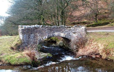
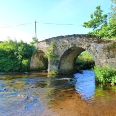
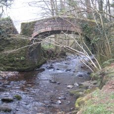
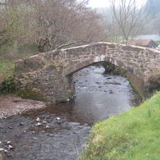
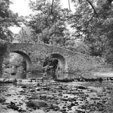
Robber's Bridge, Stone arch bridge in Oare, United Kingdom

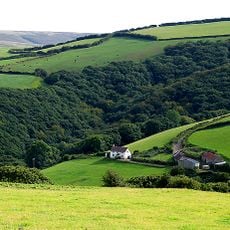
Robber's Bridge is a stone arch structure made of granite that crosses Weir Water and connects the routes through Oare Valley. It has served for centuries as a packhorse crossing, enabling the movement of goods across the remote Exmoor landscape.

The structure was first documented on the Oare Tithe Map of 1842, though it likely existed for much longer as a crucial trading route. Its foundations may date back centuries earlier, making it a long-standing crossing point in the region.

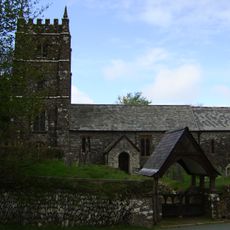
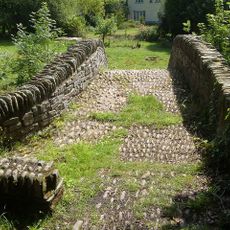
The bridge stands in the heart of Doone Valley, which inspired R.D. Blackmore's novel Lorna Doone through his grandfather's time as Oare's rector. The story has made this remote area a literary landmark that readers continue to visit and explore today.

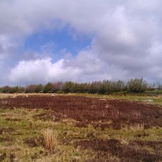
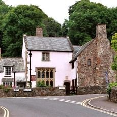
Access comes via a narrow road from Porlock Hill, with parking and grassy space for activities nearby. Finding the bridge requires some navigation skills since it sits in a remote location without major signage.

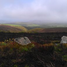
The bridge takes its name from actual outlaws who operated in this remote Exmoor area for centuries. These criminal bands shaped local history and later inspired Blackmore's fictional Doone family in his novel.

Location: Oare

Made from material: stone

GPS coordinates: 51.20500,-3.69000

Latest update: December 14, 2025 09:47

Photos
Around this place
Culbone Church
United Kingdom

Culbone Church

2.8 km
Church of St Dubricius, Porlock
United Kingdom

Church of St Dubricius, Porlock

6.6 km
Exmoor National Park
United Kingdom

Exmoor National Park

6 km
Porlock Stone Circle
United Kingdom

Porlock Stone Circle

3 km
Coleridge Way
United Kingdom

Coleridge Way

7.8 km
Watersmeet House
United Kingdom

Watersmeet House

7.9 km
Porlock Bay
United Kingdom

Porlock Bay

6.1 km
Glenthorne
United Kingdom

Glenthorne

3.8 km
Church of St Mary
United Kingdom

Church of St Mary

2 km
Stoke Pero Church
United Kingdom

Stoke Pero Church

6.5 km
Malmsmead Bridge
United Kingdom

Malmsmead Bridge

3.1 km
Hawkcombe Woods
United Kingdom

Hawkcombe Woods

6.8 km
Dovery Manor Museum
United Kingdom

Dovery Manor Museum

6.8 km
Alderman's Barrow at N of Almsworthy Common
United Kingdom

Alderman's Barrow at N of Almsworthy Common

4.4 km
The Ship Inn
United Kingdom

The Ship Inn

6.4 km
Church of St Brendan
United Kingdom

Church of St Brendan

7.1 km
Sisters Fountain And Adjoining Pool Approximately 700 Metres To South West Pf Glenthorne At Ss 7930 4917
United Kingdom

Sisters Fountain And Adjoining Pool Approximately 700 Metres To South West Pf Glenthorne At Ss 7930 4917

3.9 km
Horner packhorse bridge
United Kingdom

Horner packhorse bridge

7.7 km
Stone circle, Porlock Common
United Kingdom

Stone circle, Porlock Common

3.1 km
West Luccombe packhorse bridge
United Kingdom

West Luccombe packhorse bridge

7.8 km
Beach Cottage
United Kingdom

Beach Cottage

4.7 km
Pair Of Lime Kilns Approximately 200 Metres To East Of Watersmeet House
United Kingdom

Pair Of Lime Kilns Approximately 200 Metres To East Of Watersmeet House

7.7 km
Doverhay Reading Room And Cottage Abutting North End
United Kingdom

Doverhay Reading Room And Cottage Abutting North End

6.8 km
Oare Bridge
United Kingdom

Oare Bridge

2.1 km
Packhorse Bridge Approximately 30 Metres To West Of Leeford Bridge (That Part In Brendon Cp)
United Kingdom

Packhorse Bridge Approximately 30 Metres To West Of Leeford Bridge (That Part In Brendon Cp)

5.4 km
The Whit Stones: two standing stones 230m west of Whitstone Post
United Kingdom

The Whit Stones: two standing stones 230m west of Whitstone Post

3.3 km
Porlock Library
United Kingdom

Porlock Library

6.4 km
Churchyard Cross, About 10 Metres North East Of Porch, Church Of St Dubricius
United Kingdom

Churchyard Cross, About 10 Metres North East Of Porch, Church Of St Dubricius

6.6 km
Show the full map
Reviews

Visited this place? Tap the stars to rate it and share your experience / photos with the community! Try now! You can cancel it anytime.

« Robber's Bridge - Stone arch bridge in Oare, United Kingdom » is provided by Around Us (aroundus.com). Images and texts are derived from Wikimedia project under a Creative Commons license. You are allowed to copy, distribute, and modify copies of this page, under the conditions set by the license, as long as this note is clearly visible.

Discover hidden gems everywhere you go!

From secret cafés to breathtaking viewpoints, skip the crowded tourist spots and find places that match your style. Our app makes it easy with voice search, smart filtering, route optimization, and insider tips from travelers worldwide. Download now for the complete mobile experience.

Around Us App Screenshot

A unique approach to discovering new places

Le Figaro

All the places worth exploring

France Info

A tailor-made excursion in just a few clicks

20 Minutes