Enable Location

We need your location to show you interesting places around you

Discover nearby places

Find interesting locations and hidden gems around you

Precise directions

Get accurate directions and distances to places

Your location is never shared with other users. It's only used when you tap the location button.

Snelshall Priory

Log in to your account

Start exploring — it's free

Trusted by 63,027 travelers worldwide

Continue with Google
Continue with Apple
or

We will send you a code to connect

By continuing, you accept our Terms and Conditions and our Privacy Policy

Check your inbox

We've sent a pincode in your inbox. Please enter the code below.

Snelshall Priory
Discussion Reviews 1 Photos
1.9k Popularity

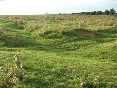
Snelshall Priory, Medieval Benedictine priory ruins in Whaddon, England.

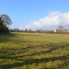
Snelshall Priory is a medieval Benedictine monastery, of which only earthworks and ditches remain visible today. The moated site occupies a defined rectangular area marked by clear boundaries that show up well in aerial photographs.

The priory was founded around 1200 when Sybil d'Aungerville donated land to establish the community. It operated for over three centuries before surrendering in 1535 during England's dissolution of monasteries.

The site preserves traces of monastic daily life that visitors can observe today, such as fishpond depressions that reveal how monks raised fish for food. These remnants speak to the practical routines of a medieval religious community.

The site can be observed from outside and shows clear earthworks and ditches that are easy to spot. As a protected archaeological monument, there are specific guidelines for how visitors can access and explore the area.

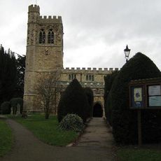
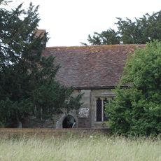
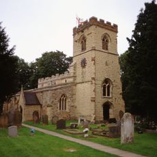
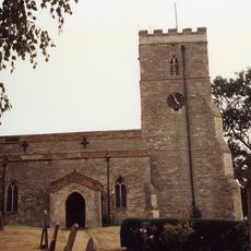
After closure, the priory's stones were not left to crumble but were reused to construct St Giles's Church in nearby Tattenhoe. This recycling reveals how the site's materials were redistributed across the region.

The community of curious travelers

AroundUs brings together thousands of curated places, local tips, and hidden gems, enriched daily by 60,000 contributors worldwide.

Start exploring
Location
GPS coordinates
52.00270,-0.81247
Latest update
January 25, 2026 19:18
Around this place
National Bowl
United Kingdom

National Bowl

4 km
The National Museum of Computing
United Kingdom

The National Museum of Computing

4.8 km
Whaddon Hall
United Kingdom

Whaddon Hall

882 m
Quadrant:MK
United Kingdom

Quadrant:MK

4.7 km
Energy World
United Kingdom

Energy World

3.3 km
Oxley Woods
United Kingdom

Oxley Woods

1 km
All Saints Church, Loughton
United Kingdom

All Saints Church, Loughton

4 km
St. Mary's Church, Bletchley
United Kingdom

St. Mary's Church, Bletchley

4.7 km
Church of the Servant King, Furzton
United Kingdom

Church of the Servant King, Furzton

3 km
St Giles's Church, Tattenhoe
United Kingdom

St Giles's Church, Tattenhoe

1.4 km
St. Mary's Church, Shenley
United Kingdom

St. Mary's Church, Shenley

2.7 km
Oxley Mead
United Kingdom

Oxley Mead

431 m
Church of the Holy Cross, Two Mile Ash
United Kingdom

Church of the Holy Cross, Two Mile Ash

4 km
Church of St Faith, Newton Longville
United Kingdom

Church of St Faith, Newton Longville

4.4 km
Church of St Mary
United Kingdom

Church of St Mary

1.2 km
Church of All Saints
United Kingdom

Church of All Saints

3.5 km
Church of St Nicholas
United Kingdom

Church of St Nicholas

4.4 km
The Talbot Inn
United Kingdom

The Talbot Inn

3.2 km
Newton Longville War Memorial
United Kingdom

Newton Longville War Memorial

4.4 km
Shenley War Memorial
United Kingdom

Shenley War Memorial

2.7 km
Former Bus Station, Station Square, Milton Keynes
United Kingdom

Former Bus Station, Station Square, Milton Keynes

4.6 km
The Shoulder Of Mutton Public House And Outbuildings Attached To North
United Kingdom

The Shoulder Of Mutton Public House And Outbuildings Attached To North

4.5 km
Old Bletchley War Memorial
United Kingdom

Old Bletchley War Memorial

4.7 km
The Crooked Billet
United Kingdom

The Crooked Billet

4 km
Milestone, Watling Street; on brow of hill in open area, Two Mile Ash
United Kingdom

Milestone, Watling Street; on brow of hill in open area, Two Mile Ash

3.8 km
Milestone, Watling Street; 100m W of roundabout with Standing Way, W of Redmoor
United Kingdom

Milestone, Watling Street; 100m W of roundabout with Standing Way, W of Redmoor

4.3 km
Milestone, Watling Street; Shenley Lodge, at jct with Kelvin Drive, N of Chaffron Way roundabout
United Kingdom

Milestone, Watling Street; Shenley Lodge, at jct with Kelvin Drive, N of Chaffron Way roundabout

3.5 km
Milestone, Watling Street; at jct with Old Bell Lane, N of Shenley Church End
United Kingdom

Milestone, Watling Street; at jct with Old Bell Lane, N of Shenley Church End

3.2 km
Show the full map
Reviews
Share your experience

No review yet

Discussions
Start a discussion...

No discussion yet

« Snelshall Priory - Medieval Benedictine priory ruins in Whaddon, England » is provided by Around Us (aroundus.com). Images and texts are derived from Wikimedia project under a Creative Commons license. You are allowed to copy, distribute, and modify copies of this page, under the conditions set by the license, as long as this note is clearly visible.

Discover hidden gems everywhere you go!

From secret cafés to breathtaking viewpoints, skip the crowded tourist spots and find places that match your style. Our app makes it easy with voice search, smart filtering, route optimization, and insider tips from travelers worldwide. Download now for the complete mobile experience.

Around Us App Screenshot

A unique approach to discovering new places

Le Figaro

All the places worth exploring

France Info

A tailor-made excursion in just a few clicks

20 Minutes

Around Us
Travel Guide & Maps
Download

Send to your phone

QR Code
1

Open the camera app on your mobile.

2

Point at the QR code with your camera. A notification will appear.

3

Tap the notification to open the link.