Chest opened
+${chestReward.xp} XP
Explorer
NOUVEAU ×${chestReward.collectible.quantity}
tapez pour fermer
Chest locked

Open chests in the app

Around Us is built for your phone — chests unlock when you walk, explore and capture nearby places.

Enable Location

We need your location to show you interesting places around you

Discover nearby places

Find interesting locations and hidden gems around you

Precise directions

Get accurate directions and distances to places

Your location is never shared with other users. It's only used when you tap the location button.

Log in to your account

Start exploring — it's free

Trusted by 72,934 travelers worldwide

Continue with Google
Continue with Apple
or

We will send you a code to connect

By continuing, you accept our Terms and Conditions and our Privacy Policy

Check your inbox

We've sent a pincode in your inbox. Please enter the code below.

Teesdale Way
Discussion Reviews Photo
2.5k Popularity

Teesdale Way, Long-distance footpath between Dufton and Warrenby, United Kingdom

The Teesdale Way is a long-distance footpath running roughly 148 kilometers along the River Tees in northern England. The route crosses open moorlands, passes through abandoned industrial areas, walks past towns with medieval roots, and eventually reaches the coast, connecting diverse landscapes and settlement types.

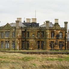
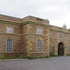
The path connects several historic places including the medieval village of Dufton, the market town of Barnard Castle, and the Victorian industrial center of Middlesbrough. These locations reflect the region's evolution from early settlements through trading hubs to modern industry.

Trail markers feature green discs bearing regional symbols: a dipper bird for Durham County and a salmon for Cleveland County. These signs connect the two regions visually as you walk.

The path divides into 14 sections, each averaging around ten kilometers and manageable in a single day of walking. Lodging options such as hostels and camping barns are positioned regularly along the route, making planning flexible and straightforward.

Between Cauldron Snout and Low Force lies High Force, where the River Tees drops roughly 21 meters over dark limestone, creating a powerful sight. These waterfalls represent one of the walk's highlights and demonstrate the river's force in carving this landscape.

The community of curious travelers

AroundUs brings together thousands of curated places, local tips, and hidden gems, enriched daily by 60,000 contributors worldwide.

Start exploring
GPS coordinates
54.61700,-1.10000
Latest update
December 12, 2025 17:41
Around this place
Zetland
United Kingdom

Zetland

2.5 km
Central Area Transmission System
United Kingdom

Central Area Transmission System

5.1 km
Wilton Castle
United Kingdom

Wilton Castle

5.4 km
Marske Hall
United Kingdom

Marske Hall

5.7 km
South Gare Lighthouse
United Kingdom

South Gare Lighthouse

4.2 km
Church of St Peter
United Kingdom

Church of St Peter

2.6 km
Church of St Cuthbert
United Kingdom

Church of St Cuthbert

5.3 km
Christ Church
United Kingdom

Christ Church

1.3 km
Church of St Cuthbert
United Kingdom

Church of St Cuthbert

3.4 km
Red Barns House and Red Barns Hotel
United Kingdom

Red Barns House and Red Barns Hotel

1.5 km
Regent Cinema
United Kingdom

Regent Cinema

1.9 km
Statue of Justice in Courtyard of Sir William Turners Hospital
United Kingdom

Statue of Justice in Courtyard of Sir William Turners Hospital

3.6 km
Turner Mausoleum Adjoining Church Of St Cuthbert
United Kingdom

Turner Mausoleum Adjoining Church Of St Cuthbert

3.4 km
Zetland Lifeboat Museum and Redcar Heritage Centre
United Kingdom

Zetland Lifeboat Museum and Redcar Heritage Centre

2.5 km
Cliff House
United Kingdom

Cliff House

5.7 km
Bastion And Adjoining Ha Ha Wall 150 Metres North Of Kirkleatham Hall Farm
United Kingdom

Bastion And Adjoining Ha Ha Wall 150 Metres North Of Kirkleatham Hall Farm

3.2 km
Kirkleatham Museum
United Kingdom

Kirkleatham Museum

3.5 km
Entrance Screen Loggias Forts Flat And Outhouses To Sir William Turners Hospital
United Kingdom

Entrance Screen Loggias Forts Flat And Outhouses To Sir William Turners Hospital

3.6 km
Kirkleatham Hall Farm
United Kingdom

Kirkleatham Hall Farm

3.4 km
Old Hall Museum
United Kingdom

Old Hall Museum

3.5 km
Town Clock
United Kingdom

Town Clock

2 km
Sir William Turner's Hospital
United Kingdom

Sir William Turner's Hospital

3.6 km
Gatepiers At Entrance To Forecourt Of Kirkleatham Hall School
United Kingdom

Gatepiers At Entrance To Forecourt Of Kirkleatham Hall School

3.4 km
Gatepiers At Entrance To Drive Of Kirkleatham Hall School
United Kingdom

Gatepiers At Entrance To Drive Of Kirkleatham Hall School

3.4 km
World War I early warning acoustic mirror 650m north west of Bridge Farm
United Kingdom

World War I early warning acoustic mirror 650m north west of Bridge Farm

3.9 km
Bastion 100 Metres North West Of Kirkleatham Hall Farm
United Kingdom

Bastion 100 Metres North West Of Kirkleatham Hall Farm

3.2 km
Gatehouse 120 Metres North East Of Kirkleatham Hall Farm
United Kingdom

Gatehouse 120 Metres North East Of Kirkleatham Hall Farm

3.3 km
Redcar Beacon
United Kingdom

Redcar Beacon

2.1 km
Show the full map
Reviews
Share your experience

No review yet

Discussions
Start a discussion...

No discussion yet

« Teesdale Way - Long-distance footpath between Dufton and Warrenby, United Kingdom » is provided by Around Us (aroundus.com). Images and texts are derived from Wikimedia project under a Creative Commons license. You are allowed to copy, distribute, and modify copies of this page, under the conditions set by the license, as long as this note is clearly visible.

Discover hidden gems everywhere you go!

From secret cafés to breathtaking viewpoints, skip the crowded tourist spots and find places that match your style. Our app makes it easy with voice search, smart filtering, route optimization, and insider tips from travelers worldwide. Download now for the complete mobile experience.

Around Us App Screenshot

A unique approach to discovering new places

Le Figaro

All the places worth exploring

France Info

A tailor-made excursion in just a few clicks

20 Minutes

Around Us
Travel Guide & Maps
Download

Send to your phone

QR Code
1

Open the camera app on your mobile.

2

Point at the QR code with your camera. A notification will appear.

3

Tap the notification to open the link.