Chest opened
+${chestReward.xp} XP
Explorer
NOUVEAU ×${chestReward.collectible.quantity}
tapez pour fermer

See the monuments around you in AR Open chests in the app

Around Us is built for your phone — point your camera at the streets and discover the monuments and places around you in augmented reality. Around Us is built for your phone — chests unlock when you walk, explore and capture nearby places.

Enable Location

We need your location to show you interesting places around you

Discover nearby places

Find interesting locations and hidden gems around you

Precise directions

Get accurate directions and distances to places

Your location is never shared with other users. It's only used when you tap the location button.

Stonehouse Creek

Log in to your account

Start exploring — it's free

Trusted by 86,820 travelers worldwide

Continue with Google
Continue with Apple
or

We will send you a code to connect

By continuing, you accept our Terms and Conditions and our Privacy Policy

Check your inbox

We've sent a pincode in your inbox. Please enter the code below.

Stonehouse Creek
Discussion Reviews 1 Photos
1.4k Popularity

Stonehouse Creek, Public park in Plymouth, United Kingdom

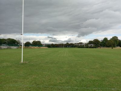
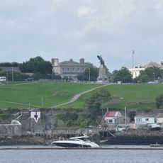
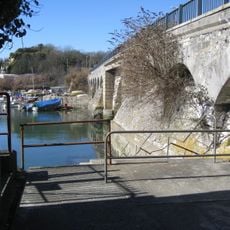
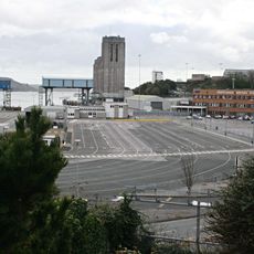
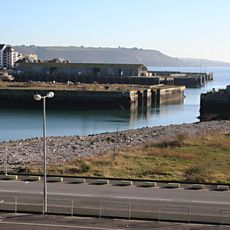
Stonehouse Creek is a waterway in Plymouth that flows with connecting channels toward the Tamar River and runs past grassy banks and walking paths. The creek is lined with open spaces and accessible points along its length, making it easy to move between different sections of the route.

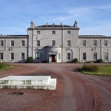
The area gained military importance in the 18th century when the Royal Naval Hospital and Stoke Military Hospital were built on opposite sides. In the early 20th century, the northern section was filled in and transformed into Victoria Park, a major change in how the area developed.

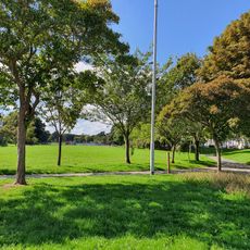
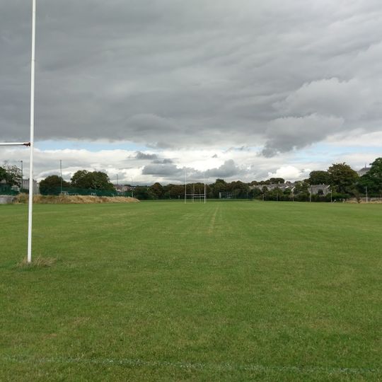
Victoria Park, created from the filled northern section of Stonehouse Creek in 1902, provides sports fields and community gathering spaces.

The best way to experience the creek is by using the walking paths that run along the banks, which are easy to follow. Be aware that conditions change with tides and weather, and some areas may be less accessible during high water.

A pedestrian bridge called Stonehouse Bridge once marked the creek's end and collected tolls from people crossing it. Local residents called it Ha'penny Bridge because the toll was just a few pence.

The community of curious travelers

AroundUs brings together thousands of curated places, local tips, and hidden gems, enriched daily by 60,000 contributors worldwide.
Start exploring
Location
Address
Mill Bridge, Stonehouse, Plymouth PL1 3NL, UK
GPS coordinates
50.37169,-4.16369
Latest update
September 13, 2026 18:42
Around this place
Plymouth Cathedral
United Kingdom

Plymouth Cathedral

0.6 mi
Admiralty House
United Kingdom

Admiralty House

0.4 mi
Church of St Andrew, Stoke Damarel
United Kingdom

Church of St Andrew, Stoke Damarel

0.2 mi
Hamoaze House
United Kingdom

Hamoaze House

0.5 mi
Victoria Park, Millbridge, Plymouth
United Kingdom

Victoria Park, Millbridge, Plymouth

0.4 mi
Church of St Peter
United Kingdom

Church of St Peter

0.4 mi
Scott Memorial
United Kingdom

Scott Memorial

0.5 mi
King Point Marina
United Kingdom

King Point Marina

0.5 mi
Stonehouse Creek Bridge
United Kingdom

Stonehouse Creek Bridge

0.1 mi
Devonport War Memorial
United Kingdom

Devonport War Memorial

0.5 mi
Boundary Stone At Junction With North Road
United Kingdom

Boundary Stone At Junction With North Road

0.3 mi
Devonport Library
United Kingdom

Devonport Library

0.5 mi
United Kingdom

Former Royal Naval Hospital Sundial In Front And West Of The Quadrangle Centre

0.3 mi
United Kingdom

Jeffery Tomb Immediately South Of Church Of St Andrew

0.2 mi
United Kingdom

Harbour Walls, Wharfs And Quays On East Side Of Stonehouse Pool

0.4 mi
Plymouth Port
United Kingdom

Plymouth Port

0.5 mi
Royal Marine Barracks, Railings Along Durnford Street
United Kingdom

Royal Marine Barracks, Railings Along Durnford Street

0.3 mi
United Kingdom

Furneaux Tomb Immediately North Of Church Of St Andrew

0.2 mi
Royal Marine Barracks Archway Block
United Kingdom

Royal Marine Barracks Archway Block

0.4 mi
Millbay Docks, Inner Basin
United Kingdom

Millbay Docks, Inner Basin

0.5 mi
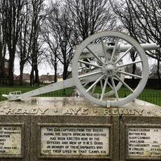
Hms Doris Memorial Gun
United Kingdom

Hms Doris Memorial Gun

0.5 mi
1-15 and 12A, Hotham Place
United Kingdom

1-15 and 12A, Hotham Place

0.3 mi
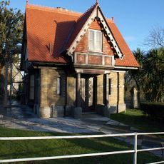
Lower Lodge
United Kingdom

Lower Lodge

0.4 mi
United Kingdom

Gate Piers, Walls And Attached Building To Devonport High School For Boys

0.2 mi
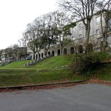
Devonport High School For Boys
United Kingdom

Devonport High School For Boys

0.2 mi
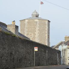
Former Royal Naval Hospital Water Tower
United Kingdom

Former Royal Naval Hospital Water Tower

0.3 mi
United Kingdom

Main Gateway At Raglan Barracks

0.4 mi
United Kingdom

Old Gun Wharf Wall

0.5 mi
Show the full map
Reviews
Share your experience

No review yet

Discussions
Start a discussion...

No discussion yet

« Stonehouse Creek - Public park in Plymouth, United Kingdom » is provided by Around Us (aroundus.com). Images and texts are derived from Wikimedia project under a Creative Commons license. You are allowed to copy, distribute, and modify copies of this page, under the conditions set by the license, as long as this note is clearly visible.

Discover hidden gems everywhere you go!

From secret cafés to breathtaking viewpoints, skip the crowded tourist spots and find places that match your style. Our app makes it easy with voice search, smart filtering, route optimization, and insider tips from travelers worldwide. Download now for the complete mobile experience.

Around Us App Screenshot

A unique approach to discovering new places

Le Figaro

All the places worth exploring

France Info

A tailor-made excursion in just a few clicks

20 Minutes

Around Us
Travel Guide & Maps
Download

Send to your phone

QR Code
1

Open the camera app on your mobile.

2

Point at the QR code with your camera. A notification will appear.

3

Tap the notification to open the link.