Wansunt Pit

Log in to your account

AroundUs is a community-driven map of interesting places, built by curious explorers like you. It grows with every review, story, and photo you share.
Connect to save your favorite spots, contribute locations, and create personalized routes.
By continuing, you accept our Terms and Conditions and our Privacy Policy
Add to collection
Map
Suggest a change
Share

Wansunt Pit, Nature reserve and geological site in Dartford Heath, United Kingdom
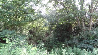
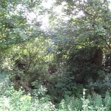
Wansunt Pit extends across 1.9 hectares of land between Crayford in the London Borough of Bexley and Dartford in Kent.

Archaeological excavations at the site revealed stone tools of Homo Heidelbergensis dating from 424,000 to 374,000 years ago.

The location forms part of Braeburn Park, managed by London Wildlife Trust, contributing to scientific research and geological understanding.

The site contains two separate units, with one section crossing Galloway Drive and another northwest of Denton Road that remains closed to access.

The exposed Dartford Heath Gravel at this location provides essential data about the relationship with Swanscombe sequence and Thames Terraces.

GPS coordinates: 51.44120,0.17702

Latest update: March 3, 2025 22:13

Around this place
Show the full map
Hall Place and Gardens
United Kingdom

Hall Place and Gardens

1.4 km
The Mick Jagger Centre
United Kingdom

The Mick Jagger Centre

2 km
One Bell
United Kingdom

One Bell

1.4 km
Bexley Civic Offices
United Kingdom

Bexley Civic Offices

2.3 km
Braeburn Park
United Kingdom

Braeburn Park

566 m
The King's Head Inn
United Kingdom

The King's Head Inn

1.9 km
Crayford Town Hall
United Kingdom

Crayford Town Hall

1 km
Church of St Paulinus, Crayford
United Kingdom

Church of St Paulinus, Crayford

1.5 km
Parish Church of St Mary the Virgin
United Kingdom

Parish Church of St Mary the Virgin

1.6 km
Christ Church
United Kingdom

Christ Church

1.8 km
Coal Duty Boundary Marker (In The Fence To The Back Of The Garden Of Number 57 Baldwyn's Park) And Adjacent Iron Bollard
United Kingdom

Coal Duty Boundary Marker (In The Fence To The Back Of The Garden Of Number 57 Baldwyn's Park) And Adjacent Iron Bollard

1.3 km
Bexley War Memorial
United Kingdom

Bexley War Memorial

2.2 km
Coal Duty Boundary Marker (On The South Side Of Number 1)
United Kingdom

Coal Duty Boundary Marker (On The South Side Of Number 1)

1 km
Crayford War Memorial
United Kingdom

Crayford War Memorial

1.9 km
Barn At Hall Place
United Kingdom

Barn At Hall Place

1.4 km
The Long Shed (Part Of David Evans Limited Factory At Number 71)
United Kingdom

The Long Shed (Part Of David Evans Limited Factory At Number 71)

1.2 km
Cray House
United Kingdom

Cray House

1.7 km
Lychgate to South West of Parish Church of St Mary the Virgin
United Kingdom

Lychgate to South West of Parish Church of St Mary the Virgin

1.6 km
Milestone Opposite Nos 179 And 179A
United Kingdom

Milestone Opposite Nos 179 And 179A

1.5 km
16, North Cray Road
United Kingdom

16, North Cray Road

1.7 km
Granary Approximately 25 Metres South South East Of Hall Place
United Kingdom

Granary Approximately 25 Metres South South East Of Hall Place

1.4 km
Lychgate to West of Parish Church of St Paulinus
United Kingdom

Lychgate to West of Parish Church of St Paulinus

1.5 km
Crayford Manor House
United Kingdom

Crayford Manor House

1.9 km
Garden Wall, Gatepiers And Gates To North Amd West Of Hall Place
United Kingdom

Garden Wall, Gatepiers And Gates To North Amd West Of Hall Place

1.5 km
The Oakwood
United Kingdom

The Oakwood

1.6 km
Milepost, Hurst Road, nr jct with Bexley High Street, by Church Hall
United Kingdom

Milepost, Hurst Road, nr jct with Bexley High Street, by Church Hall

2.1 km
High Street House
United Kingdom

High Street House

1.7 km
Milestone, Old Bexley Lane, 40m E of Kent Boundary post
United Kingdom

Milestone, Old Bexley Lane, 40m E of Kent Boundary post

990 m
Show the full map

Reviews

Visited this place? Tap the stars to rate it and share your experience / photos with the community! Try now! You can cancel it anytime.

« Wansunt Pit: Nature reserve and geological site in Dartford Heath, United Kingdom » is provided by Around Us (aroundus.com). Images and texts are derived from Wikimedia project under a Creative Commons license. You are allowed to copy, distribute, and modify copies of this page, under the conditions set by the license, as long as this note is clearly visible.

Discover hidden gems everywhere you go!

From secret cafés to breathtaking viewpoints, skip the crowded tourist spots and find places that match your style. Our app makes it easy with voice search, smart filtering, route optimization, and insider tips from travelers worldwide. Download now for the complete mobile experience.

Around Us App Screenshot

A unique approach to discovering new places

Le Figaro

All the places worth exploring

France Info

A tailor-made excursion in just a few clicks

20 Minutes