Enable Location

We need your location to show you interesting places around you

Discover nearby places

Find interesting locations and hidden gems around you

Precise directions

Get accurate directions and distances to places

Your location is never shared with other users. It's only used when you tap the location button.

Fort Bovisand

Log in to your account

Join the adventure

Create your free account and start exploring (like 60k+ others)

We will send you a code to connect

or
Continue with Google
Continue with Apple
By continuing, you accept our Terms and Conditions and our Privacy Policy

Check your inbox

We've sent a pincode in your inbox. Please enter the code below.

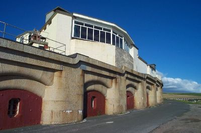
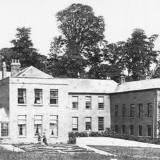
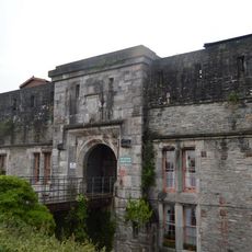
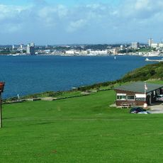
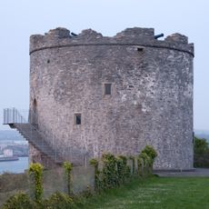
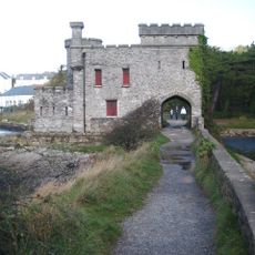
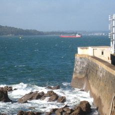
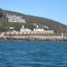
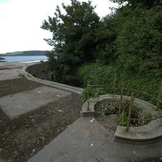
Fort Bovisand, Victorian coastal fort in Wembury, England.

Description

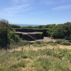
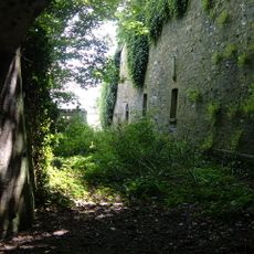
Fort Bovisand is a 19th-century military fortification on the Wembury coast featuring stone walls, gun emplacements, and multiple levels of defense installations. The structure includes interconnected passages, observation points, and various chambers that demonstrate the coastal defense engineering approach of that period.

History

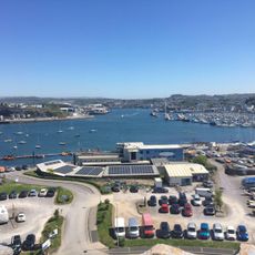
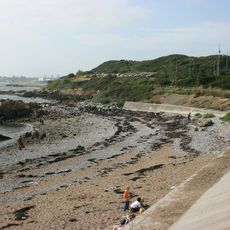
The fort was established in 1861 as part of a defensive network protecting Plymouth Sound from potential naval threats during the Victorian era. This construction reflected Britain's security concerns at a time of international maritime tensions.

Culture

The fort serves as a place where visitors can experience Victorian-era military life and understand the importance of coastal defense in everyday community life. Walking through its chambers and passages reveals how the structure shaped the way people thought about protection and security in the 1800s.

Practical

Access to the different levels involves narrow staircases and low doorways, so sturdy footwear and careful movement are advisable. Guided tours help visitors understand the function of each chamber and passage while safely navigating through the fort.

Did you know?

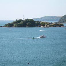
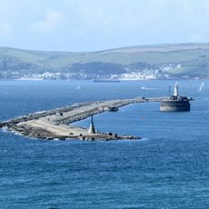
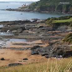
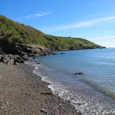
The site still displays water collection systems that reveal how sailing vessels once gathered fresh water supplies at this location. A preserved stone jetty serves as physical evidence of this practical relationship between the fort and naval supply routes.

i
Location
i
Inception
1861
i
GPS coordinates
50.33667,-4.12722
i
Latest update
December 11, 2025 11:06

AroundUs brings together thousands of curated places, local tips, and hidden gems, enriched daily by 60,000 contributors worldwide. Discover all places nearby (Wembury).

Around this place
Drake's Island
United Kingdom

Drake's Island

2.8 km
Plymouth Breakwater
United Kingdom

Plymouth Breakwater

1.5 km
RM Turnchapel
United Kingdom

RM Turnchapel

2.7 km
Radford
United Kingdom

Radford

2.5 km
Fort Stamford
United Kingdom

Fort Stamford

2.1 km
Plymouth Sound, Shores and Cliffs
United Kingdom

Plymouth Sound, Shores and Cliffs

1.1 km
Staddon Fort
United Kingdom

Staddon Fort

1.4 km
Lord Howard's Battery
United Kingdom

Lord Howard's Battery

1.7 km
Lentney Battery
United Kingdom

Lentney Battery

1.6 km
Jennycliff
United Kingdom

Jennycliff

1.7 km
Plymouth Breakwater Lighthouse
United Kingdom

Plymouth Breakwater Lighthouse

2.3 km
Mount Batten Watersports & Activities
United Kingdom

Mount Batten Watersports & Activities

2.6 km
Mount Batten Beach
United Kingdom

Mount Batten Beach

2.3 km
Mount Batten Breakwater
United Kingdom

Mount Batten Breakwater

2.6 km
Mount Batten Tower
United Kingdom

Mount Batten Tower

2.6 km
Plymouth Breakwater, Fort and Lighthouse
United Kingdom

Plymouth Breakwater, Fort and Lighthouse

2.2 km
Hooe Lake
United Kingdom

Hooe Lake

2.5 km
Flying Boat Hangars At Former Raf Mount Batten
United Kingdom

Flying Boat Hangars At Former Raf Mount Batten

2.4 km
Group Of 4 Second World War Coastal Artillery Search Lights
United Kingdom

Group Of 4 Second World War Coastal Artillery Search Lights

122 m
Radford Bridge And Castle
United Kingdom

Radford Bridge And Castle

2.8 km
Bovisand Harbour And Pier
United Kingdom

Bovisand Harbour And Pier

76 m
RAF Mount Batten Memorial
United Kingdom

RAF Mount Batten Memorial

2.6 km
Staddon Heights Defences including Fort Staddon Fort, Brownhill Battery, Watch House Battery, Staddon Heights Battery, Staddon Battery and associated features and structures
United Kingdom

Staddon Heights Defences including Fort Staddon Fort, Brownhill Battery, Watch House Battery, Staddon Heights Battery, Staddon Battery and associated features and structures

930 m
Plymouth Breakwater Fort
United Kingdom

Plymouth Breakwater Fort

1.6 km
Staddon Heights Battery
United Kingdom

Staddon Heights Battery

101 m
The coastal fortifications of Drake's Island
United Kingdom

The coastal fortifications of Drake's Island

2.8 km
Commanding Officers House
United Kingdom

Commanding Officers House

2.9 km
Mount Batten: 17th century artillery tower, Civil War breastwork, and World War II remains
United Kingdom

Mount Batten: 17th century artillery tower, Civil War breastwork, and World War II remains

2.5 km
Show the full map
Reviews

Visited this place? Tap the stars to rate it and share your experience / photos with the community! Try now! You can cancel it anytime.

« Fort Bovisand - Victorian coastal fort in Wembury, England » is provided by Around Us (aroundus.com). Images and texts are derived from Wikimedia project under a Creative Commons license. You are allowed to copy, distribute, and modify copies of this page, under the conditions set by the license, as long as this note is clearly visible.

Discover hidden gems everywhere you go!

From secret cafés to breathtaking viewpoints, skip the crowded tourist spots and find places that match your style. Our app makes it easy with voice search, smart filtering, route optimization, and insider tips from travelers worldwide. Download now for the complete mobile experience.

Around Us App Screenshot

A unique approach to discovering new places

Le Figaro

All the places worth exploring

France Info

A tailor-made excursion in just a few clicks

20 Minutes