Plymouth Sound, Shores and Cliffs

Log in to your account

AroundUs is a community-driven map of interesting places, built by curious explorers like you. It grows with every review, story, and photo you share.
Connect to save your favorite spots, contribute locations, and create personalized routes.
Continue with Google
Continue with Apple
Continue with X
Continue with Facebook
Continue with email
By continuing, you accept our Terms and Conditions and our Privacy Policy
Create an account
Add to collection
Map
Suggest a change
Share

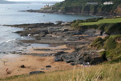
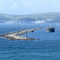
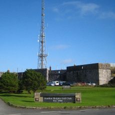
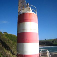
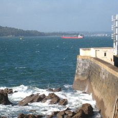
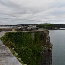
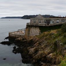
Plymouth Sound, Shores and Cliffs, Protected marine inlet in Devon, United Kingdom.

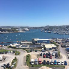
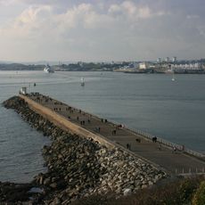
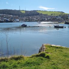
Plymouth Sound is a protected marine inlet on England's southwest coast, stretching between Cornwall and Devon and sheltered from English Channel tides by a breakwater. The waters receive two river inflows and provide multiple passages to open sea and freshwater sources, creating a complex maritime ecosystem.

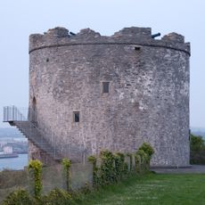
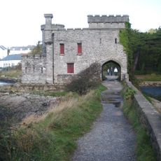
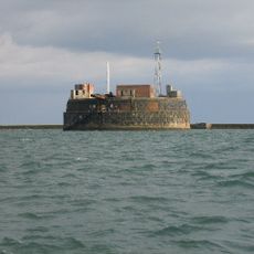
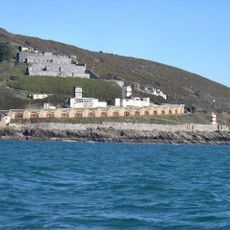
This inlet held military significance as early as the 14th century, when English fleets gathered here before embarking on major battles. Its role as a strategic harbor remained central throughout the centuries, making it a turning point in European maritime history.

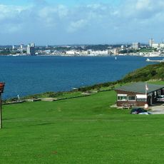
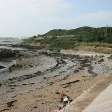
The name Plymouth Sound reflects its role as a protected harbor that has welcomed trading vessels for centuries and shaped the region's economic identity. Today visitors experience the shoreline as a meeting point between sea and land, a connection that holds meaning for both sailors and researchers.

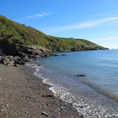
Visitors can explore the bays and shorelines on foot or by boat, with access varying depending on tides and weather conditions. It helps to check tide information before planning your visit to find the best conditions for your intended activities.

An unusual historical incident occurred here in 1774 when a pioneering experimenter tested a homemade diving device and lost his life in the attempt. This early venture into underwater technology makes the sound a site of importance for the history of human exploration.

GPS coordinates: 50.34610,-4.12208

Latest update: December 14, 2025 11:23

Photos
Around this place
Plymouth Breakwater
United Kingdom

Plymouth Breakwater

2.3 km
Fort Bovisand
United Kingdom

Fort Bovisand

1.1 km
RM Turnchapel
United Kingdom

RM Turnchapel

1.5 km
Radford
United Kingdom

Radford

1.6 km
Fort Stamford
United Kingdom

Fort Stamford

1 km
Staddon Fort
United Kingdom

Staddon Fort

574 m
Royal Chapel of St Katherine-upon-the-Hoe
United Kingdom

Royal Chapel of St Katherine-upon-the-Hoe

2.3 km
Lord Howard's Battery
United Kingdom

Lord Howard's Battery

657 m
Jennycliff
United Kingdom

Jennycliff

635 m
Mount Batten Watersports & Activities
United Kingdom

Mount Batten Watersports & Activities

1.6 km
Mount Batten Beach
United Kingdom

Mount Batten Beach

1.3 km
Mount Batten Breakwater
United Kingdom

Mount Batten Breakwater

1.7 km
Mount Batten Tower
United Kingdom

Mount Batten Tower

1.6 km
Hooe Lake
United Kingdom

Hooe Lake

1.4 km
RAF Mount Batten Memorial
United Kingdom

RAF Mount Batten Memorial

1.7 km
Flying Boat Hangars At Former Raf Mount Batten
United Kingdom

Flying Boat Hangars At Former Raf Mount Batten

1.4 km
Mayflower Sailing Club
United Kingdom

Mayflower Sailing Club

2.2 km
Group Of 4 Second World War Coastal Artillery Search Lights
United Kingdom

Group Of 4 Second World War Coastal Artillery Search Lights

1.1 km
Radford Bridge And Castle
United Kingdom

Radford Bridge And Castle

1.7 km
Bovisand Harbour And Pier
United Kingdom

Bovisand Harbour And Pier

1.1 km
Staddon Heights Defences including Fort Staddon Fort, Brownhill Battery, Watch House Battery, Staddon Heights Battery, Staddon Battery and associated features and structures
United Kingdom

Staddon Heights Defences including Fort Staddon Fort, Brownhill Battery, Watch House Battery, Staddon Heights Battery, Staddon Battery and associated features and structures

516 m
Duttons Cafe (Former Artillery Store/Magazine)
United Kingdom

Duttons Cafe (Former Artillery Store/Magazine)

2.1 km
Plymouth Breakwater Fort
United Kingdom

Plymouth Breakwater Fort

2.3 km
Wilkinson's Battery
United Kingdom

Wilkinson's Battery

2.1 km
Mount Batten: 17th century artillery tower, Civil War breastwork, and World War II remains
United Kingdom

Mount Batten: 17th century artillery tower, Civil War breastwork, and World War II remains

1.6 km
Boathouse, Armoury And St Kevernes Cottages
United Kingdom

Boathouse, Armoury And St Kevernes Cottages

2 km
Staddon Heights Battery
United Kingdom

Staddon Heights Battery

1 km
Remains of Frederick's Battery on Plymouth Hoe
United Kingdom

Remains of Frederick's Battery on Plymouth Hoe

2.1 km
Show the full map
Reviews

Visited this place? Tap the stars to rate it and share your experience / photos with the community! Try now! You can cancel it anytime.

« Plymouth Sound, Shores and Cliffs - Protected marine inlet in Devon, United Kingdom » is provided by Around Us (aroundus.com). Images and texts are derived from Wikimedia project under a Creative Commons license. You are allowed to copy, distribute, and modify copies of this page, under the conditions set by the license, as long as this note is clearly visible.

Discover hidden gems everywhere you go!

From secret cafés to breathtaking viewpoints, skip the crowded tourist spots and find places that match your style. Our app makes it easy with voice search, smart filtering, route optimization, and insider tips from travelers worldwide. Download now for the complete mobile experience.

Around Us App Screenshot

A unique approach to discovering new places

Le Figaro

All the places worth exploring

France Info

A tailor-made excursion in just a few clicks

20 Minutes