Enable Location

We need your location to show you interesting places around you

Discover nearby places

Find interesting locations and hidden gems around you

Precise directions

Get accurate directions and distances to places

Your location is never shared with other users. It's only used when you tap the location button.

Log in to your account

Start exploring — it's free

Trusted by 67,475 travelers worldwide

Continue with Google
Continue with Apple
or

We will send you a code to connect

By continuing, you accept our Terms and Conditions and our Privacy Policy

Check your inbox

We've sent a pincode in your inbox. Please enter the code below.

Massereene Lower
Discussion Reviews Photo
1.5k Popularity

Massereene Lower, Barony in County Antrim, Northern Ireland

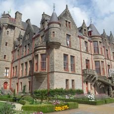
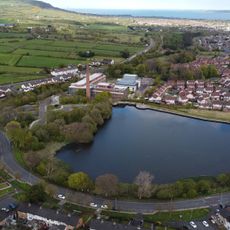
Massereene Lower is a historical barony in County Antrim, Northern Ireland, situated beside Lough Neagh and encompassing around 45 distinct townlands and two civil parishes. The region connects with neighboring baronies and forms an important part of the administrative framework of the area.

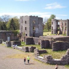
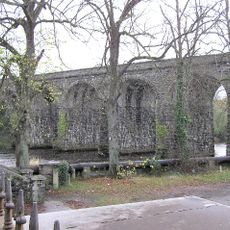
The region has medieval roots evident in a density of about three ringforts per square kilometer, the highest concentration of such structures in Ireland. These archaeological remains testify to a long history of human settlement and fortification.

The area carries traditional names in English and Irish, known as Mása Ríona Íochtarach, and shows in settlements like Muckamore and Aldergrove how different linguistic traditions coexist. Visitors can see this blend today in street signs and place names that reflect both languages.

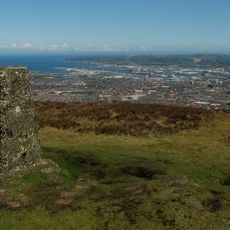
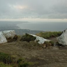
The region lies immediately beside Lough Neagh and offers direct access to this large lake for visitors wanting to explore the waterside. Nearby settlements like Muckamore and Aldergrove serve as practical reference points for orientation and supplies.

Martin's Bank, a location on Lough Neagh's shore, features natural saline springs that produce crystallized salt through solar evaporation. This unusual natural occurrence remains overlooked by many visitors despite being a rare phenomenon in the region.

The community of curious travelers

AroundUs brings together thousands of curated places, local tips, and hidden gems, enriched daily by 60,000 contributors worldwide.

Start exploring
Location
GPS coordinates
54.66371,-6.18507
Latest update
December 14, 2025 14:43
Around this place
Belfast Castle
United Kingdom

Belfast Castle

15.8 km
Cavehill
United Kingdom

Cavehill

15.2 km
Shane's Castle ruins
United Kingdom

Shane's Castle ruins

9.4 km
Belfast Zoo
United Kingdom

Belfast Zoo

15.7 km
Dundrod Circuit
United Kingdom

Dundrod Circuit

11.4 km
Black Mountain
United Kingdom

Black Mountain

13.6 km
Divis
United Kingdom

Divis

12.2 km
Antrim Castle
United Kingdom

Antrim Castle

7.1 km
Clonard Monastery
United Kingdom

Clonard Monastery

16.4 km
Castle Upton
United Kingdom

Castle Upton

7.5 km
Peace Wall
United Kingdom

Peace Wall

16.3 km
Ram's Island
United Kingdom

Ram's Island

11.5 km
Holy Cross Church, Ardoyne
United Kingdom

Holy Cross Church, Ardoyne

15.4 km
Ballyclare Town Hall
United Kingdom

Ballyclare Town Hall

15.4 km
Mossley Mill
United Kingdom

Mossley Mill

15.7 km
Chapel Of The Resurrection Innisfayle Park Antrim Road Belfast
United Kingdom

Chapel Of The Resurrection Innisfayle Park Antrim Road Belfast

16.1 km
Ballinderry Middle Church Lower Ballinderry Road Brakenhill Glenavy Crumlin County Antrim Bt28 2jh
United Kingdom

Ballinderry Middle Church Lower Ballinderry Road Brakenhill Glenavy Crumlin County Antrim Bt28 2jh

14 km
Deerpark Bridge Antrim Castle Gardens Randalstown Road Antrim Co Antrim
United Kingdom

Deerpark Bridge Antrim Castle Gardens Randalstown Road Antrim Co Antrim

6.4 km
Glengormley Library
United Kingdom

Glengormley Library

14.8 km
Clotworthy House Randalstown Road Antrim Bt41 4lh
United Kingdom

Clotworthy House Randalstown Road Antrim Bt41 4lh

6.5 km
St Comgall's Rc Church Castle Street Antrim
United Kingdom

St Comgall's Rc Church Castle Street Antrim

6.6 km
Belfast Castle, Antrim Road Belfast
United Kingdom

Belfast Castle, Antrim Road Belfast

15.8 km
Railway Bridge Straidballymorris Dunadry Co Antrim
United Kingdom

Railway Bridge Straidballymorris Dunadry Co Antrim

4.6 km
The Steeple Steeple Road Antrim Co Antrim Bt41 1bj
United Kingdom

The Steeple Steeple Road Antrim Co Antrim Bt41 1bj

7.1 km
Long Canals And Round Pond Antrim Castle Gardens Randalstown Road Antrim Co Antrim
United Kingdom

Long Canals And Round Pond Antrim Castle Gardens Randalstown Road Antrim Co Antrim

6.6 km
McArt's Fort
United Kingdom

McArt's Fort

15.4 km
Railway Viaduct Randalstown Antrim Co Antrim
United Kingdom

Railway Viaduct Randalstown Antrim Co Antrim

12.7 km
Non-subscribing Presbyterian Church Main Street Crumlin Co Antrim
United Kingdom

Non-subscribing Presbyterian Church Main Street Crumlin Co Antrim

5.3 km
Show the full map
Reviews
Share your experience

No review yet

Discussions
Start a discussion...

No discussion yet

« Massereene Lower - Barony in County Antrim, Northern Ireland » is provided by Around Us (aroundus.com). Images and texts are derived from Wikimedia project under a Creative Commons license. You are allowed to copy, distribute, and modify copies of this page, under the conditions set by the license, as long as this note is clearly visible.

Discover hidden gems everywhere you go!

From secret cafés to breathtaking viewpoints, skip the crowded tourist spots and find places that match your style. Our app makes it easy with voice search, smart filtering, route optimization, and insider tips from travelers worldwide. Download now for the complete mobile experience.

Around Us App Screenshot

A unique approach to discovering new places

Le Figaro

All the places worth exploring

France Info

A tailor-made excursion in just a few clicks

20 Minutes

Around Us
Travel Guide & Maps
Download

Send to your phone

QR Code
1

Open the camera app on your mobile.

2

Point at the QR code with your camera. A notification will appear.

3

Tap the notification to open the link.