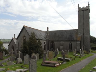
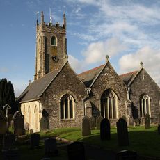
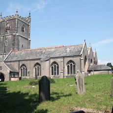
Church of St Andrew, Parish church in Bere Ferrers, England
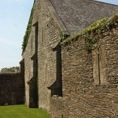
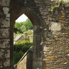
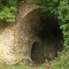
The Church of St Andrew is a medieval parish church featuring stone walls, pointed arches, and carved stonework that reflect traditional ecclesiastical design. The structure displays the characteristic building techniques and decorative details typical of its construction period.
The church was founded in 1250 and ranks among the earliest religious structures built in the Devon region. Its long history makes it an important witness to medieval church construction in England.
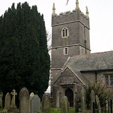
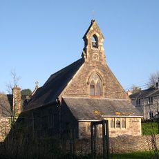
The church serves as a gathering place for the Bere Ferrers community, hosting regular worship services and parish events that connect residents. Visitors can observe how the building remains actively embedded in local life today.
The church is located on Catherine Street in Bere Ferrers and welcomes visitors interested in viewing its architecture or attending services. It is advisable to check opening times in advance to ensure access during your visit.
The church holds Grade I listed status, placing it among the rarest protected structures in England due to its exceptional historical and architectural value. This recognition reflects the building's outstanding significance within the national heritage.
Location: Bere Ferrers
Inception: 13 century
Website: http://bereanglicans.org.uk
GPS coordinates: 50.45030,-4.17145
Latest update: December 14, 2025 18:11
Buckland Abbey
4.4 km
Maristow House
1.9 km
Warleigh House
1.7 km
Woodlands Fort
4.3 km
Tavy Bridge
2.1 km
Lopwell
2.1 km
Knowles Battery
3.8 km
The Who'D Have Thought It Inn
4 km
Church of St Mary
2.9 km
Church of St Budeaux
4.2 km
Church of St Leonard and St Dilp
3.4 km
Church of the Holy Spirit
3.8 km
Southway Library
4 km
Agaton Fort
3.8 km
Tithe Barn directly to east of Buckland Abbey
4.4 km
Blaxton Creek mill
755 m
Milestone Near Garden Wall West Of Cressy
2.6 km
Gate Piers And Adjoining Wall To South-South-East Approximately 20 Metres To South-East Of Buckland Abbey
4.3 km
Lime Kiln At Blaxton Quay
680 m
Linhay Approximately 20 Metres East Of Tithe Barn
4.4 km
Tamerton Bridge
3.1 km
Milestone, 50m SE of where track from Maristow crosses Watery Lane
2.3 km
Milestone, 250m inside the Estate, beside road/track
4.2 km
Guidestone, Tavistock Cross, E of Bere Alston, at fork in road
3.8 km
Guidestone, fork where road leaves for Bere Ferrers & Calstock
3.8 km
Milestone, off track leading from Lower Lodge into the estate, 10m NE the track gate
2.8 km
Guidestone, Tavistock Cross, E side of fork to Denhambridge
3.9 km
Guidestone, road to Calstock, at fork where road splits to Bere Ferrers and Alston
3.8 kmVisited this place? Tap the stars to rate it and share your experience / photos with the community! Try now! You can cancel it anytime.
Discover hidden gems everywhere you go!
From secret cafés to breathtaking viewpoints, skip the crowded tourist spots and find places that match your style. Our app makes it easy with voice search, smart filtering, route optimization, and insider tips from travelers worldwide. Download now for the complete mobile experience.
A unique approach to discovering new places❞
— Le Figaro
All the places worth exploring❞
— France Info
A tailor-made excursion in just a few clicks❞
— 20 Minutes