Enable Location

We need your location to show you interesting places around you

Discover nearby places

Find interesting locations and hidden gems around you

Precise directions

Get accurate directions and distances to places

Your location is never shared with other users. It's only used when you tap the location button.

Padley Hall

Log in to your account

Start exploring — it's free

Trusted by 62,914 travelers worldwide

Continue with Google
Continue with Apple
or

We will send you a code to connect

By continuing, you accept our Terms and Conditions and our Privacy Policy

Check your inbox

We've sent a pincode in your inbox. Please enter the code below.

Discussion Reviews 1 Photos
2k Popularity

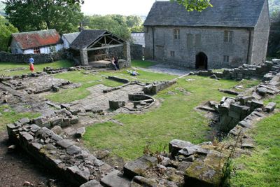
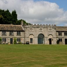
Padley Hall, Medieval manor ruins in Grindleford, England

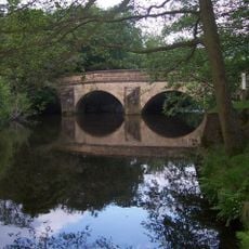
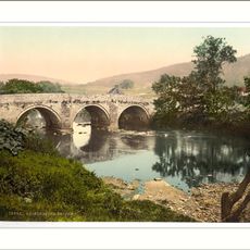
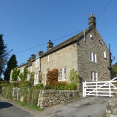
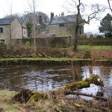
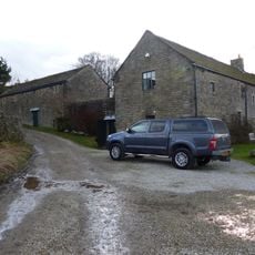
Padley Hall is a ruined medieval manor situated on a hillside with views of the River Derwent in the Peak District of Derbyshire. Stone foundation walls remain visible, showing where the main building once stood before falling into decay over the centuries.

This manor was originally granted to the De Bernac family after the Norman Conquest in the eleventh century. The Padley family later constructed their hall here in the fourteenth century before the building gradually fell into ruin.

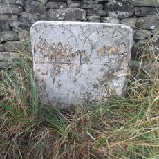
The ruins carry the memory of two Catholic priests who sought refuge here during the religious turmoil of the 1580s, making this an important place of remembrance for those interested in that troubled period. Locals and visitors still recognize this connection to one of England's darker chapters.

The ruins can be reached on foot via marked pathways from nearby Grindleford station throughout the year. Wear sturdy shoes as the ground is uneven in places and the hillside can be muddy after rain.

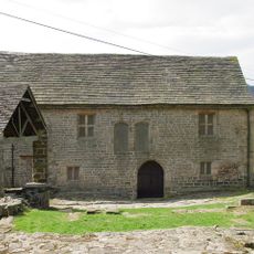
The gatehouse was later transformed into a small Catholic chapel dedicated to the two priests who were found hiding there. This repurposing created a rare blend of architectural history and spiritual remembrance on the same site.

The community of curious travelers

AroundUs brings together thousands of curated places, local tips, and hidden gems, enriched daily by 60,000 contributors worldwide.

Start exploring
Location
GPS coordinates
53.30730,-1.63063
Latest update
December 14, 2025 09:42
Around this place
Carl Wark
United Kingdom

Carl Wark

2.7 km
Stoke Hall, Derbyshire
United Kingdom

Stoke Hall, Derbyshire

2.9 km
Longshaw Estate
United Kingdom

Longshaw Estate

2 km
Padley Chapel
United Kingdom

Padley Chapel

47 m
Embanked stone circle known as Wet Withens, and adjacent cairn
United Kingdom

Embanked stone circle known as Wet Withens, and adjacent cairn

2.2 km
Scraperlow Farmhouse and attached outbuildings
United Kingdom

Scraperlow Farmhouse and attached outbuildings

2.4 km
Fox House Inn and adjoining cottage service buildings and stables
United Kingdom

Fox House Inn and adjoining cottage service buildings and stables

2.3 km
Brunt's Barn, Upper Padley, Grindleford
United Kingdom

Brunt's Barn, Upper Padley, Grindleford

74 m
Froggatt Bridge
United Kingdom

Froggatt Bridge

2.9 km
Burbage Brook Bridge
United Kingdom

Burbage Brook Bridge

2.9 km
Guide post at OS 265776
United Kingdom

Guide post at OS 265776

2.3 km
Padley Mill
United Kingdom

Padley Mill

374 m
Leadmill Bridge
United Kingdom

Leadmill Bridge

2.1 km
Grindleford Bridge
United Kingdom

Grindleford Bridge

1.2 km
Booth's Farmhouse
United Kingdom

Booth's Farmhouse

2 km
Milepost 20 Yards To The South West Of The Entrance To Hathersage Hall
United Kingdom

Milepost 20 Yards To The South West Of The Entrance To Hathersage Hall

2.9 km
Stoke View
United Kingdom

Stoke View

2.7 km
Milestone, Grindleford, E of Sheriff Wood (Leam Hall)
United Kingdom

Milestone, Grindleford, E of Sheriff Wood (Leam Hall)

815 m
Lower Booths Farmhouse
United Kingdom

Lower Booths Farmhouse

1.9 km
Stoke Flat West prehistoric field system and stone circle
United Kingdom

Stoke Flat West prehistoric field system and stone circle

2.5 km
Wayside and boundary cross known as Lady's Cross
United Kingdom

Wayside and boundary cross known as Lady's Cross

2.5 km
Nether Hall
United Kingdom

Nether Hall

2.9 km
Mile Post 800 Yards To The South West Of Burbage Bridge
United Kingdom

Mile Post 800 Yards To The South West Of Burbage Bridge

1.5 km
Milestone, N of Wooden Pole, S of jct with A6187
United Kingdom

Milestone, N of Wooden Pole, S of jct with A6187

2.1 km
Milestone, roadside at SK259783
United Kingdom

Milestone, roadside at SK259783

1.4 km
Mitchell Field Farmhouse
United Kingdom

Mitchell Field Farmhouse

2.8 km
Milestone, N of Froggatt village sign
United Kingdom

Milestone, N of Froggatt village sign

1.7 km
Milestone, NE of Wooden Pole jct
United Kingdom

Milestone, NE of Wooden Pole jct

2.4 km
Show the full map
Reviews
Share your experience

No review yet

Discussions
Start a discussion...

No discussion yet

« Padley Hall - Medieval manor ruins in Grindleford, England » is provided by Around Us (aroundus.com). Images and texts are derived from Wikimedia project under a Creative Commons license. You are allowed to copy, distribute, and modify copies of this page, under the conditions set by the license, as long as this note is clearly visible.

Discover hidden gems everywhere you go!

From secret cafés to breathtaking viewpoints, skip the crowded tourist spots and find places that match your style. Our app makes it easy with voice search, smart filtering, route optimization, and insider tips from travelers worldwide. Download now for the complete mobile experience.

Around Us App Screenshot

A unique approach to discovering new places

Le Figaro

All the places worth exploring

France Info

A tailor-made excursion in just a few clicks

20 Minutes

Around Us
Travel Guide & Maps
Download

Send to your phone

QR Code
1

Open the camera app on your mobile.

2

Point at the QR code with your camera. A notification will appear.

3

Tap the notification to open the link.