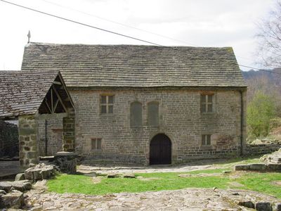
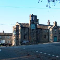
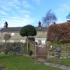
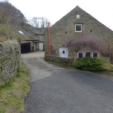
Padley Chapel, Medieval chapel in Grindleford, England
Padley Chapel is a medieval stone structure built within the remains of a 14th-century manor house and displays Gothic features with carved stonework and religious objects from various periods. The building shows how a small private chapel was constructed, with thick walls and narrow windows typical of religious buildings from that time.
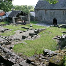
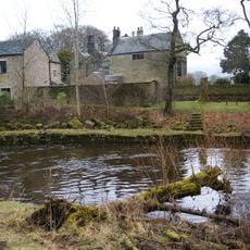
The chapel was built in the 14th century as part of a manor house and served believers for generations. In 1588, the discovery of priests in hiding led to arrests that became a turning point in religious persecution at this location.
The chapel served as a place for secret worship during times when Catholic practice faced legal restrictions in England. Visitors can see how spaces were arranged to accommodate hidden religious gatherings.
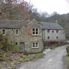
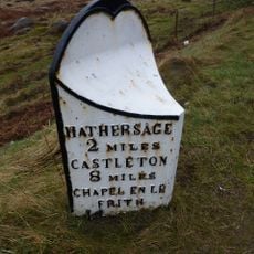
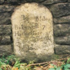
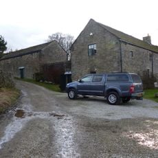
The chapel is reachable on foot from Grindleford railway station, which has regular train service. The site can be visited in most weather conditions, though paths are sometimes unpaved and sturdy footwear is advised.
An altar stone was buried in the garden in 1588 to protect it from authorities and remained hidden for nearly 350 years. Its rediscovery in the 1930s revealed how people preserved sacred objects during dangerous times.
Location: Grindleford
Inception: 14 century
GPS coordinates: 53.30700,-1.63112
Latest update: December 12, 2025 17:43
Carl Wark
2.8 km
Stoke Hall, Derbyshire
2.9 km
Longshaw Estate
2 km
Padley Hall
47 m
Embanked stone circle known as Wet Withens, and adjacent cairn
2.1 km
Scraperlow Farmhouse and attached outbuildings
2.5 km
Fox House Inn and adjoining cottage service buildings and stables
2.4 km
Froggatt Bridge
2.9 km
Brunt's Barn, Upper Padley, Grindleford
31 m
Guide post at OS 265776
2.3 km
Booth's Farmhouse
2 km
Leadmill Bridge
2.1 km
Padley Mill
398 m
Grindleford Bridge
1.2 km
Stoke View
2.7 km
Milepost 20 Yards To The South West Of The Entrance To Hathersage Hall
3 km
Stoke Flat West prehistoric field system and stone circle
2.4 km
Lower Booths Farmhouse
2 km
Nether Hall
2.9 km
Mile Post 800 Yards To The South West Of Burbage Bridge
1.6 km
Wayside and boundary cross known as Lady's Cross
2.6 km
Milestone, Grindleford, E of Sheriff Wood (Leam Hall)
771 m
Milestone, N of Wooden Pole, S of jct with A6187
2.1 km
Milestone, roadside at SK259783
1.4 km
Mitchell Field Farmhouse
2.8 km
Milestone, N of Froggatt village sign
1.7 km
Milestone, NE of Wooden Pole jct
2.5 km
Milestone, Longshaw Meadow, Longshaw Estate (NT), W of Visitors Centre
2.4 kmVisited this place? Tap the stars to rate it and share your experience / photos with the community! Try now! You can cancel it anytime.
Discover hidden gems everywhere you go!
From secret cafés to breathtaking viewpoints, skip the crowded tourist spots and find places that match your style. Our app makes it easy with voice search, smart filtering, route optimization, and insider tips from travelers worldwide. Download now for the complete mobile experience.
A unique approach to discovering new places❞
— Le Figaro
All the places worth exploring❞
— France Info
A tailor-made excursion in just a few clicks❞
— 20 Minutes