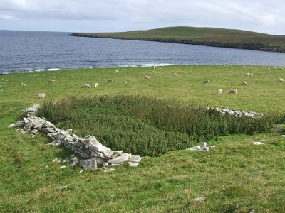
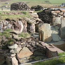
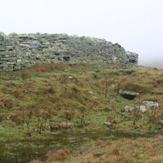
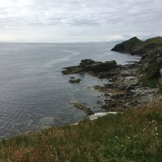
Broch of Cullingsburgh, Iron Age stone structure on Bressay, Shetland Islands, Scotland.
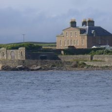
The Broch of Cullingsburgh is a circular Iron Age stone structure located on a rocky platform on Bressay. Its thick walls stretch several meters across and command views over the bay to the water below.
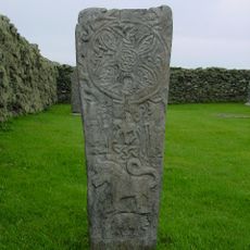
The structure dates to the Iron Age, when fortified circular towers were built across the Shetland Islands. A stone bearing Pictish symbols discovered near the site in 1852 provided insight into the social ranks of ancient inhabitants.
The location reflects how people chose to settle on elevated ground with water views, suggesting its value to early communities. Walking around reveals the relationship between the structure and its natural surroundings, which clearly mattered to those who built it.
The site is accessible by local paths on Bressay but requires some fitness due to its elevated location. Visitors should dress for changing weather, as the islands are exposed to wind and rain throughout the year.
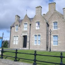
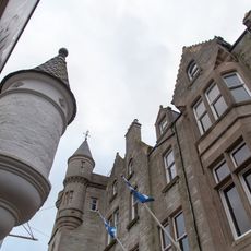
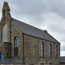
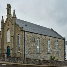
Stones from the original broch were later incorporated into the nearby St. Mary's Church, showing how later generations reused older materials. This blending of structures reveals the long-term relationship between the community and its landscape.
Location: Shetland Islands
Part of: Cullingsburgh, St Mary's Church, churchyard and broch
GPS coordinates: 60.16190,-1.06316
Latest update: December 14, 2025 18:04
Fort Charlotte
4.6 km
Lerwick Town Hall
4.7 km
Shetland Museum
4.7 km
Mareel
4.6 km
Gardie House
3.3 km
Lerwick, King Erik Street, County Buldings
4.7 km
The Lodberrie
4.3 km
Bressay Stone
27 m
Burnt Mound of Cruester
3.9 km
Heogan fishing station
4.8 km
Bressay, Gardie House, Steading
3.3 km
Bressay, Gardie House, Pier
3.4 km
Maryfield House, including boundary walls and gatepiers
3.2 km
Wadbister Souterrain
2.9 km
St Ola's Church and burial-ground
2.4 km
Bressay, Maryfield, Boat Store And Slipway
3.3 km
Bressay, South Road, The Glebe
3.3 km
Hill of Cruester, standing stone 570m NE of Hiltoun
3.1 km
Grand Hotel
4.6 km
Lerwick, 2 Church Lane, Lifeboat Station
4.4 km
Lerwick, Gressy Loan, Janet Courtney Hostel
4.3 km
Lerwick, 9 Commercial Street, The Old Manse
4.2 km
Lerwick, 9 Hillhead, Wesley Manse
4.7 km
The Knab, fixed torpedo platform 130m NE of
4.4 km
Lerwick, Lovers Loan, Anderson Institute
4.3 km
Anderson And Co, 60-62 Commercial Street, Lerwick
4.5 km
St Olaf's Hall, Hillhead, Lerwick
4.5 km
Market Cross, Commercial Street, Lerwick
4.5 kmVisited this place? Tap the stars to rate it and share your experience / photos with the community! Try now! You can cancel it anytime.
Discover hidden gems everywhere you go!
From secret cafés to breathtaking viewpoints, skip the crowded tourist spots and find places that match your style. Our app makes it easy with voice search, smart filtering, route optimization, and insider tips from travelers worldwide. Download now for the complete mobile experience.
A unique approach to discovering new places❞
— Le Figaro
All the places worth exploring❞
— France Info
A tailor-made excursion in just a few clicks❞
— 20 Minutes