Carn Llidi

Log in to your account

AroundUs is a community-driven map of interesting places, built by curious explorers like you. It grows with every review, story, and photo you share.
Connect to save your favorite spots, contribute locations, and create personalized routes.
Continue with Google
Continue with Apple
Continue with X
Continue with Facebook
Continue with email
By continuing, you accept our Terms and Conditions and our Privacy Policy
Create an account
Add to collection
Map
Suggest a change
Share

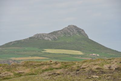
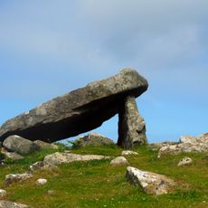
Carn Llidi, Rocky hill at St David's Head, Wales

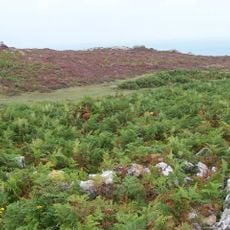
Carn Llidi is a rocky hill at St David's Head that rises distinctly above Whitesands Bay. The summit provides views across the coast and displays traces of various past uses on its surface.

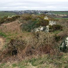
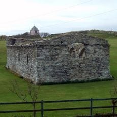
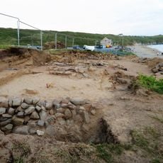
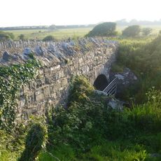
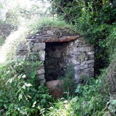
During World War II, the summit served as an early-warning radar station with concrete-reinforced structures and military fortifications remaining visible. Much older traces come from prehistoric times when people lived here and buried their dead thousands of years ago.

The name comes from South Welsh language roots, with 'Carn' meaning a rocky outcrop and 'Llidi' referring to ashes. The area served as a burial and settlement place for people across thousands of years.

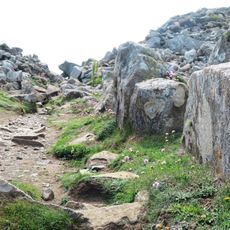
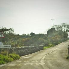
A marked trail leads from Whitesands Bay car park to the summit with clear way-finding along the route. The location is straightforward to reach and has basic facilities near the starting point.

The World War II defenses remain surprisingly well preserved, including concrete remnants and a gun pit from machine gun positions. These military remains give insight into coastal air defense history along the Welsh coast.

Location: Pembrokeshire

Elevation above the sea: 181 m

GPS coordinates: 51.90456,-5.28967

Latest update: December 12, 2025 12:04

Photos
Around this place
St Davids Cathedral
United Kingdom

St Davids Cathedral

2.9 km
Whitesands Bay
United Kingdom

Whitesands Bay

1.2 km
St Davids Bishops Palace
United Kingdom

St Davids Bishops Palace

2.8 km
Coetan Arthur
United Kingdom

Coetan Arthur

1.3 km
Clegyr Boia
United Kingdom

Clegyr Boia

2.9 km
Porth-y-Tŵr
United Kingdom

Porth-y-Tŵr

3 km
Ruins of St. Justinian's Chapel, Porthstinian
United Kingdom

Ruins of St. Justinian's Chapel, Porthstinian

3.1 km
Clawdd y Milwyr
United Kingdom

Clawdd y Milwyr

1.5 km
Ebeneser Welsh Independent Chapel
United Kingdom

Ebeneser Welsh Independent Chapel

3 km
Cylch Cerrig Treleddyd Fawr
United Kingdom

Cylch Cerrig Treleddyd Fawr

1 km
Tabernacl Chapel
United Kingdom

Tabernacl Chapel

3.1 km
St Patrick's Chapel, Pembrokeshire
United Kingdom

St Patrick's Chapel, Pembrokeshire

846 m
Former Church School,Quickwell Hill
United Kingdom

Former Church School,Quickwell Hill

2.9 km
St Davids Library
United Kingdom

St Davids Library

3.1 km
St. David's Cathedral Hall (formerly Chapel Of St.mary's College) & Attached Cloister Ruins,the Cathe
United Kingdom

St. David's Cathedral Hall (formerly Chapel Of St.mary's College) & Attached Cloister Ruins,the Cathe

2.9 km
Pont Penarthur,B4583,Penarthur
United Kingdom

Pont Penarthur,B4583,Penarthur

2.1 km
Pont Y Gwrhyd,Rhodiad Y Brenin
United Kingdom

Pont Y Gwrhyd,Rhodiad Y Brenin

3 km
Treleddyd Fawr,Treleddyd Fawr
United Kingdom

Treleddyd Fawr,Treleddyd Fawr

1.5 km
Menai,Including Garden Walls,Gates & Railings, Cross Square
United Kingdom

Menai,Including Garden Walls,Gates & Railings, Cross Square

3.1 km
Well-Head opposite Rhosson Farm
United Kingdom

Well-Head opposite Rhosson Farm

2.9 km
Old Lifeboat House, Porthstinian/St. Justinian's
United Kingdom

Old Lifeboat House, Porthstinian/St. Justinian's

3.1 km
Pont Y Penyd,The Cathedral Close
United Kingdom

Pont Y Penyd,The Cathedral Close

2.6 km
Brecon House
United Kingdom

Brecon House

2.8 km
The City Cross,cross Square (in Centre)
United Kingdom

The City Cross,cross Square (in Centre)

3.1 km
Outbuilding Range On S.Side of Farmyard at Rhosson Ganol,Rhosson
United Kingdom

Outbuilding Range On S.Side of Farmyard at Rhosson Ganol,Rhosson

2.9 km
Nos.22 & 23 Cross Square (Cartref Restaurant)
United Kingdom

Nos.22 & 23 Cross Square (Cartref Restaurant)

3.1 km
Rhosson Uchaf/Rhosson Farmhouse
United Kingdom

Rhosson Uchaf/Rhosson Farmhouse

2.9 km
The Close Wall (formerly Listed With Porth Y Twr) The Cathedral Close
United Kingdom

The Close Wall (formerly Listed With Porth Y Twr) The Cathedral Close

3 km
Show the full map
Reviews

Visited this place? Tap the stars to rate it and share your experience / photos with the community! Try now! You can cancel it anytime.

« Carn Llidi - Rocky hill at St David's Head, Wales » is provided by Around Us (aroundus.com). Images and texts are derived from Wikimedia project under a Creative Commons license. You are allowed to copy, distribute, and modify copies of this page, under the conditions set by the license, as long as this note is clearly visible.

Discover hidden gems everywhere you go!

From secret cafés to breathtaking viewpoints, skip the crowded tourist spots and find places that match your style. Our app makes it easy with voice search, smart filtering, route optimization, and insider tips from travelers worldwide. Download now for the complete mobile experience.

Around Us App Screenshot

A unique approach to discovering new places

Le Figaro

All the places worth exploring

France Info

A tailor-made excursion in just a few clicks

20 Minutes