Enable Location

We need your location to show you interesting places around you

Discover nearby places

Find interesting locations and hidden gems around you

Precise directions

Get accurate directions and distances to places

Your location is never shared with other users. It's only used when you tap the location button.

Pooley Bridge

Log in to your account

Start exploring — it's free

Trusted by 61,460 travelers worldwide

Continue with Google
Continue with Apple
or

We will send you a code to connect

By continuing, you accept our Terms and Conditions and our Privacy Policy

Check your inbox

We've sent a pincode in your inbox. Please enter the code below.

Pooley Bridge

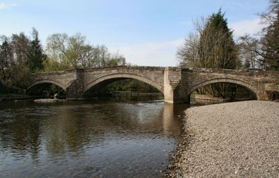
Pooley Bridge, Road bridge in Pooley Bridge, United Kingdom.

Description

Pooley Bridge is a modern road crossing over the River Eamont in the Lake District area of England. The structure uses stainless steel throughout and features an arch design that supports the deck above the water.

History

An older stone bridge from 1764 originally stood at this location and served the community for more than 250 years. It was destroyed by severe flooding in 2015, which led to the construction of this replacement structure.

Culture

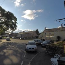
The bridge connects two parts of the village and serves as a gateway to walking routes and natural areas nearby. Locals and visitors cross it regularly to reach riverside paths and access the wider landscape.

Practical

The crossing is open to vehicles and pedestrians, with dedicated walkways on both sides for foot traffic. The route remains accessible throughout the year and directly connects the two village areas.

Did you know?

At the time of its completion, this was the first bridge of its kind built with stainless steel in the entire country. The open arch design is uncommon for road bridges and represents an engineering approach not typically seen in such structures.

Location
GPS coordinates
54.61224,-2.82219
Latest update
December 14, 2025 17:40

AroundUs brings together thousands of curated places, local tips, and hidden gems, enriched daily by 60,000 contributors worldwide. Discover all places nearby (Dacre).

Around this place
Dalemain
United Kingdom

Dalemain

2.6 km
Askham Hall
United Kingdom

Askham Hall

4.7 km
Dacre Castle
United Kingdom

Dacre Castle

2.3 km
Little Mell Fell
United Kingdom

Little Mell Fell

4.7 km
Arthur's Pike
United Kingdom

Arthur's Pike

3.9 km
St Andrew's Church, Dacre
United Kingdom

St Andrew's Church, Dacre

2.4 km
St Michael's Church
United Kingdom

St Michael's Church

2.6 km
Bonscale Pike
United Kingdom

Bonscale Pike

4.6 km
All Saints Church, Watermillock
United Kingdom

All Saints Church, Watermillock

4.1 km
White Raise round cairn, Askham Fell
United Kingdom

White Raise round cairn, Askham Fell

2.7 km
Church of St Michael, Lowther
United Kingdom

Church of St Michael, Lowther

4.9 km
Church of St Peter
United Kingdom

Church of St Peter

4.8 km
Helton Methodist Chapel
United Kingdom

Helton Methodist Chapel

4.6 km
Punch Bowl Hotel Public House
United Kingdom

Punch Bowl Hotel Public House

4.7 km
St Paul's Church
United Kingdom

St Paul's Church

271 m
Ring cairn on Askham Fell including The Cop Stone
United Kingdom

Ring cairn on Askham Fell including The Cop Stone

3.8 km
Limekiln Approximately 60 Metres East Of Winder Hall Cottage
United Kingdom

Limekiln Approximately 60 Metres East Of Winder Hall Cottage

2.2 km
The Queens Head Inn
United Kingdom

The Queens Head Inn

4.4 km
Redhill Limekilns, 120 Metres South East Of Slapestones Roundabout
United Kingdom

Redhill Limekilns, 120 Metres South East Of Slapestones Roundabout

4.8 km
Lowther Mausoleum South West Of Church Of St Michael
United Kingdom

Lowther Mausoleum South West Of Church Of St Michael

4.9 km
Round cairn on Askham Fell, 270m north of The Cop Stone
United Kingdom

Round cairn on Askham Fell, 270m north of The Cop Stone

3.6 km
Hutton John And Barn Adjoining
United Kingdom

Hutton John And Barn Adjoining

3.9 km
Midtown Farmhouse
United Kingdom

Midtown Farmhouse

4.5 km
Boundary Stone South East Of Junction Of A66 And Dacre Road
United Kingdom

Boundary Stone South East Of Junction Of A66 And Dacre Road

3.8 km
Two round cairns 415m and 420m NNE of The Cockpit, Moor Divock
United Kingdom

Two round cairns 415m and 420m NNE of The Cockpit, Moor Divock

2.4 km
The Cockpit stone circle and seven adjacent clearance cairns, Moor Divock
United Kingdom

The Cockpit stone circle and seven adjacent clearance cairns, Moor Divock

2.5 km
Glebe Farmhouse
United Kingdom

Glebe Farmhouse

2.5 km
Milestone, Dalemain
United Kingdom

Milestone, Dalemain

2.7 km
Show the full map
« Pooley Bridge - Road bridge in Pooley Bridge, United Kingdom » is provided by Around Us (aroundus.com). Images and texts are derived from Wikimedia project under a Creative Commons license. You are allowed to copy, distribute, and modify copies of this page, under the conditions set by the license, as long as this note is clearly visible.

Discover hidden gems everywhere you go!

From secret cafés to breathtaking viewpoints, skip the crowded tourist spots and find places that match your style. Our app makes it easy with voice search, smart filtering, route optimization, and insider tips from travelers worldwide. Download now for the complete mobile experience.

Around Us App Screenshot

A unique approach to discovering new places

Le Figaro

All the places worth exploring

France Info

A tailor-made excursion in just a few clicks

20 Minutes

Around Us
Travel Guide & Maps
Download

Send to your phone

QR Code
1

Open the camera app on your mobile.

2

Point at the QR code with your camera. A notification will appear.

3

Tap the notification to open the link.