Tahquamenon Falls

Log in to your account

AroundUs is a community-driven map of interesting places, built by curious explorers like you. It grows with every review, story, and photo you share.
Connect to save your favorite spots, contribute locations, and create personalized routes.
Continue with Google
Continue with Apple
Continue with X
Continue with Facebook
Continue with email
By continuing, you accept our Terms and Conditions and our Privacy Policy
Create an account
Add to collection
Map
Suggest a change
Share

Tahquamenon Falls, Waterfall system in Upper Peninsula, Michigan, United States.

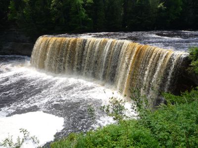
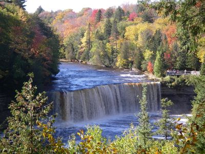
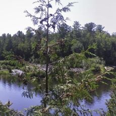
Tahquamenon Falls is a waterfall in northern Michigan that divides into two sections flowing through dense forest. The upper section drops roughly 15 meters (50 feet), while the lower forms several shallower steps that slide over smooth rock.

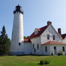
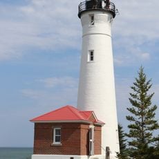
The Ojibwe lived in this area for a long time before European settlers arrived in the nineteenth century. The site was later protected as a state park to preserve the falls and the surrounding wilderness.

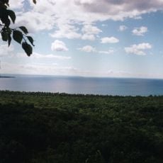
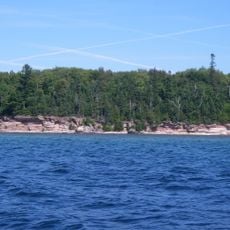
The name comes from the Ojibwe language and means discharge or river, describing how the water flows here. Visitors today see a landscape framed by cedar and hemlock trees, its natural character protected for generations.

Access to the upper section is easier and has paved paths, while the lower requires more walking. The best time to visit is in spring and autumn, when the water flows stronger or the trees change color.

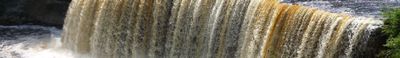
The water picks up tannins from surrounding swamps, which makes it appear brown and form white foam as it tumbles over the rocks. This natural tint remains visible throughout the year and sets it apart from clear mountain streams.

Location: Michigan

Height: 15 m

Part of: Tahquamenon River

GPS coordinates: 46.57400,-85.25600

Latest update: December 13, 2025 18:27

Photos
Around this place
Tahquamenon Falls State Park
United States of America

Tahquamenon Falls State Park

4.4 km
Great Lakes Shipwreck Museum
United States of America

Great Lakes Shipwreck Museum

31.6 km
Whitefish Point Light
United States of America

Whitefish Point Light

31.6 km
Point Iroquois Light
United States of America

Point Iroquois Light

48.8 km
Crisp Point Light
United States of America

Crisp Point Light

19.9 km
SS John Mitchell
United States of America

SS John Mitchell

31.9 km
Whitefish Point Bird Observatory
United States of America

Whitefish Point Bird Observatory

31.6 km
Delirium Wilderness
United States of America

Delirium Wilderness

52.4 km
Ile Parisienne Light
Canada

Ile Parisienne Light

41.4 km
Gros Cap Reefs Light
Canada

Gros Cap Reefs Light

49.5 km
Birch Lodge
United States of America

Birch Lodge

46 km
Sandy Islands Provincial Park
Canada

Sandy Islands Provincial Park

53.6 km
Hiawatha Sportsman's Club 1931 Maintenance Building and Commissary
United States of America

Hiawatha Sportsman's Club 1931 Maintenance Building and Commissary

51.3 km
M-28–Tahquamenon River Bridge
United States of America

M-28–Tahquamenon River Bridge

34.1 km
Manitou Lodge
United States of America

Manitou Lodge

54.8 km
Ile Parisienne Conservation Reserve
Canada

Ile Parisienne Conservation Reserve

42.1 km
Tahqua Land Theater
United States of America

Tahqua Land Theater

31.1 km
Edmund Fitzgerald Memorial
United States of America

Edmund Fitzgerald Memorial

31.7 km
Luce County Sheriff's House and Jail
United States of America

Luce County Sheriff's House and Jail

31.7 km
Whitefish Point Lighthouse Historical Marker
United States of America

Whitefish Point Lighthouse Historical Marker

31.7 km
Newberry State Bank Historical Marker
United States of America

Newberry State Bank Historical Marker

31.3 km
Jail and Sheriff's Residence Historical Marker
United States of America

Jail and Sheriff's Residence Historical Marker

31.7 km
Whitefish Township Community Library
United States of America

Whitefish Township Community Library

17.1 km
Lower Falls
United States of America

Lower Falls

5 km
Post Office Historical Marker
United States of America

Post Office Historical Marker

28.9 km
Tahquamenon Area Public Library
United States of America

Tahquamenon Area Public Library

31.6 km
Sherman Park
United States of America

Sherman Park

31.6 km
Luce County Government Building
United States of America

Luce County Government Building

31.6 km
Show the full map
Reviews

Visited this place? Tap the stars to rate it and share your experience / photos with the community! Try now! You can cancel it anytime.

« Tahquamenon Falls - Waterfall system in Upper Peninsula, Michigan, United States » is provided by Around Us (aroundus.com). Images and texts are derived from Wikimedia project under a Creative Commons license. You are allowed to copy, distribute, and modify copies of this page, under the conditions set by the license, as long as this note is clearly visible.

Discover hidden gems everywhere you go!

From secret cafés to breathtaking viewpoints, skip the crowded tourist spots and find places that match your style. Our app makes it easy with voice search, smart filtering, route optimization, and insider tips from travelers worldwide. Download now for the complete mobile experience.

Around Us App Screenshot

A unique approach to discovering new places

Le Figaro

All the places worth exploring

France Info

A tailor-made excursion in just a few clicks

20 Minutes