Enable Location

We need your location to show you interesting places around you

Discover nearby places

Find interesting locations and hidden gems around you

Precise directions

Get accurate directions and distances to places

Your location is never shared with other users. It's only used when you tap the location button.

Marion

Log in to your account

Start exploring — it's free

Trusted by 63,992 travelers worldwide

Continue with Google
Continue with Apple
or

We will send you a code to connect

By continuing, you accept our Terms and Conditions and our Privacy Policy

Check your inbox

We've sent a pincode in your inbox. Please enter the code below.

Discussion Reviews 1 Photos
18.7k Popularity

Marion, city in Arkansas, USA

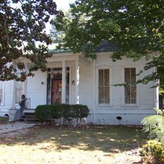
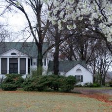
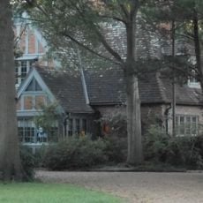
Marion is a small city in Crittenden County, Kentucky, and serves as the county seat of the region. The town spans just over 3 square miles with simple, welcoming buildings and quiet streets surrounded by gentle hills and farmland.

Marion was founded in 1842 after the county was created and became an official city in 1844. The town is named after Francis Marion, a general in the American Revolutionary War, and local doctor John S. Gilliam donated the land for its establishment.

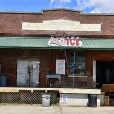
Marion is home to a large Amish community of over five hundred families who maintain traditional crafts and ways of living. Visitors can purchase handmade furniture, baked goods, and preserved foods in local shops that offer a quiet and relaxed shopping atmosphere.

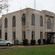
Marion is easily accessible via major roads that connect the town to nearby communities and simplify navigation. The city offers local amenities including shops, restaurants, a library, a forty-acre park, and medical services all in one central location.

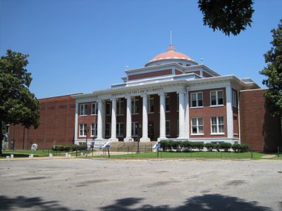
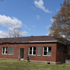
A historic Rosenwald School building from 1926 in Marion stands as a notable part of the past, marking a time when schools were divided by race. The building remains today and tells an important story about local educational history.

The community of curious travelers

AroundUs brings together thousands of curated places, local tips, and hidden gems, enriched daily by 60,000 contributors worldwide.

Start exploring
Elevation above the sea
69 m
GPS coordinates
35.20611,-90.20167
Latest update
February 16, 2026 23:20
Around this place
Hernando de Soto Bridge
United States of America

Hernando de Soto Bridge

13.9 km
Memphis & Arkansas Bridge
United States of America

Memphis & Arkansas Bridge

14.4 km
Memphis Suspension Railway
United States of America

Memphis Suspension Railway

14.6 km
Harahan Bridge
United States of America

Harahan Bridge

14.3 km
100 North Main
United States of America

100 North Main

15.2 km
Burkle Estate
United States of America

Burkle Estate

15.1 km
Frisco Bridge
United States of America

Frisco Bridge

14.3 km
The Cotton Museum
United States of America

The Cotton Museum

15.1 km
Fort Assumption
United States of America

Fort Assumption

14.9 km
Belz Museum of Asian and Judaic Art
United States of America

Belz Museum of Asian and Judaic Art

15.2 km
Morgan Keegan Tower
United States of America

Morgan Keegan Tower

15 km
Metal Museum
United States of America

Metal Museum

14.7 km
Shrine Building
United States of America

Shrine Building

15.1 km
The Renaissance Apartments
United States of America

The Renaissance Apartments

15 km
B. Lowenstein & Brothers Building
United States of America

B. Lowenstein & Brothers Building

15.2 km
Crittenden County Courthouse
United States of America

Crittenden County Courthouse

1.2 km
Slave Haven Underground Railroad Museum
United States of America

Slave Haven Underground Railroad Museum

15.1 km
John Alexander Austin House
United States of America

John Alexander Austin House

15.1 km
D.T. Porter Building
United States of America

D.T. Porter Building

15.2 km
Cotton Row Historic District
United States of America

Cotton Row Historic District

15.1 km
Hamilton Apartments
United States of America

Hamilton Apartments

6.4 km
Lawrie House
United States of America

Lawrie House

6.3 km
West Memphis City Hall
United States of America

West Memphis City Hall

6.9 km
Marion Colored High School
United States of America

Marion Colored High School

1.7 km
Crittenden County Bank and Trust Company
United States of America

Crittenden County Bank and Trust Company

1.1 km
Johnson-Portis House
United States of America

Johnson-Portis House

6.2 km
Wilson Power and Light Company Ice Plant
United States of America

Wilson Power and Light Company Ice Plant

6.8 km
Lincoln American Tower
United States of America

Lincoln American Tower

15.1 km
Show the full map
Reviews
Share your experience

No review yet

Discussions
Start a discussion...

No discussion yet

« Marion - city in Arkansas, USA » is provided by Around Us (aroundus.com). Images and texts are derived from Wikimedia project under a Creative Commons license. You are allowed to copy, distribute, and modify copies of this page, under the conditions set by the license, as long as this note is clearly visible.

Discover hidden gems everywhere you go!

From secret cafés to breathtaking viewpoints, skip the crowded tourist spots and find places that match your style. Our app makes it easy with voice search, smart filtering, route optimization, and insider tips from travelers worldwide. Download now for the complete mobile experience.

Around Us App Screenshot

A unique approach to discovering new places

Le Figaro

All the places worth exploring

France Info

A tailor-made excursion in just a few clicks

20 Minutes

Around Us
Travel Guide & Maps
Download

Send to your phone

QR Code
1

Open the camera app on your mobile.

2

Point at the QR code with your camera. A notification will appear.

3

Tap the notification to open the link.