Chest opened
+${chestReward.xp} XP
Explorer
NOUVEAU ×${chestReward.collectible.quantity}
tapez pour fermer
Chest locked

Open chests in the app

Around Us is built for your phone — chests unlock when you walk, explore and capture nearby places.

Enable Location

We need your location to show you interesting places around you

Discover nearby places

Find interesting locations and hidden gems around you

Precise directions

Get accurate directions and distances to places

Your location is never shared with other users. It's only used when you tap the location button.

Bethel

Log in to your account

Start exploring — it's free

Trusted by 72,888 travelers worldwide

Continue with Google
Continue with Apple
or

We will send you a code to connect

By continuing, you accept our Terms and Conditions and our Privacy Policy

Check your inbox

We've sent a pincode in your inbox. Please enter the code below.

Discussion Reviews 1 Photos
33.9k Popularity

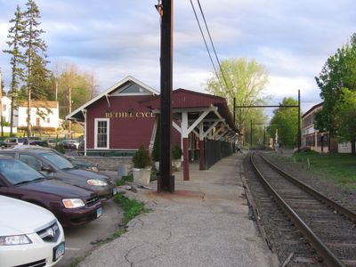
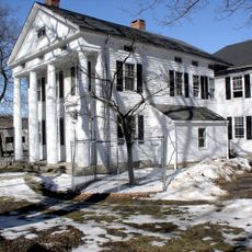
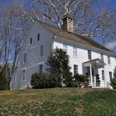
Bethel, Town in Fairfield County, Connecticut, United States

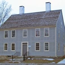
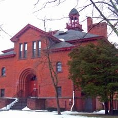
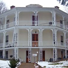
Bethel is a town in Fairfield County, Connecticut, located in hilly terrain and bordered by Redding, Danbury, Brookfield, and Newtown. The community center and municipal offices are located in the downtown area near School Street, serving local government functions.

The town originated as part of Danbury in 1685 and became incorporated as a separate community in 1855. This independence marked a turning point for local growth and self-governance.

Artist Art Young, a renowned cartoonist, spent considerable time here in the early 1900s and left a lasting impact on local creative life. The community continues to honor his memory through exhibitions and cultural recognition.

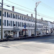
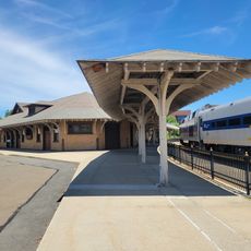
Walking through downtown is the easiest way to get around and find most local services and amenities. Government offices are centrally located and accessible during regular business hours with extended availability on select days.

In 1934 the first American vodka distillery opened here, producing the now-famous Smirnoff brand using a traditional recipe. This facility established a surprising industrial presence in this otherwise quiet New England town.

The community of curious travelers

AroundUs brings together thousands of curated places, local tips, and hidden gems, enriched daily by 60,000 contributors worldwide.

Start exploring
Location
Inception
1855
Elevation above the sea
115 m
Part of
New York metropolitan area, Greater Danbury
Shares border with
Brookfield, Danbury, Newtown, Redding
GPS coordinates
41.37121,-73.41401
Latest update
December 19, 2025 23:10
Around this place
Hearthstone Castle
United States of America

Hearthstone Castle

3 km
Main Street Historic District
United States of America

Main Street Historic District

4.2 km
Putnam Memorial State Park
United States of America

Putnam Memorial State Park

4.3 km
Collis P. Huntington State Park
United States of America

Collis P. Huntington State Park

5.5 km
Charles Ives House
United States of America

Charles Ives House

2.8 km
Tarrywile
United States of America

Tarrywile

3.4 km
Danbury Museum and Historical Society
United States of America

Danbury Museum and Historical Society

3.3 km
Meeker's Hardware
United States of America

Meeker's Hardware

4.3 km
John Rider House
United States of America

John Rider House

3.3 km
Ball and Roller Bearing Company
United States of America

Ball and Roller Bearing Company

4.4 km
Greenwood Avenue Historic District
United States of America

Greenwood Avenue Historic District

111 m
Highstead Arboretum
United States of America

Highstead Arboretum

5.6 km
P. Robinson Fur Cutting Company
United States of America

P. Robinson Fur Cutting Company

4.7 km
Joseph W. Pepin Memorial Building
United States of America

Joseph W. Pepin Memorial Building

4.1 km
Seth Seelye House
United States of America

Seth Seelye House

17 m
Rev. John Ely House
United States of America

Rev. John Ely House

966 m
Danbury Railway Museum
United States of America

Danbury Railway Museum

4.2 km
Octagon House
United States of America

Octagon House

4.6 km
United States of America

Eureka Lake

2.4 km
United States of America

Bushy Hill Pond

4.5 km
United States of America

Nichols' Opera House

22 m
United States of America

Star Family Theatre

4.3 km
United States of America

Main Street Historic District

4.1 km
United States of America

Rogers Park Pond

2.4 km
United States of America

Chestnut Ridge Reservoir

2.8 km
United States of America

Rock Ridge Country Club

5.7 km
United States of America

Scenic viewpoint

4.3 km
United States of America

Scenic viewpoint

3.6 km
Show the full map
Reviews
Share your experience

No review yet

Discussions
Start a discussion...

No discussion yet

« Bethel - Town in Fairfield County, Connecticut, United States » is provided by Around Us (aroundus.com). Images and texts are derived from Wikimedia project under a Creative Commons license. You are allowed to copy, distribute, and modify copies of this page, under the conditions set by the license, as long as this note is clearly visible.

Discover hidden gems everywhere you go!

From secret cafés to breathtaking viewpoints, skip the crowded tourist spots and find places that match your style. Our app makes it easy with voice search, smart filtering, route optimization, and insider tips from travelers worldwide. Download now for the complete mobile experience.

Around Us App Screenshot

A unique approach to discovering new places

Le Figaro

All the places worth exploring

France Info

A tailor-made excursion in just a few clicks

20 Minutes

Around Us
Travel Guide & Maps
Download

Send to your phone

QR Code
1

Open the camera app on your mobile.

2

Point at the QR code with your camera. A notification will appear.

3

Tap the notification to open the link.