Enable Location

We need your location to show you interesting places around you

Discover nearby places

Find interesting locations and hidden gems around you

Precise directions

Get accurate directions and distances to places

Your location is never shared with other users. It's only used when you tap the location button.

Harvey County

Log in to your account

Start exploring — it's free

Trusted by 61,507 travelers worldwide

Continue with Google
Continue with Apple
or

We will send you a code to connect

By continuing, you accept our Terms and Conditions and our Privacy Policy

Check your inbox

We've sent a pincode in your inbox. Please enter the code below.

Harvey County, County in central Kansas, United States

Description

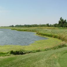
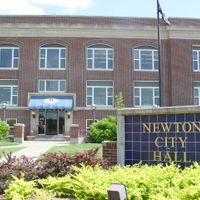
Harvey County is an administrative division in central Kansas covering approximately 541 square miles of prairie landscape, with the Little Arkansas River flowing through its farming territories. The region functions as primarily agricultural land with Newton serving as the county's main hub for commerce and government.

History

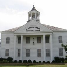
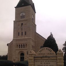
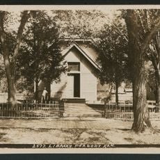
The county was established in 1872 after Newton's representatives left a regional political meeting and successfully petitioned for separate administrative status. Settlement intensified following the arrival of Russian Mennonite farmers in 1874, who introduced new wheat varieties suited to the local climate.

Culture

Mennonite communities who arrived in the 1870s shaped the region's identity through their farming practices and religious traditions. Their presence remains visible in how locals organize community life and maintain family-centered values.

Practical

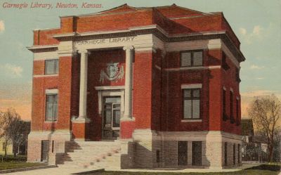
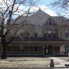
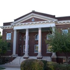
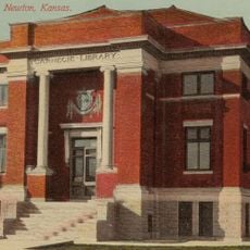
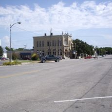
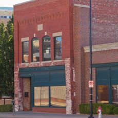
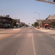
Newton, the county seat, is positioned along major transportation corridors including the Santa Fe Railroad and highways US81 and US50, making the area accessible by road and rail. Visitors should know that the region is rural, so most services and amenities concentrate in the county's main towns.

Did you know?

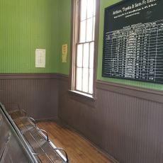
The region lay along the Chisholm Trail, where massive cattle herds moved northward, and Newton became a major railhead between 1871 and 1873. This boom period turned the area into a cattle trading hub for the Great Plains.

Location
Inception
February 29, 1872
Capital city
Newton
Shares border with
McPherson County, Sedgwick County, Marion County, Butler County, Reno County
GPS coordinates
38.12389,-97.64528
Latest update
December 7, 2025 20:45

AroundUs brings together thousands of curated places, local tips, and hidden gems, enriched daily by 60,000 contributors worldwide. Discover all places nearby (Kansas).

Around this place
Sedgwick County Zoo
United States of America

Sedgwick County Zoo

49.9 km
Cessna Stadium
United States of America

Cessna Stadium

54.3 km
Botanica, The Wichita Gardens
United States of America

Botanica, The Wichita Gardens

53.7 km
Alexanderwohl Mennonite Church
United States of America

Alexanderwohl Mennonite Church

31.2 km
Wichita Art Museum
United States of America

Wichita Art Museum

54.1 km
Warkentin House
United States of America

Warkentin House

28.2 km
Sand Creek Station Golf Course
United States of America

Sand Creek Station Golf Course

27.3 km
Mid-America All-Indian Center
United States of America

Mid-America All-Indian Center

54.1 km
United States of America

KWCH Tower

12.6 km
St. Mark Church
United States of America

St. Mark Church

43.5 km
Fischer Field Stadium
United States of America

Fischer Field Stadium

26.8 km
Old Cowtown Museum
United States of America

Old Cowtown Museum

54.1 km
Ulrich Museum of Art
United States of America

Ulrich Museum of Art

54.7 km
Calvary Baptist Church
United States of America

Calvary Baptist Church

54.8 km
Riverview Apartments
United States of America

Riverview Apartments

54.3 km
B. H. Campbell House
United States of America

B. H. Campbell House

53.1 km
Peabody Historical Library Museum
United States of America

Peabody Historical Library Museum

47.4 km
Governor L. D. Lewelling House
United States of America

Governor L. D. Lewelling House

53.9 km
Carnegie Library
United States of America

Carnegie Library

27.8 km
Peabody Downtown Historic District
United States of America

Peabody Downtown Historic District

47.4 km
Peabody City Park
United States of America

Peabody City Park

46.9 km
W.H. Morgan House
United States of America

W.H. Morgan House

47.4 km
Fairmount Congregational Church
United States of America

Fairmount Congregational Church

54.8 km
Arkansas Valley Lodge No. 21, Prince Hall Masons
United States of America

Arkansas Valley Lodge No. 21, Prince Hall Masons

54.8 km
Canton Township Carnegie Library
United States of America

Canton Township Carnegie Library

35.1 km
Peabody Township Library
United States of America

Peabody Township Library

47.4 km
Mennonite Settler statue
United States of America

Mennonite Settler statue

26.7 km
Newton Main Street Historic District II
United States of America

Newton Main Street Historic District II

27.6 km
Show the full map
Administrative divisions
« Harvey County - County in central Kansas, United States » is provided by Around Us (aroundus.com). Images and texts are derived from Wikimedia project under a Creative Commons license. You are allowed to copy, distribute, and modify copies of this page, under the conditions set by the license, as long as this note is clearly visible.

Discover hidden gems everywhere you go!

From secret cafés to breathtaking viewpoints, skip the crowded tourist spots and find places that match your style. Our app makes it easy with voice search, smart filtering, route optimization, and insider tips from travelers worldwide. Download now for the complete mobile experience.

Around Us App Screenshot

A unique approach to discovering new places

Le Figaro

All the places worth exploring

France Info

A tailor-made excursion in just a few clicks

20 Minutes

Around Us
Travel Guide & Maps
Download

Send to your phone

QR Code
1

Open the camera app on your mobile.

2

Point at the QR code with your camera. A notification will appear.

3

Tap the notification to open the link.