Cataract Falls, Natural waterfall in Owen County, Indiana
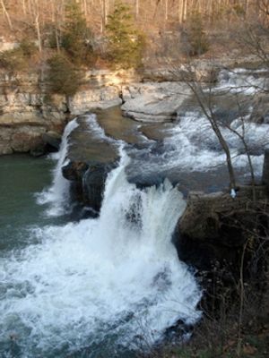
Cataract Falls features two distinct cascades along Mill Creek, with the upper drop reaching approximately 45 feet and the lower cascade about 30 feet. The water tumbles over layers of limestone, creating pools and mist as it descends through the wooded gorge.
The limestone formations date back millions of years when the region lay beneath an ancient sea and slowly emerged as ocean levels changed. Over time, Mill Creek carved through these rock layers, gradually creating the waterfalls visible today.
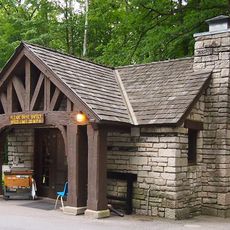
The waterfall area serves as an educational site where visitors learn about Indiana's geological formations and natural water systems through interpretive programs.
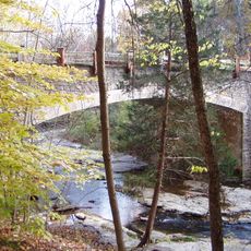
Both cascades are reachable via marked trails branching from State Road 42, with several viewing spots positioned along the creek. The paths can become slippery after rain, so sturdy footwear and careful footing are advisable.
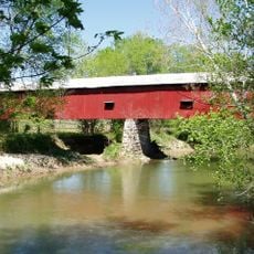
A covered bridge spans Mill Creek with picnic tables inside, allowing visitors to eat while watching the water cascade nearby. This unusual setup creates a sheltered spot to linger and observe the natural display from a unique vantage point.
Location: Owen County
Part of: Mill Creek
GPS coordinates: 39.43440,-86.81320
Latest update: December 6, 2025 16:02
Indiana features a variety of natural and cultural sites across its counties. Visitors can explore underground networks such as the Bluespring Caves, which extend over 34 kilometers, view the sandstone canyons and geological formations at Turkey Run State Park, or admire the Cataract Falls on Mill...
McCormick's Creek State Park
17.2 km
Cataract Falls Covered Bridge
123 m
Delta Kappa Epsilon Fraternity House
23.1 km
Putnamville Presbyterian Church
16.1 km
Owen County Courthouse
19.1 km
David Enoch Beem House
16.5 km
McCormick's Creek State Park Entrance and Gatehouse
18.3 km
Indiana State Highway Bridge 46-11-1316
18.7 km
Allison-Robinson House
17 km
Poland Presbyterian Church and Cemetery
12.2 km
Secrest Ferry Bridge
16.3 km
Stone Arch Bridge over McCormick's Creek
18.1 km
Heck-Hasler House
18.9 km
Spencer Public Library
17.3 km
Secrest-Wampler House
16.3 km
CCC Recreation Building-Nature Museum
17.6 km
Putnam County Bridge No. 159
18.6 km
Indiana State Highway Bridge 42-11-3101
15.6 km
Moffett-Ralston House
15.5 km
Gosport Historic District
16 km
Stinesville Commercial Historic District
20.6 km
Lycurgus Stoner House
18.8 km
Dr. H.G. Osgood House
15.8 km
Eaglefield Place
21.4 km
Blankenship-Hodges-Brown House
21.6 km
Houck Covered Bridge
19.7 km
Big Walnut Creek
13.7 km
McCormick's Creek Bridge
18.2 kmVisited this place? Tap the stars to rate it and share your experience / photos with the community! Try now! You can cancel it anytime.
Discover hidden gems everywhere you go!
From secret cafés to breathtaking viewpoints, skip the crowded tourist spots and find places that match your style. Our app makes it easy with voice search, smart filtering, route optimization, and insider tips from travelers worldwide. Download now for the complete mobile experience.
A unique approach to discovering new places❞
— Le Figaro
All the places worth exploring❞
— France Info
A tailor-made excursion in just a few clicks❞
— 20 Minutes