Enable Location

We need your location to show you interesting places around you

Discover nearby places

Find interesting locations and hidden gems around you

Precise directions

Get accurate directions and distances to places

Your location is never shared with other users. It's only used when you tap the location button.

Xenia

Log in to your account

Start exploring — it's free

Trusted by 63,553 travelers worldwide

Continue with Google
Continue with Apple
or

We will send you a code to connect

By continuing, you accept our Terms and Conditions and our Privacy Policy

Check your inbox

We've sent a pincode in your inbox. Please enter the code below.

Discussion Reviews 3 Photos
78.5k Popularity

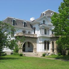
Xenia, County seat in Greene County, Ohio, United States.

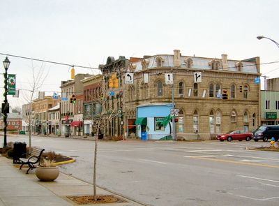
Xenia is a county seat in southwestern Ohio, positioned where three major highways meet and where the land rises to roughly 930 feet (about 280 meters) above sea level. The town spreads across gently rolling terrain with fields and scattered woodland surrounding the built-up center.

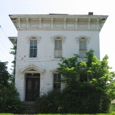
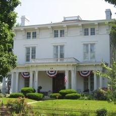
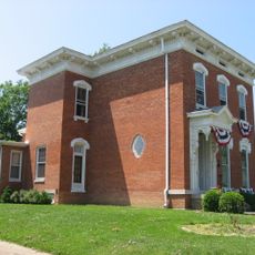
John Paul purchased about 2,000 acres in 1803 and laid the groundwork for one of the earliest permanent settlements in Greene County. In April 1974 a tornado of extreme force destroyed roughly half the buildings, prompting a reconstruction effort over the following years.

The Greek-derived name reflects the local commitment to hospitality, as proposed during an early town meeting by Reverend Robert Armstrong in the 1800s.

City offices in the center provide access to various public services and offer general guidance for anyone seeking basic information. Staff can answer questions about operating hours and available resources for visitors or residents.

In the 19th century Reverend Robert Armstrong suggested the Greek-derived name meaning hospitality during an early town meeting, and it stuck. That proposal continues to shape how residents understand their community today.

The community of curious travelers

AroundUs brings together thousands of curated places, local tips, and hidden gems, enriched daily by 60,000 contributors worldwide.

Start exploring
Location
Inception
1803
Elevation above the sea
284 m
Shares border with
Yellow Springs
GPS coordinates
39.68360,-83.93810
Latest update
December 13, 2025 16:48
Around this place
Charles Young Buffalo Soldiers National Monument
United States of America

Charles Young Buffalo Soldiers National Monument

4.6 km
Ohio Soldiers' and Sailors' Orphans' Home
United States of America

Ohio Soldiers' and Sailors' Orphans' Home

2.4 km
Kil-Kare Raceway
United States of America

Kil-Kare Raceway

3.9 km
United States of America

National Afro-American Museum and Cultural Center

6.2 km
Greene County Courthouse
United States of America

Greene County Courthouse

819 m
Hollencamp House
United States of America

Hollencamp House

1.3 km
McDonald Farm
United States of America

McDonald Farm

6.7 km
East Second Street Historic District
United States of America

East Second Street Historic District

1.1 km
Ballard Road Covered Bridge
United States of America

Ballard Road Covered Bridge

10.5 km
Bank of Xenia
United States of America

Bank of Xenia

789 m
United States of America

Dean Family Farm

10.3 km
Samuel N. Patterson House
United States of America

Samuel N. Patterson House

846 m
Alexander Conner House
United States of America

Alexander Conner House

840 m
Millen-Schmidt House
United States of America

Millen-Schmidt House

679 m
National Afro-American Museum and Cultural Center
United States of America

National Afro-American Museum and Cultural Center

6.1 km
United States of America

East Second Street Historic District

1 km
Wilberforce Carnegie Library
United States of America

Wilberforce Carnegie Library

6.1 km
Stevenson Road Covered Bridge
United States of America

Stevenson Road Covered Bridge

6.6 km
United States of America

Waterstreet Historic District

442 m
United States of America

Main Street Historic District

10.3 km
Charleton Mill Covered Bridge
United States of America

Charleton Mill Covered Bridge

7.7 km
Galloway Log House
United States of America

Galloway Log House

738 m
United States of America

Great Council State Park

5.1 km
United States of America

Country Club of the North

7.3 km
United States of America

Caesar Ford Park Amphitheatre

9.5 km
United States of America

The Corn Maze Adventure

8.4 km
United States of America

Kiddie Maze

8.4 km
United States of America

Scenic viewpoint

5.5 km
Show the full map
Reviews
Share your experience

No review yet

Discussions
Start a discussion...

No discussion yet

« Xenia - County seat in Greene County, Ohio, United States » is provided by Around Us (aroundus.com). Images and texts are derived from Wikimedia project under a Creative Commons license. You are allowed to copy, distribute, and modify copies of this page, under the conditions set by the license, as long as this note is clearly visible.

Discover hidden gems everywhere you go!

From secret cafés to breathtaking viewpoints, skip the crowded tourist spots and find places that match your style. Our app makes it easy with voice search, smart filtering, route optimization, and insider tips from travelers worldwide. Download now for the complete mobile experience.

Around Us App Screenshot

A unique approach to discovering new places

Le Figaro

All the places worth exploring

France Info

A tailor-made excursion in just a few clicks

20 Minutes

Around Us
Travel Guide & Maps
Download

Send to your phone

QR Code
1

Open the camera app on your mobile.

2

Point at the QR code with your camera. A notification will appear.

3

Tap the notification to open the link.