Chest opened
+${chestReward.xp} XP
Explorer
NOUVEAU ×${chestReward.collectible.quantity}
tapez pour fermer
Chest locked

Open chests in the app

Around Us is built for your phone — chests unlock when you walk, explore and capture nearby places.

Enable Location

We need your location to show you interesting places around you

Discover nearby places

Find interesting locations and hidden gems around you

Precise directions

Get accurate directions and distances to places

Your location is never shared with other users. It's only used when you tap the location button.

Log in to your account

Start exploring — it's free

Trusted by 72,886 travelers worldwide

Continue with Google
Continue with Apple
or

We will send you a code to connect

By continuing, you accept our Terms and Conditions and our Privacy Policy

Check your inbox

We've sent a pincode in your inbox. Please enter the code below.

Atchison Storage Facility
Discussion Reviews Photo
5.3k Popularity

Atchison Storage Facility, Storage facility in Atchison, Kansas, US.

The Atchison Storage Facility is an underground storage complex housed in a former limestone mine that extends 50 to 150 feet below ground level. The site comprises a vast network of chambers with regulated temperature and humidity to protect sensitive materials.

The site was converted from a limestone mine into a refrigerated storage center during World War II to preserve farm products for wartime needs. This transformation represents how natural resources were repurposed for strategic purposes during the conflict.

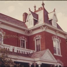
The facility represents the transformation of American industrial spaces, evolving from a 19th-century limestone quarry to a strategic military storage center.

Access to the underground facility is provided through clearly marked entrances, and level pathways allow for safe exploration. Visitors should expect cool temperatures underground regardless of the season.

The facility stored massive quantities of perishable goods in the 1940s, including eggs and dried fruits in specialized underground chambers. These stockpiles demonstrate how the military secured food supplies during wartime.

The community of curious travelers

AroundUs brings together thousands of curated places, local tips, and hidden gems, enriched daily by 60,000 contributors worldwide.

Start exploring
Location
GPS coordinates
39.54330,-95.11750
Latest update
December 10, 2025 16:27
Around this place
Amelia Earhart Birthplace
United States of America

Amelia Earhart Birthplace

2.3 km
Amelia Earhart Bridge
United States of America

Amelia Earhart Bridge

1.8 km
McInteer Villa
United States of America

McInteer Villa

2.6 km
Lewis and Clark State Park
United States of America

Lewis and Clark State Park

5.2 km
Larry Wilcox Stadium
United States of America

Larry Wilcox Stadium

3.8 km
St. Patrick's Catholic Church
United States of America

St. Patrick's Catholic Church

8.2 km
Ebenezer Baptist Church
United States of America

Ebenezer Baptist Church

3 km
Trinity Episcopal Church
United States of America

Trinity Episcopal Church

1.8 km
J. P. Brown House
United States of America

J. P. Brown House

2.9 km
W. W. Hetherington House
United States of America

W. W. Hetherington House

2.3 km
Atchison County Courthouse
United States of America

Atchison County Courthouse

2.5 km
Jansen House
United States of America

Jansen House

2.9 km
Frank Howard House
United States of America

Frank Howard House

2.3 km
Glick–Orr House
United States of America

Glick–Orr House

2.2 km
Robert L. Pease House
United States of America

Robert L. Pease House

2.2 km
A. J. Harwi House
United States of America

A. J. Harwi House

2.7 km
B. P. Waggener House
United States of America

B. P. Waggener House

3 km
Francis and Harriet Baker House
United States of America

Francis and Harriet Baker House

3 km
Price Villa
United States of America

Price Villa

1.3 km
Frederick W. Stein House
United States of America

Frederick W. Stein House

2.3 km
Edgar W. Howe House
United States of America

Edgar W. Howe House

3.5 km
Balie P. Waggener House
United States of America

Balie P. Waggener House

3.1 km
H. E. Muchnic House
United States of America

H. E. Muchnic House

2.8 km
Amelia Earhart Hangar Museum
United States of America

Amelia Earhart Hangar Museum

5.9 km
Sugar Lake State Park Open Shelter
United States of America

Sugar Lake State Park Open Shelter

5 km
Amelia Earhart Historic District
United States of America

Amelia Earhart Historic District

2.8 km
Amelia Earhart Bridge
United States of America

Amelia Earhart Bridge

1.9 km
BNSF Missouri River Bridge
United States of America

BNSF Missouri River Bridge

1.9 km
Show the full map
Reviews
Share your experience

No review yet

Discussions
Start a discussion...

No discussion yet

« Atchison Storage Facility - Storage facility in Atchison, Kansas, US » is provided by Around Us (aroundus.com). Images and texts are derived from Wikimedia project under a Creative Commons license. You are allowed to copy, distribute, and modify copies of this page, under the conditions set by the license, as long as this note is clearly visible.

Discover hidden gems everywhere you go!

From secret cafés to breathtaking viewpoints, skip the crowded tourist spots and find places that match your style. Our app makes it easy with voice search, smart filtering, route optimization, and insider tips from travelers worldwide. Download now for the complete mobile experience.

Around Us App Screenshot

A unique approach to discovering new places

Le Figaro

All the places worth exploring

France Info

A tailor-made excursion in just a few clicks

20 Minutes

Around Us
Travel Guide & Maps
Download

Send to your phone

QR Code
1

Open the camera app on your mobile.

2

Point at the QR code with your camera. A notification will appear.

3

Tap the notification to open the link.