Enable Location

We need your location to show you interesting places around you

Discover nearby places

Find interesting locations and hidden gems around you

Precise directions

Get accurate directions and distances to places

Your location is never shared with other users. It's only used when you tap the location button.

Big Rocky Fork Covered Bridge

Log in to your account

Start exploring — it's free

Trusted by 62,127 travelers worldwide

Continue with Google
Continue with Apple
or

We will send you a code to connect

By continuing, you accept our Terms and Conditions and our Privacy Policy

Check your inbox

We've sent a pincode in your inbox. Please enter the code below.

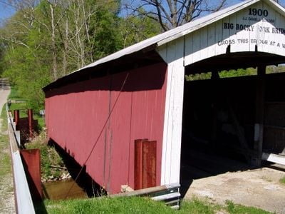
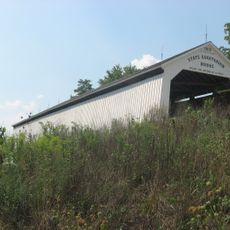
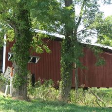
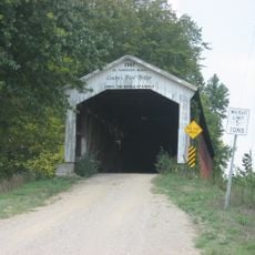
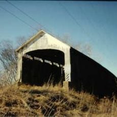
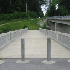
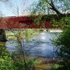
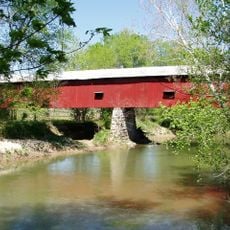
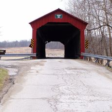
Big Rocky Fork Covered Bridge, Covered bridge in Parke County, Indiana, US

Big Rocky Fork Covered Bridge is a wooden arch crossing that spans a creek in rural Indiana. The structure features limestone foundations and the type of timber construction typical of this era and region.

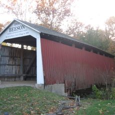
Construction of this bridge finished in 1900 during the early years of a new century. The structure has survived more than a hundred years, standing as evidence of how such crossings were built in that era.

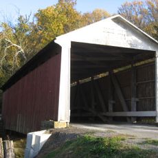
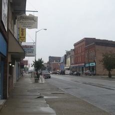
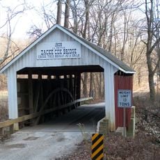
This bridge is part of a network of wooden crossings in the region that draws visitors interested in 19th and 20th century construction methods. The structure reflects how rural communities built and maintained their own transportation links.

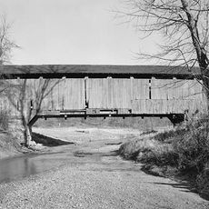
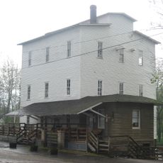
The bridge sits in a rural area southeast of the town of Mansfield and is reached by county road. Visitors should be prepared for unpaved access routes and farm roads leading to the crossing.

The area near this bridge has a connection to early 20th century crime, as a known bank robber once used it as a hideout. Today the crossing serves only as a historical landmark free of such associations.

The community of curious travelers

AroundUs brings together thousands of curated places, local tips, and hidden gems, enriched daily by 60,000 contributors worldwide.

Start exploring
Location
Inception
1900
GPS coordinates
39.66292,-87.08069
Latest update
December 14, 2025 18:09
Around this place
Bridgeton Covered Bridge
United States of America

Bridgeton Covered Bridge

8.3 km
Jeffries Ford Covered Bridge
United States of America

Jeffries Ford Covered Bridge

11.5 km
Neet Covered Bridge
United States of America

Neet Covered Bridge

10.9 km
State Sanitorium Covered Bridge
United States of America

State Sanitorium Covered Bridge

14.3 km
Beeson Covered Bridge
United States of America

Beeson Covered Bridge

15.5 km
Billie Creek Covered Bridge
United States of America

Billie Creek Covered Bridge

15.4 km
Leatherwood Station Covered Bridge
United States of America

Leatherwood Station Covered Bridge

15.2 km
Rockville Chautauqua Pavilion
United States of America

Rockville Chautauqua Pavilion

17.1 km
McAllister Covered Bridge
United States of America

McAllister Covered Bridge

10.8 km
Thorpe Ford Covered Bridge
United States of America

Thorpe Ford Covered Bridge

16.2 km
Crooks Covered Bridge
United States of America

Crooks Covered Bridge

11.5 km
Brazil Downtown Historic District
United States of America

Brazil Downtown Historic District

16 km
Conley's Ford Covered Bridge
United States of America

Conley's Ford Covered Bridge

4.5 km
United States Post Office
United States of America

United States Post Office

16 km
Clay County Courthouse
United States of America

Clay County Courthouse

15.7 km
Nevins Covered Bridge
United States of America

Nevins Covered Bridge

11.5 km
Zacke Cox Covered Bridge
United States of America

Zacke Cox Covered Bridge

17.9 km
Rockville Historic District
United States of America

Rockville Historic District

17 km
Alfred Hirt House
United States of America

Alfred Hirt House

17.8 km
Putnam County Bridge No. 159
United States of America

Putnam County Bridge No. 159

15.7 km
Lycurgus Stoner House
United States of America

Lycurgus Stoner House

16.8 km
Eaglefield Place
United States of America

Eaglefield Place

14 km
Meridian-Forest Historic District
United States of America

Meridian-Forest Historic District

16 km
Mansfield Roller Mill
United States of America

Mansfield Roller Mill

2.4 km
Mansfield Covered Bridge
United States of America

Mansfield Covered Bridge

2.4 km
Houck Covered Bridge
United States of America

Houck Covered Bridge

15.1 km
Dunbar Covered Bridge
United States of America

Dunbar Covered Bridge

16.9 km
Dills Ford Bridge
United States of America

Dills Ford Bridge

11.8 km
Show the full map
« Big Rocky Fork Covered Bridge - Covered bridge in Parke County, Indiana, US » is provided by Around Us (aroundus.com). Images and texts are derived from Wikimedia project under a Creative Commons license. You are allowed to copy, distribute, and modify copies of this page, under the conditions set by the license, as long as this note is clearly visible.

Discover hidden gems everywhere you go!

From secret cafés to breathtaking viewpoints, skip the crowded tourist spots and find places that match your style. Our app makes it easy with voice search, smart filtering, route optimization, and insider tips from travelers worldwide. Download now for the complete mobile experience.

Around Us App Screenshot

A unique approach to discovering new places

Le Figaro

All the places worth exploring

France Info

A tailor-made excursion in just a few clicks

20 Minutes

Around Us
Travel Guide & Maps
Download

Send to your phone

QR Code
1

Open the camera app on your mobile.

2

Point at the QR code with your camera. A notification will appear.

3

Tap the notification to open the link.