Parke County

Log in to your account

AroundUs is a community-driven map of interesting places, built by curious explorers like you. It grows with every review, story, and photo you share.
Connect to save your favorite spots, contribute locations, and create personalized routes.
By continuing, you accept our Terms and Conditions and our Privacy Policy
Add to collection
Map
Suggest a change
Share

Parke County, County administrative division in western Indiana, United States.

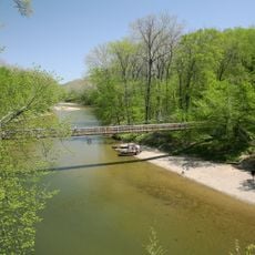
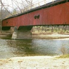
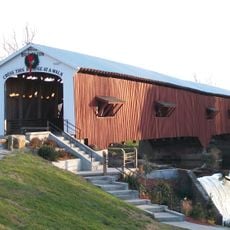
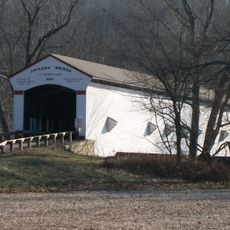
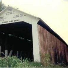
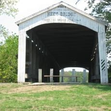
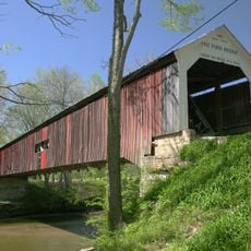
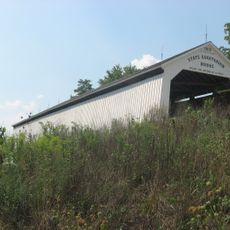
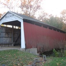
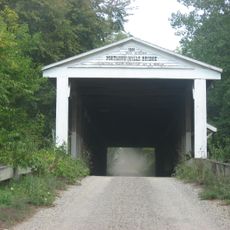
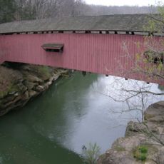
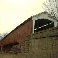
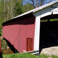
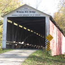
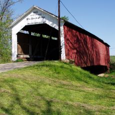
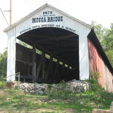
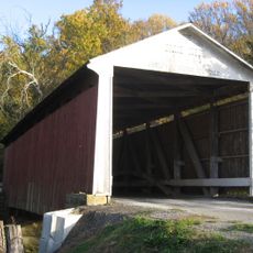
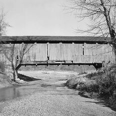
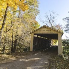
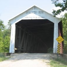
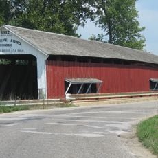
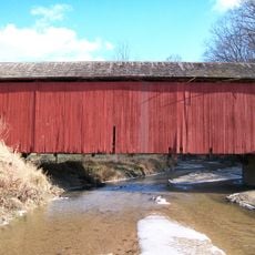
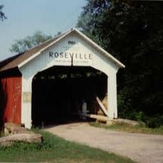
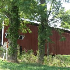
Parke County is an administrative division in western Indiana with the Wabash River marking its western edge. The area contains 31 historic covered bridges that span small creeks and tributary waterways.

The county was created in 1821 as part of the former Vigo County territory and named after a pioneer who played a role in early military conflicts. Its founding occurred during a period of westward expansion and settlement of the Indiana territory.

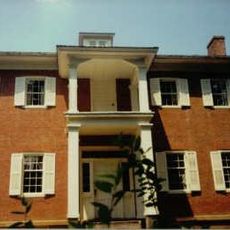
The county name honors Benjamin Parke, an early settler and military leader of the region. Visitors can observe how farming still shapes daily life and families maintain their bond to the land across generations.

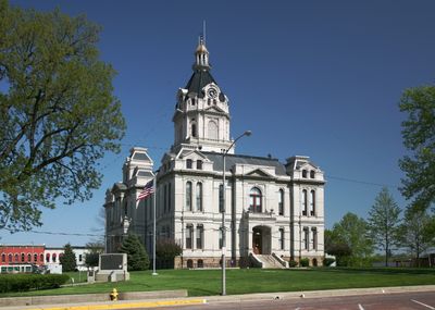
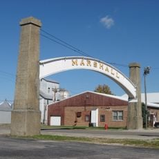
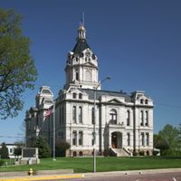
Visitors will find the county administrative offices in Rockville on High Street. It is best to explore the area by car since the bridges and natural areas are spread across several miles.

Turkey Run State Park within the county displays deep sandstone canyons and gorges carved by glacial meltwater thousands of years ago. These geological formations make the park a rare example of ice-age landscape changes in the region.

Location: Indiana

Inception: January 9, 1821

Capital city: Rockville

Shares border with: Fountain County, Montgomery County, Putnam County, Clay County, Vigo County, Vermillion County

Website: http://parkecounty.org

GPS coordinates: 39.78000,-87.21000

Latest update: December 7, 2025 19:27

Photos
Around this place
Show the full map
Turkey Run State Park
United States of America

Turkey Run State Park

11.6 km
Shades State Park
United States of America

Shades State Park

20.6 km
Bridgeton Covered Bridge
United States of America

Bridgeton Covered Bridge

14.8 km
Lusk Home and Mill Site
United States of America

Lusk Home and Mill Site

12.6 km
Jackson Covered Bridge
United States of America

Jackson Covered Bridge

12.7 km
Jeffries Ford Covered Bridge
United States of America

Jeffries Ford Covered Bridge

16.7 km
Neet Covered Bridge
United States of America

Neet Covered Bridge

8.8 km
Cox Ford Covered Bridge
United States of America

Cox Ford Covered Bridge

11.8 km
State Sanitorium Covered Bridge
United States of America

State Sanitorium Covered Bridge

5.6 km
Beeson Covered Bridge
United States of America

Beeson Covered Bridge

1.9 km
Portland Mills Covered Bridge
United States of America

Portland Mills Covered Bridge

13.7 km
Narrows Covered Bridge
United States of America

Narrows Covered Bridge

12.5 km
West Union Covered Bridge
United States of America

West Union Covered Bridge

13.6 km
Big Rocky Fork Covered Bridge
United States of America

Big Rocky Fork Covered Bridge

17.1 km
Wilkins Mill Covered Bridge
United States of America

Wilkins Mill Covered Bridge

13.3 km
Sim Smith Covered Bridge
United States of America

Sim Smith Covered Bridge

10.4 km
Mecca Covered Bridge
United States of America

Mecca Covered Bridge

11.3 km
Billie Creek Covered Bridge
United States of America

Billie Creek Covered Bridge

2.1 km
Leatherwood Station Covered Bridge
United States of America

Leatherwood Station Covered Bridge

2.5 km
Melcher Covered Bridge
United States of America

Melcher Covered Bridge

10.7 km
Marshall Arch
United States of America

Marshall Arch

7.8 km
Rockville Chautauqua Pavilion
United States of America

Rockville Chautauqua Pavilion

3.1 km
McAllister Covered Bridge
United States of America

McAllister Covered Bridge

8 km
Thorpe Ford Covered Bridge
United States of America

Thorpe Ford Covered Bridge

16.6 km
Harry Evans Covered Bridge
United States of America

Harry Evans Covered Bridge

15 km
Roseville-Coxville Covered Bridge
United States of America

Roseville-Coxville Covered Bridge

15.9 km
Crooks Covered Bridge
United States of America

Crooks Covered Bridge

6.5 km
George Seybold House
United States of America

George Seybold House

17.7 km
Show the full map
Reviews

Visited this place? Tap the stars to rate it and share your experience / photos with the community! Try now! You can cancel it anytime.

Administrative divisions
« Parke County - County administrative division in western Indiana, United States » is provided by Around Us (aroundus.com). Images and texts are derived from Wikimedia project under a Creative Commons license. You are allowed to copy, distribute, and modify copies of this page, under the conditions set by the license, as long as this note is clearly visible.

Discover hidden gems everywhere you go!

From secret cafés to breathtaking viewpoints, skip the crowded tourist spots and find places that match your style. Our app makes it easy with voice search, smart filtering, route optimization, and insider tips from travelers worldwide. Download now for the complete mobile experience.

Around Us App Screenshot

A unique approach to discovering new places

Le Figaro

All the places worth exploring

France Info

A tailor-made excursion in just a few clicks

20 Minutes