Billie Creek Covered Bridge

Log in to your account

AroundUs is a community-driven map of interesting places, built by curious explorers like you. It grows with every review, story, and photo you share.
Connect to save your favorite spots, contribute locations, and create personalized routes.
Continue with Google
Continue with Apple
Continue with X
Continue with Facebook
Continue with email
By continuing, you accept our Terms and Conditions and our Privacy Policy
Create an account
Add to collection
Map
Suggest a change
Share

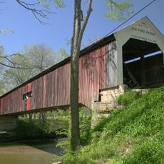
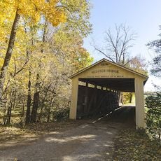
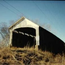
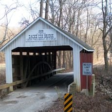
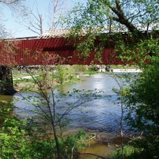
Billie Creek Covered Bridge, Covered bridge in Parke County, Indiana.

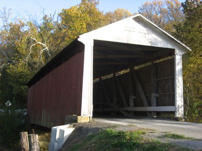
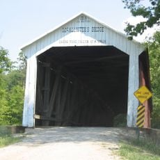
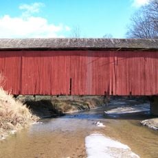
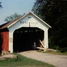
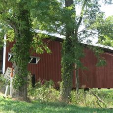
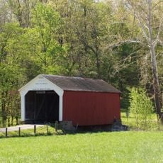
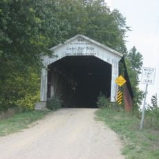
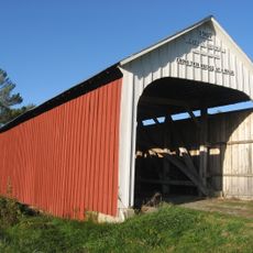
Billie Creek Covered Bridge is a wooden bridge crossing Williams Creek with a Burr Arch truss design and sandstone foundation. The structure spans 62 feet (19 meters) and sits east of Rockville in Parke County.

Joseph J. Daniels built this bridge in 1895 for $820 to replace an earlier wooden structure from 1880. It survived the modernization wave of the 1900s when many similar bridges in the region were demolished.

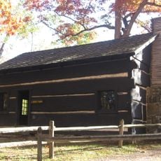
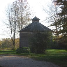
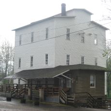
The bridge stands as part of Billie Creek Village, where numerous historical buildings have been relocated to create an educational heritage site.

Access to the bridge may be temporarily restricted during special events or heavy visitor traffic. Visitors should watch for local notices and plan alternative routes if maintenance or safety work is underway.

This bridge escaped demolition because the road was rerouted away from it, while similar structures elsewhere were torn down. The fortunate detour saved it from the fate that befell many neighboring bridges during the modernization wave.

Location: Parke County

Inception: 1895

Website: http://coveredbridges.com/poi/billie-creek-covered-bridge-39

GPS coordinates: 39.76125,-87.20658

Latest update: December 14, 2025 18:44

Photos
Around this place
Turkey Run State Park
United States of America

Turkey Run State Park

13.7 km
Bridgeton Covered Bridge
United States of America

Bridgeton Covered Bridge

12.7 km
Neet Covered Bridge
United States of America

Neet Covered Bridge

6.7 km
Cox Ford Covered Bridge
United States of America

Cox Ford Covered Bridge

13.9 km
State Sanitorium Covered Bridge
United States of America

State Sanitorium Covered Bridge

5.7 km
Beeson Covered Bridge
United States of America

Beeson Covered Bridge

222 m
Sim Smith Covered Bridge
United States of America

Sim Smith Covered Bridge

10.7 km
Mecca Covered Bridge
United States of America

Mecca Covered Bridge

10.7 km
Leatherwood Station Covered Bridge
United States of America

Leatherwood Station Covered Bridge

458 m
Melcher Covered Bridge
United States of America

Melcher Covered Bridge

11.4 km
Marshall Arch
United States of America

Marshall Arch

9.7 km
Rockville Chautauqua Pavilion
United States of America

Rockville Chautauqua Pavilion

2.4 km
McAllister Covered Bridge
United States of America

McAllister Covered Bridge

5.9 km
Harry Evans Covered Bridge
United States of America

Harry Evans Covered Bridge

13.4 km
Roseville-Coxville Covered Bridge
United States of America

Roseville-Coxville Covered Bridge

14.3 km
Crooks Covered Bridge
United States of America

Crooks Covered Bridge

4.4 km
Phillips Covered Bridge
United States of America

Phillips Covered Bridge

10 km
Conley's Ford Covered Bridge
United States of America

Conley's Ford Covered Bridge

13 km
Catlin Covered Bridge
United States of America

Catlin Covered Bridge

4.3 km
Nevins Covered Bridge
United States of America

Nevins Covered Bridge

8.6 km
Joseph Finney House
United States of America

Joseph Finney House

12.3 km
Zacke Cox Covered Bridge
United States of America

Zacke Cox Covered Bridge

10 km
Rockville Historic District
United States of America

Rockville Historic District

2.1 km
Richard Lieber Log Cabin
United States of America

Richard Lieber Log Cabin

13.7 km
Wabash Township Graded School
United States of America

Wabash Township Graded School

11.5 km
William Hill Polygonal Barn
United States of America

William Hill Polygonal Barn

7 km
Mansfield Roller Mill
United States of America

Mansfield Roller Mill

13 km
Mansfield Covered Bridge
United States of America

Mansfield Covered Bridge

13 km
Show the full map
Reviews

Visited this place? Tap the stars to rate it and share your experience / photos with the community! Try now! You can cancel it anytime.

« Billie Creek Covered Bridge - Covered bridge in Parke County, Indiana » is provided by Around Us (aroundus.com). Images and texts are derived from Wikimedia project under a Creative Commons license. You are allowed to copy, distribute, and modify copies of this page, under the conditions set by the license, as long as this note is clearly visible.

Discover hidden gems everywhere you go!

From secret cafés to breathtaking viewpoints, skip the crowded tourist spots and find places that match your style. Our app makes it easy with voice search, smart filtering, route optimization, and insider tips from travelers worldwide. Download now for the complete mobile experience.

Around Us App Screenshot

A unique approach to discovering new places

Le Figaro

All the places worth exploring

France Info

A tailor-made excursion in just a few clicks

20 Minutes