Enable Location

We need your location to show you interesting places around you

Discover nearby places

Find interesting locations and hidden gems around you

Precise directions

Get accurate directions and distances to places

Your location is never shared with other users. It's only used when you tap the location button.

Cox Ford Covered Bridge

Log in to your account

Start exploring — it's free

Trusted by 64,194 travelers worldwide

Continue with Google
Continue with Apple
or

We will send you a code to connect

By continuing, you accept our Terms and Conditions and our Privacy Policy

Check your inbox

We've sent a pincode in your inbox. Please enter the code below.

Discussion Reviews 1 Photos
1.6k Popularity

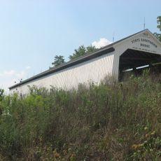
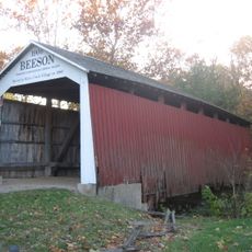
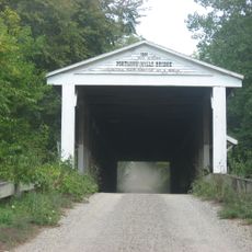
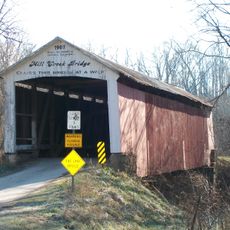
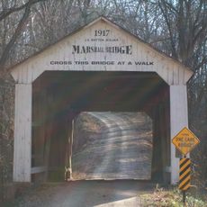
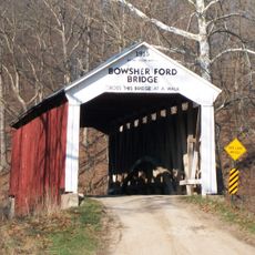
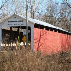
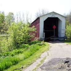
Cox Ford Covered Bridge, Covered bridge in Parke County, United States

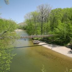
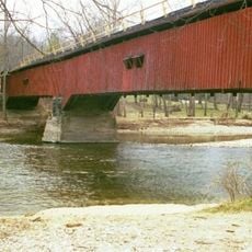
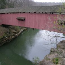
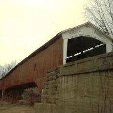
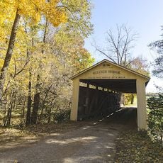
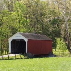
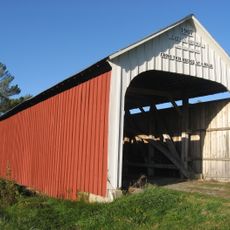
Cox Ford Covered Bridge is a roofed crossing over Sugar Creek built with a wooden Burr Arch truss design and painted red exterior walls. The structure spans about 176 feet with a clearance height of 13 feet, allowing vehicles and pedestrians to pass through.

Joseph A. Britton built this structure in 1913 after a severe flood destroyed the previous steel bridge at the site. The construction reused arches from a neighboring older bridge to create the new Burr Arch design.

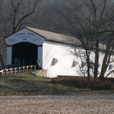
The bridge shows how communities built structures that adapted to nature's challenges, with its red wooden walls and sturdy design reflecting the craftsmanship of its time. It belongs to a group of covered crossings that define the area's visual identity and connect people to local heritage.

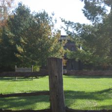
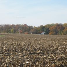
The bridge sits about half a mile west of a state park and opens up to hiking trails and canoe launch areas nearby. Visitors should check weather conditions beforehand, as unpaved access roads can become muddy or slippery after rain.

The foundation mixes original 19th-century stone blocks with concrete additions that raised the entire structure about 5 feet higher than before. This reinforcement was crucial for protecting the bridge against future floods and extending its lifespan.

The community of curious travelers

AroundUs brings together thousands of curated places, local tips, and hidden gems, enriched daily by 60,000 contributors worldwide.

Start exploring
Location
Inception
1913
GPS coordinates
39.88544,-87.22379
Latest update
December 14, 2025 14:26
Around this place
Turkey Run State Park
United States of America

Turkey Run State Park

1.5 km
Shades State Park
United States of America

Shades State Park

12.9 km
Lusk Home and Mill Site
United States of America

Lusk Home and Mill Site

3.3 km
Jackson Covered Bridge
United States of America

Jackson Covered Bridge

5 km
State Sanitorium Covered Bridge
United States of America

State Sanitorium Covered Bridge

13.4 km
Beeson Covered Bridge
United States of America

Beeson Covered Bridge

13.7 km
Portland Mills Covered Bridge
United States of America

Portland Mills Covered Bridge

11.9 km
Narrows Covered Bridge
United States of America

Narrows Covered Bridge

3.3 km
West Union Covered Bridge
United States of America

West Union Covered Bridge

10.2 km
Wilkins Mill Covered Bridge
United States of America

Wilkins Mill Covered Bridge

1.6 km
Billie Creek Covered Bridge
United States of America

Billie Creek Covered Bridge

13.9 km
Leatherwood Station Covered Bridge
United States of America

Leatherwood Station Covered Bridge

14.3 km
Melcher Covered Bridge
United States of America

Melcher Covered Bridge

14.3 km
Marshall Arch
United States of America

Marshall Arch

5.2 km
Rockville Chautauqua Pavilion
United States of America

Rockville Chautauqua Pavilion

14 km
Phillips Covered Bridge
United States of America

Phillips Covered Bridge

15.2 km
Mill Creek Covered Bridge
United States of America

Mill Creek Covered Bridge

12 km
Lancelot C. Ewbank House
United States of America

Lancelot C. Ewbank House

4.2 km
Marshall Covered Bridge
United States of America

Marshall Covered Bridge

8.8 km
Bowsher Ford Covered Bridge
United States of America

Bowsher Ford Covered Bridge

12 km
Catlin Covered Bridge
United States of America

Catlin Covered Bridge

10.5 km
Joseph Finney House
United States of America

Joseph Finney House

5 km
Rush Creek Covered Bridge
United States of America

Rush Creek Covered Bridge

7.9 km
Rockville Historic District
United States of America

Rockville Historic District

13.6 km
Richard Lieber Log Cabin
United States of America

Richard Lieber Log Cabin

1.5 km
William Hill Polygonal Barn
United States of America

William Hill Polygonal Barn

8.3 km
Wallace Covered Bridge
United States of America

Wallace Covered Bridge

13 km
Rocky Hollow-Falls Canyon Nature Preserve
United States of America

Rocky Hollow-Falls Canyon Nature Preserve

1.9 km
Show the full map
Reviews
Share your experience

No review yet

Discussions
Start a discussion...

No discussion yet

« Cox Ford Covered Bridge - Covered bridge in Parke County, United States » is provided by Around Us (aroundus.com). Images and texts are derived from Wikimedia project under a Creative Commons license. You are allowed to copy, distribute, and modify copies of this page, under the conditions set by the license, as long as this note is clearly visible.

Discover hidden gems everywhere you go!

From secret cafés to breathtaking viewpoints, skip the crowded tourist spots and find places that match your style. Our app makes it easy with voice search, smart filtering, route optimization, and insider tips from travelers worldwide. Download now for the complete mobile experience.

Around Us App Screenshot

A unique approach to discovering new places

Le Figaro

All the places worth exploring

France Info

A tailor-made excursion in just a few clicks

20 Minutes

Around Us
Travel Guide & Maps
Download

Send to your phone

QR Code
1

Open the camera app on your mobile.

2

Point at the QR code with your camera. A notification will appear.

3

Tap the notification to open the link.