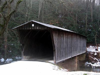
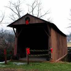
Bob White Covered Bridge, Covered bridge in Woolwine, United States.
Bob White Covered Bridge is a wooden structure that crosses the Smith River using Queen-post truss construction and a protective roof covering. The bridge measures approximately 80 feet long and features the enclosed design typical of covered bridges built during that era.
The bridge was built in 1921 by Walter Weaver and later added to the National Register of Historic Places in 1973. After a concrete replacement took over motor traffic in 1981, the original wooden structure stood until flooding destroyed it in 2015.
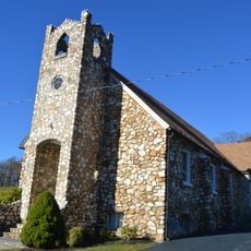
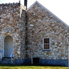
The structure took its name from the bobwhite quails found throughout the surrounding woods and fields. It served as a vital link for the local community, connecting residents to the nearby Smith River Church of the Brethren.
The bridge sat about 13 miles north of Stuart, accessible via Bob White Road branching from State Route 8. Since it was retired from motor traffic in 1981, it remained open primarily for foot traffic and non-motorized vehicles in its later years.
The bridge was one of only seven public covered bridges in Virginia and drew visitors with annual horse-drawn wagon rides. These events took place during the Patrick County Covered Bridge Festival and made it a special gathering point for the community.
The community of curious travelers
AroundUs brings together thousands of curated places, local tips, and hidden gems, enriched daily by 60,000 contributors worldwide.