Chest opened
+${chestReward.xp} XP
Explorer
NOUVEAU ×${chestReward.collectible.quantity}
tapez pour fermer
Chest locked

Open chests in the app

Around Us is built for your phone — chests unlock when you walk, explore and capture nearby places.

Enable Location

We need your location to show you interesting places around you

Discover nearby places

Find interesting locations and hidden gems around you

Precise directions

Get accurate directions and distances to places

Your location is never shared with other users. It's only used when you tap the location button.

Log in to your account

Start exploring — it's free

Trusted by 72,880 travelers worldwide

Continue with Google
Continue with Apple
or

We will send you a code to connect

By continuing, you accept our Terms and Conditions and our Privacy Policy

Check your inbox

We've sent a pincode in your inbox. Please enter the code below.

Fort Cap au Gris
Discussion Reviews Photo
3k Popularity

Fort Cap au Gris, Military fort in Lincoln County, Missouri, US.

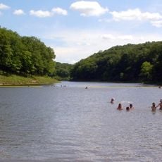
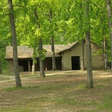
Fort Cap au Gris is a military fortification from the early 1800s situated on a bluff along the eastern bank of the Mississippi River. The structure was positioned at a strategic point to oversee river traffic and protect settlements downriver from threats.

The fort was constructed in September 1814 during the War of 1812, following an attack on the nearby Fort Johnson by British and allied forces. It served under General Zachary Taylor's command as a shelter and defensive position for American soldiers.

The place carries a French name reflecting early French exploration of the region. This heritage appears in settlement names throughout the Mississippi River valley, where such French terms mark how the area was first known and traveled.

The site sits on elevated ground along the river, making it easy to see across the surroundings and the valley. Visitors should wear comfortable shoes since the terrain is uneven and the grounds are best explored on foot.

A conflict occurred nearby in May 1815 when Missouri Rangers fought against Sac Indians led by Black Hawk. This event shows the complicated power struggles between different groups during that frontier period.

The community of curious travelers

AroundUs brings together thousands of curated places, local tips, and hidden gems, enriched daily by 60,000 contributors worldwide.

Start exploring
GPS coordinates
38.99583,-90.68444
Latest update
December 12, 2025 12:04
Around this place
Koster Site
United States of America

Koster Site

26.4 km
Cuivre River State Park
United States of America

Cuivre River State Park

21.9 km
Harlen C. Hunter Stadium
United States of America

Harlen C. Hunter Stadium

28.2 km
United States of America

Fort Zumwalt Park

22.3 km
Lock and Dam No. 25
United States of America

Lock and Dam No. 25

1 km
Two Rivers National Wildlife Refuge
United States of America

Two Rivers National Wildlife Refuge

8.3 km
Bowlero
United States of America

Bowlero

21.7 km
St. Mary's Institute of O'Fallon
United States of America

St. Mary's Institute of O'Fallon

20.3 km
Golden Eagle-Toppmeyer Site
United States of America

Golden Eagle-Toppmeyer Site

16.8 km
Hamilton Primary School
United States of America

Hamilton Primary School

25.6 km
Duncan Farm
United States of America

Duncan Farm

15.1 km
Old Rock House
United States of America

Old Rock House

20.6 km
Wentzville Tobacco Company Factory
United States of America

Wentzville Tobacco Company Factory

25.2 km
Lindenwood Hall
United States of America

Lindenwood Hall

28.2 km
Elsah Historic District
United States of America

Elsah Historic District

28.4 km
Paris Mason Building
United States of America

Paris Mason Building

20.4 km
Charles Brainerd House
United States of America

Charles Brainerd House

22.2 km
Smith-Duncan House and Eastman Barn
United States of America

Smith-Duncan House and Eastman Barn

15.2 km
Samuel Stewart Watson House
United States of America

Samuel Stewart Watson House

27.3 km
Slaten-LaMarsh House
United States of America

Slaten-LaMarsh House

21.9 km
Schudel No. 2 Site
United States of America

Schudel No. 2 Site

18.7 km
Brussels Historic District
United States of America

Brussels Historic District

9.9 km
Grafton Historic District
United States of America

Grafton Historic District

22.1 km
Grafton Bank
United States of America

Grafton Bank

22 km
John and Amelia McClintock House
United States of America

John and Amelia McClintock House

22.2 km
Cave Springs Lanes
United States of America

Cave Springs Lanes

24.9 km
Lindenwood Neighborhood Historic District
United States of America

Lindenwood Neighborhood Historic District

28.3 km
Cuivre River State Park Administrative Area Historic District
United States of America

Cuivre River State Park Administrative Area Historic District

21 km
Show the full map
Reviews
Share your experience

No review yet

Discussions
Start a discussion...

No discussion yet

« Fort Cap au Gris - Military fort in Lincoln County, Missouri, US » is provided by Around Us (aroundus.com). Images and texts are derived from Wikimedia project under a Creative Commons license. You are allowed to copy, distribute, and modify copies of this page, under the conditions set by the license, as long as this note is clearly visible.

Discover hidden gems everywhere you go!

From secret cafés to breathtaking viewpoints, skip the crowded tourist spots and find places that match your style. Our app makes it easy with voice search, smart filtering, route optimization, and insider tips from travelers worldwide. Download now for the complete mobile experience.

Around Us App Screenshot

A unique approach to discovering new places

Le Figaro

All the places worth exploring

France Info

A tailor-made excursion in just a few clicks

20 Minutes

Around Us
Travel Guide & Maps
Download

Send to your phone

QR Code
1

Open the camera app on your mobile.

2

Point at the QR code with your camera. A notification will appear.

3

Tap the notification to open the link.