Enable Location

We need your location to show you interesting places around you

Discover nearby places

Find interesting locations and hidden gems around you

Precise directions

Get accurate directions and distances to places

Your location is never shared with other users. It's only used when you tap the location button.

Foster's Tavern

Log in to your account

Start exploring — it's free

Trusted by 62,560 travelers worldwide

Continue with Google
Continue with Apple
or

We will send you a code to connect

By continuing, you accept our Terms and Conditions and our Privacy Policy

Check your inbox

We've sent a pincode in your inbox. Please enter the code below.

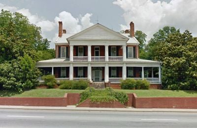
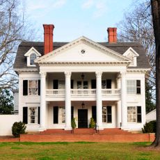
Foster's Tavern, human settlement in South Carolina, United States of America

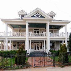
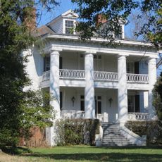
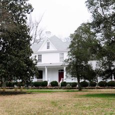
Foster's Tavern is a brick structure built around 1808 by Anthony Foster as a lodging point for travelers along a major stagecoach route. The building features handmade brick walls, tied chimneys, hand-carved woodwork inside, and a front portico added in 1845, with porches built around 1915.

The structure was built around 1808 by Anthony Foster and served as a lodging stop on an active stagecoach route. It was added to the National Register of Historic Places in 1970 and has remained in private family ownership since 1922.

The building served as a stopping point on a busy stagecoach route where travelers and merchants gathered to rest and share news. This role as a social hub reflected the importance of such taverns in connecting rural communities during the early 1800s.

The structure is privately owned and can be viewed from the outside, though interior access requires permission from the current owners. The location sits at an intersection of old roads in a quiet rural setting that allows for easy viewing of its exterior features.

A notable feature is the John C. Calhoun Room on the second floor, a private chamber reserved exclusively for the prominent senator when he visited. Guests who had booked this room were relocated to other accommodations to make space for him, reflecting his high status.

The community of curious travelers

AroundUs brings together thousands of curated places, local tips, and hidden gems, enriched daily by 60,000 contributors worldwide.

Start exploring
Location
GPS coordinates
34.92167,-81.88722
Latest update
February 9, 2026 08:20
Around this place
Wofford College
United States of America

Wofford College

6 km
Converse University
United States of America

Converse University

4.6 km
Gibbs Stadium
United States of America

Gibbs Stadium

6.1 km
Spartanburg Memorial Auditorium
United States of America

Spartanburg Memorial Auditorium

5.9 km
Daniel Morgan Monument
United States of America

Daniel Morgan Monument

5.2 km
South Carolina School for the Deaf and Blind
United States of America

South Carolina School for the Deaf and Blind

1.3 km
Montgomery Building
United States of America

Montgomery Building

5.3 km
Drayton Mill
United States of America

Drayton Mill

5.7 km
Hampton Heights
United States of America

Hampton Heights

4.6 km
Hatcher Garden and Woodland Preserve
United States of America

Hatcher Garden and Woodland Preserve

6.5 km
Jammie Seay House
United States of America

Jammie Seay House

5.1 km
Spartanburg Historic District
United States of America

Spartanburg Historic District

5.4 km
Frank Evans High School
United States of America

Frank Evans High School

4.7 km
American Legion Building
United States of America

American Legion Building

2.8 km
Bivings-Converse House
United States of America

Bivings-Converse House

5.2 km
Walter Scott Montgomery House
United States of America

Walter Scott Montgomery House

3.9 km
Evans-Russell House
United States of America

Evans-Russell House

4 km
Alexander House
United States of America

Alexander House

4.7 km
Converse Heights Historic District
United States of America

Converse Heights Historic District

3.9 km
Evins-Bivings House
United States of America

Evins-Bivings House

6.5 km
Golightly-Dean House
United States of America

Golightly-Dean House

5.3 km
Schuyler Apartments
United States of America

Schuyler Apartments

4.6 km
Bishop William Wallace Duncan House
United States of America

Bishop William Wallace Duncan House

5.9 km
Cleveland Law Range
United States of America

Cleveland Law Range

5.4 km
Spartanburg County Courthouse (1958)
United States of America

Spartanburg County Courthouse (1958)

5.5 km
St. Paul the Apostle Church
United States of America

St. Paul the Apostle Church

4.9 km
Wilson Hall, Converse University
United States of America

Wilson Hall, Converse University

4.7 km
Masonic Temple (Spartanburg)
United States of America

Masonic Temple (Spartanburg)

5.3 km
Show the full map
« Foster's Tavern - human settlement in South Carolina, United States of America » is provided by Around Us (aroundus.com). Images and texts are derived from Wikimedia project under a Creative Commons license. You are allowed to copy, distribute, and modify copies of this page, under the conditions set by the license, as long as this note is clearly visible.

Discover hidden gems everywhere you go!

From secret cafés to breathtaking viewpoints, skip the crowded tourist spots and find places that match your style. Our app makes it easy with voice search, smart filtering, route optimization, and insider tips from travelers worldwide. Download now for the complete mobile experience.

Around Us App Screenshot

A unique approach to discovering new places

Le Figaro

All the places worth exploring

France Info

A tailor-made excursion in just a few clicks

20 Minutes

Around Us
Travel Guide & Maps
Download

Send to your phone

QR Code
1

Open the camera app on your mobile.

2

Point at the QR code with your camera. A notification will appear.

3

Tap the notification to open the link.