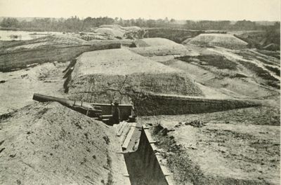
Fort Darling, Confederate fort in Chesterfield County, Virginia, US
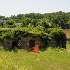
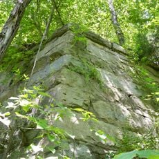
Fort Darling is a military fortification in Chesterfield County, Virginia, standing roughly 90 feet (27 meters) above the James River with earthen embankments and gun positions spread across the site. The structure features three large seacoast cannons mounted at strategic locations to control the river approach.
The fortification was built in 1862 to defend Richmond from Union naval assault and achieved this goal during the pivotal Battle of Drewry's Bluff on May 15, 1862. In this engagement, Union gunboats attempting to advance on the capital were stopped by Confederate artillery fire.
The fort served as a training center for Confederate naval forces and Marines between 1862 and 1864 under Captain Sydney Smith Lee's leadership. You can still see how this military past shaped the landscape and its use today.
The site is now part of Richmond National Battlefield Park, accessible through marked trails that wind through the preserved earthworks and gun positions. Expect some elevation changes and uneven ground as you explore different parts of the fortification.
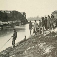
President Abraham Lincoln passed by the fort on April 4, 1865, after the James River had been cleared of obstacles, traveling to the recently captured city of Richmond. This journey occurred just days before his assassination.
The community of curious travelers
AroundUs brings together thousands of curated places, local tips, and hidden gems, enriched daily by 60,000 contributors worldwide.