Chest opened
+${chestReward.xp} XP
Explorer
NOUVEAU ×${chestReward.collectible.quantity}
tapez pour fermer
Chest locked

Open chests in the app

Around Us is built for your phone — chests unlock when you walk, explore and capture nearby places.

Enable Location

We need your location to show you interesting places around you

Discover nearby places

Find interesting locations and hidden gems around you

Precise directions

Get accurate directions and distances to places

Your location is never shared with other users. It's only used when you tap the location button.

Log in to your account

Start exploring — it's free

Trusted by 72,876 travelers worldwide

Continue with Google
Continue with Apple
or

We will send you a code to connect

By continuing, you accept our Terms and Conditions and our Privacy Policy

Check your inbox

We've sent a pincode in your inbox. Please enter the code below.

Foothills Parkway
Discussion Reviews Photo
22.9k Popularity

Foothills Parkway, National parkway in Blount and Sevier Counties, United States

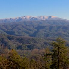
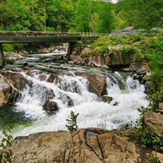
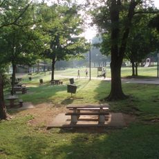
The Foothills Parkway is a mountain road crossing ridges in eastern Tennessee that offers views toward the Great Smoky Mountains. The completed sections wind across high ground and connect several observation areas where you can see valleys and distant mountain ranges.

Planning for this road began in 1944, and construction started in 1960, proceeding in phases over many decades. Different sections were completed at different times as funding and technical challenges in difficult mountain terrain slowed the work.

The road's naming reflects local places and shows how it connects communities with mountain terrain. Visitors notice how the route uses elevation changes to bring drivers closer to the natural surroundings.

The open sections can be driven year-round, with access from US 129 near Chilhowee Lake and US 321 at Walland. Visit during good weather when visibility and road conditions are best for enjoying the views.

Though the parkway as a project is over 70 years old, roughly 34 kilometers of the planned route still remains unbuilt, making it an unfinished undertaking. These missing sections are partly unresolved due to conservation concerns and partly due to funding questions.

The community of curious travelers

AroundUs brings together thousands of curated places, local tips, and hidden gems, enriched daily by 60,000 contributors worldwide.

Start exploring
Location
Location
Location
GPS coordinates
35.68425,-83.88629
Latest update
December 20, 2025 15:13
Around this place
Abrams Falls Trail
United States of America

Abrams Falls Trail

11 km
Tuckaleechee Caverns
United States of America

Tuckaleechee Caverns

10.6 km
Gregory Bald
United States of America

Gregory Bald

18.3 km
The Sinks
United States of America

The Sinks

20.3 km
United States of America

Maryville Alcoa Greenway

13.9 km
Sam Houston Schoolhouse
United States of America

Sam Houston Schoolhouse

13.2 km
Clover Hill Mill
United States of America

Clover Hill Mill

15 km
New Salem United Methodist Church
United States of America

New Salem United Methodist Church

22.4 km
Sandy Springs Park
United States of America

Sandy Springs Park

10.1 km
Anderson Hall
United States of America

Anderson Hall

10.4 km
Isaac Yearout House
United States of America

Isaac Yearout House

13.1 km
A.J. Fisher House
United States of America

A.J. Fisher House

8.3 km
David Jones House
United States of America

David Jones House

10.7 km
Great Smoky Mountains Heritage Center
United States of America

Great Smoky Mountains Heritage Center

14.8 km
McNutt-Howard House
United States of America

McNutt-Howard House

11.2 km
Samuel George House
United States of America

Samuel George House

20.4 km
Morningside
United States of America

Morningside

9.6 km
John Alexander House
United States of America

John Alexander House

10.2 km
McNutt-McReynolds House
United States of America

McNutt-McReynolds House

11.2 km
John M. Rorex House
United States of America

John M. Rorex House

20 km
Willard-Clark House
United States of America

Willard-Clark House

11.2 km
Cades Cove Missionary Baptist Church
United States of America

Cades Cove Missionary Baptist Church

10.1 km
Look Rock Observation Tower
United States of America

Look Rock Observation Tower

7.7 km
Cades Cove Methodist Church
United States of America

Cades Cove Methodist Church

10.6 km
Cades Cove Primitive Baptist Church
United States of America

Cades Cove Primitive Baptist Church

11.3 km
Cades Cove Visitor Center
United States of America

Cades Cove Visitor Center

11.7 km
Carter Shields Cabin
United States of America

Carter Shields Cabin

13.2 km
Elijah Oliver Place
United States of America

Elijah Oliver Place

10.2 km
Show the full map
Reviews
Share your experience

No review yet

Discussions
Start a discussion...

No discussion yet

« Foothills Parkway - National parkway in Blount and Sevier Counties, United States » is provided by Around Us (aroundus.com). Images and texts are derived from Wikimedia project under a Creative Commons license. You are allowed to copy, distribute, and modify copies of this page, under the conditions set by the license, as long as this note is clearly visible.

Discover hidden gems everywhere you go!

From secret cafés to breathtaking viewpoints, skip the crowded tourist spots and find places that match your style. Our app makes it easy with voice search, smart filtering, route optimization, and insider tips from travelers worldwide. Download now for the complete mobile experience.

Around Us App Screenshot

A unique approach to discovering new places

Le Figaro

All the places worth exploring

France Info

A tailor-made excursion in just a few clicks

20 Minutes

Around Us
Travel Guide & Maps
Download

Send to your phone

QR Code
1

Open the camera app on your mobile.

2

Point at the QR code with your camera. A notification will appear.

3

Tap the notification to open the link.