Fort Michilimackinac State Park

Log in to your account

AroundUs is a community-driven map of interesting places, built by curious explorers like you. It grows with every review, story, and photo you share.
Connect to save your favorite spots, contribute locations, and create personalized routes.
Continue with Google
Continue with Apple
Continue with X
Continue with Facebook
Continue with email
By continuing, you accept our Terms and Conditions and our Privacy Policy
Create an account

Fort Michilimackinac State Park

Add to collection
Map
Suggest a change
Share

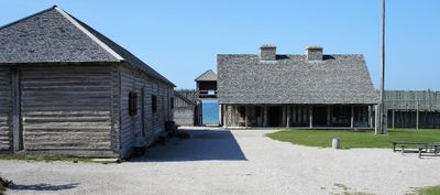
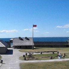
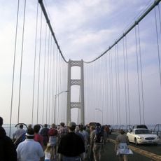
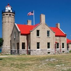
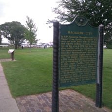
Fort Michilimackinac State Park, 18th-century reconstructed fort in Mackinaw City, United States.

Fort Michilimackinac is a reconstructed colonial military fort located where Lake Huron and Lake Michigan meet. The grounds contain replica buildings from the 1700s, fortification structures, and ongoing archaeological dig sites that reveal objects from the past.

French traders established this trading post in 1715 to control a strategic location in the Great Lakes region. The British took over the fort in 1761 following military conflict, and it served both powers as a vital hub for fur trading and regional defense.

Costumed interpreters perform daily demonstrations showing military routines, metalwork, and food preparation as colonists would have practiced them. Visitors experience directly how the fort functioned as a working community in the 1700s.

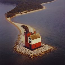
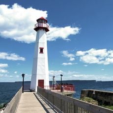
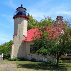
The park is easiest to visit during warmer months when the weather cooperates and demonstrations run daily. Visitors need a Michigan vehicle pass for access, and the adjacent lighthouse is worth including in your visit since it is part of the same property.

Archaeologists have been digging at this location for decades continuously, making it one of the longest-running excavation projects at a single site in North America. Visitors can watch this scientific work actually happen in real time as they walk the grounds.

Location: Michigan

Website: https://www2.dnr.state.mi.us/ParksandTrails/Details.aspx?id=444&type=SPRK

GPS coordinates: 45.78690,-84.73560

Latest update: December 11, 2025 11:04

Photos
Around this place
Mackinac Bridge
United States of America

Mackinac Bridge

3.3 km
Grand Hotel
United States of America

Grand Hotel

11.1 km
Fort Michilimackinac
United States of America

Fort Michilimackinac

39 m
Mackinac Bridge Walk
United States of America

Mackinac Bridge Walk

4 km
Devil's Kitchen
United States of America

Devil's Kitchen

10.5 km
Father Marquette National Memorial
United States of America

Father Marquette National Memorial

7.4 km
Round Island Light
United States of America

Round Island Light

10.8 km
Wawatam Lighthouse
United States of America

Wawatam Lighthouse

8.9 km
Straits of Mackinac Shipwreck Preserve
United States of America

Straits of Mackinac Shipwreck Preserve

3.2 km
The Headlands
United States of America

The Headlands

3.7 km
Straits State Park
United States of America

Straits State Park

7.4 km
Historic Mill Creek State Park
United States of America

Historic Mill Creek State Park

7 km
McGulpin Point Light
United States of America

McGulpin Point Light

2.9 km
Round Island Passage Light
United States of America

Round Island Passage Light

11.3 km
St. Anthony's Rock
United States of America

St. Anthony's Rock

9.1 km
St. Ignace Mission
United States of America

St. Ignace Mission

9.4 km
Mama Mia's Pizza
United States of America

Mama Mia's Pizza

822 m
John Chambers House
United States of America

John Chambers House

9 km
Forrest J. Stimpson House
United States of America

Forrest J. Stimpson House

675 m
Gros Cap Archaeological District
United States of America

Gros Cap Archaeological District

10.2 km
Marquette Street Archaeological District
United States of America

Marquette Street Archaeological District

8.9 km
Historic Mill Creek Discovery Park
United States of America

Historic Mill Creek Discovery Park

6.8 km
Old Mackinac Point Light
United States of America

Old Mackinac Point Light

483 m
The Wacky Taxidermy and Miniatures Museum
United States of America

The Wacky Taxidermy and Miniatures Museum

1 km
Mackinaw Bridge Museum
United States of America

Mackinaw Bridge Museum

814 m
Michigan State Ferry System Historical Marker
United States of America

Michigan State Ferry System Historical Marker

1.2 km
Mackinaw City Historical Marker
United States of America

Mackinaw City Historical Marker

1 km
Gros Cap and Saint Helena Island Historical Marker
United States of America

Gros Cap and Saint Helena Island Historical Marker

10.8 km
Show the full map
Reviews

Visited this place? Tap the stars to rate it and share your experience / photos with the community! Try now! You can cancel it anytime.

« Fort Michilimackinac State Park - 18th-century reconstructed fort in Mackinaw City, United States » is provided by Around Us (aroundus.com). Images and texts are derived from Wikimedia project under a Creative Commons license. You are allowed to copy, distribute, and modify copies of this page, under the conditions set by the license, as long as this note is clearly visible.

Discover hidden gems everywhere you go!

From secret cafés to breathtaking viewpoints, skip the crowded tourist spots and find places that match your style. Our app makes it easy with voice search, smart filtering, route optimization, and insider tips from travelers worldwide. Download now for the complete mobile experience.

Around Us App Screenshot

A unique approach to discovering new places

Le Figaro

All the places worth exploring

France Info

A tailor-made excursion in just a few clicks

20 Minutes