Fowlers Hollow State Park

Log in to your account

AroundUs is a community-driven map of interesting places, built by curious explorers like you. It grows with every review, story, and photo you share.
Connect to save your favorite spots, contribute locations, and create personalized routes.
Continue with Google
Continue with Apple
Continue with X
Continue with Facebook
Continue with email
By continuing, you accept our Terms and Conditions and our Privacy Policy
Create an account
Add to collection
Map
Suggest a change
Share

Fowlers Hollow State Park, State park in Perry County, Pennsylvania

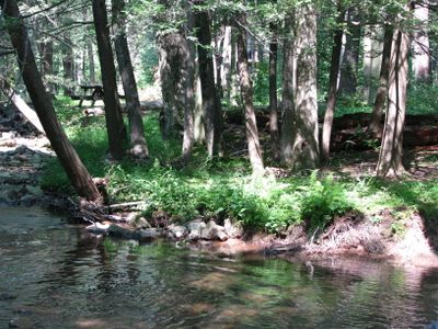
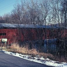
Fowlers Hollow State Park is a 104-acre park nestled in a narrow valley carved by Fowler Hollow Run. The land connects to nearby Tuscarora State Forest with hiking trails that wind through the forested landscape.

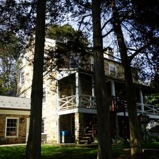
Pennsylvania acquired this land in 1907 from Perry Lumber Company after decades of intensive logging had cleared the forest. The Civilian Conservation Corps later built stone fireplaces and facilities here during the Great Depression to restore the park.

The Civilian Conservation Corps constructed stone fireplaces and facilities throughout the park during the Great Depression as part of public works initiatives.

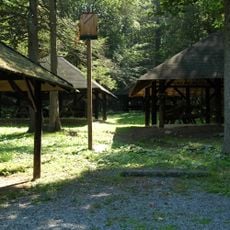
The park has 18 camping areas spread across the grounds, with designated spots for both trailers and tents available year-round. Access is straightforward via Fowlers Hollow Road with clear signage from the main entrance.

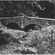
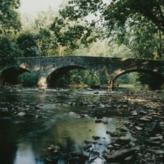
Fowler Hollow Run flowing through the park supports a brown trout population that makes year-round fishing possible for visitors. This thriving waterway emerged as the forest recovered from the earlier heavy logging.

Location: Pennsylvania

Inception: 1936

Website: https://dcnr.pa.gov/StateParks/FindAPark/FowlersHollowStatePark

GPS coordinates: 40.27250,-77.57970

Latest update: December 12, 2025 17:42

Photos
Around this place
Shippensburg University of Pennsylvania
United States of America

Shippensburg University of Pennsylvania

23.9 km
United States of America

Torrey C. Brown Rail Trail

22.1 km
Colonel Denning State Park
United States of America

Colonel Denning State Park

13.9 km
Shippen House
United States of America

Shippen House

25.3 km
Middle Spring Presbyterian Church
United States of America

Middle Spring Presbyterian Church

21.5 km
Dykeman's Spring
United States of America

Dykeman's Spring

26.2 km
New Germantown Covered Bridge
United States of America

New Germantown Covered Bridge

3.9 km
Adairs Covered Bridge
United States of America

Adairs Covered Bridge

15.8 km
Ramp Covered Bridge
United States of America

Ramp Covered Bridge

15.9 km
Runk Bridge
United States of America

Runk Bridge

26.1 km
Book's Covered Bridge
United States of America

Book's Covered Bridge

7.4 km
Mount Pleasant Covered Bridge
United States of America

Mount Pleasant Covered Bridge

5.5 km
Rice Covered Bridge
United States of America

Rice Covered Bridge

24 km
Saville Covered Bridge
United States of America

Saville Covered Bridge

24.1 km
Benjamin B. Leas House
United States of America

Benjamin B. Leas House

25 km
Bistline Covered Bridge
United States of America

Bistline Covered Bridge

11.5 km
Kochendefer Covered Bridge
United States of America

Kochendefer Covered Bridge

23.5 km
Waggoner Covered Bridge
United States of America

Waggoner Covered Bridge

20 km
Bridge in Metal Township
United States of America

Bridge in Metal Township

23.8 km
Shippensburg Historic District
United States of America

Shippensburg Historic District

25 km
McClay's Twin Bridge (East)
United States of America

McClay's Twin Bridge (East)

19.6 km
Lewis Smalley Homestead
United States of America

Lewis Smalley Homestead

23.5 km
Newville Historic District
United States of America

Newville Historic District

19 km
Dunbar-Creigh House
United States of America

Dunbar-Creigh House

24.4 km
Israel and Samuel Lupfer Tannery Site and House
United States of America

Israel and Samuel Lupfer Tannery Site and House

4 km
Big Spring State Forest Picnic Area
United States of America

Big Spring State Forest Picnic Area

6.1 km
McClay's Twin Bridge
United States of America

McClay's Twin Bridge

19.6 km
O'Donel House and Farm
United States of America

O'Donel House and Farm

3.7 km
Show the full map
Reviews

Visited this place? Tap the stars to rate it and share your experience / photos with the community! Try now! You can cancel it anytime.

« Fowlers Hollow State Park - State park in Perry County, Pennsylvania » is provided by Around Us (aroundus.com). Images and texts are derived from Wikimedia project under a Creative Commons license. You are allowed to copy, distribute, and modify copies of this page, under the conditions set by the license, as long as this note is clearly visible.

Discover hidden gems everywhere you go!

From secret cafés to breathtaking viewpoints, skip the crowded tourist spots and find places that match your style. Our app makes it easy with voice search, smart filtering, route optimization, and insider tips from travelers worldwide. Download now for the complete mobile experience.

Around Us App Screenshot

A unique approach to discovering new places

Le Figaro

All the places worth exploring

France Info

A tailor-made excursion in just a few clicks

20 Minutes