Enable Location

We need your location to show you interesting places around you

Discover nearby places

Find interesting locations and hidden gems around you

Precise directions

Get accurate directions and distances to places

Your location is never shared with other users. It's only used when you tap the location button.

Log in to your account

Start exploring — it's free

Trusted by 60,659 travelers worldwide

Continue with Google
Continue with Apple
or

We will send you a code to connect

By continuing, you accept our Terms and Conditions and our Privacy Policy

Check your inbox

We've sent a pincode in your inbox. Please enter the code below.

Torrey C. Brown Rail Trail

Torrey C. Brown Rail Trail, Maryland–Pennsylvania footpath along a former railroad

Description

Torrey C. Brown Rail Trail is a hiking and biking path built on a former railroad line in Pennsylvania. The route follows the old railway corridor for roughly 12 miles through relatively flat terrain, with wide, smooth surfaces suitable for walking, cycling, and jogging.

History

The trail is built on a railroad line that operated in the early 1900s and was later abandoned. This conversion of railroad property into a public footpath reflects a broader movement to repurpose old rail corridors for recreation and community use.

Practical

The path is accessible to visitors of all ages and requires no special skills for walking or biking. The flat surface makes it especially suitable for families and less active walkers, and you can enjoy it throughout the year without major seasonal challenges.

Did you know?

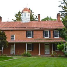
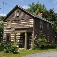
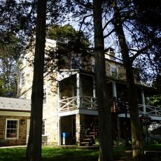
The trail connects several small towns and allows visitors to discover different perspectives of the local landscape and heritage along the way. Many people appreciate this route for the opportunity to explore rural areas in a simple and relaxed manner.

Location
Inception
1984
GPS coordinates
40.10510,-77.43990
Latest update
December 15, 2025 13:27

AroundUs brings together thousands of curated places, local tips, and hidden gems, enriched daily by 60,000 contributors worldwide. Discover all places nearby (Pennsylvania).

Around this place
Shippensburg University of Pennsylvania
United States of America

Shippensburg University of Pennsylvania

8.5 km
Pine Grove Furnace State Park
United States of America

Pine Grove Furnace State Park

14 km
Caledonia State Park
United States of America

Caledonia State Park

21.8 km
Michaux State Forest
United States of America

Michaux State Forest

14.5 km
Colonel Denning State Park
United States of America

Colonel Denning State Park

18.8 km
Shippen House
United States of America

Shippen House

9.3 km
Appalachian Trail Museum
United States of America

Appalachian Trail Museum

14 km
Pine Grove Iron Works
United States of America

Pine Grove Iron Works

14.2 km
Fowlers Hollow State Park
United States of America

Fowlers Hollow State Park

22.1 km
Kings Gap Environmental Education and Training Center
United States of America

Kings Gap Environmental Education and Training Center

13 km
Middle Spring Presbyterian Church
United States of America

Middle Spring Presbyterian Church

9 km
Rocky Spring Presbyterian Church
United States of America

Rocky Spring Presbyterian Church

24 km
Old West, Dickinson College
United States of America

Old West, Dickinson College

23.5 km
Hessian Powder Magazine
United States of America

Hessian Powder Magazine

24.5 km
LeTort Spring Run Nature Trail
United States of America

LeTort Spring Run Nature Trail

23.2 km
Amelia S. Givin Free Library
United States of America

Amelia S. Givin Free Library

21.4 km
Dykeman's Spring
United States of America

Dykeman's Spring

9.5 km
Carlisle Historic District
United States of America

Carlisle Historic District

24.3 km
Ramp Covered Bridge
United States of America

Ramp Covered Bridge

7.9 km
James Finley House
United States of America

James Finley House

20.7 km
Shippensburg Historic District
United States of America

Shippensburg Historic District

9 km
McClay's Twin Bridge (East)
United States of America

McClay's Twin Bridge (East)

11.1 km
Corker Hill
United States of America

Corker Hill

18.9 km
Newville Historic District
United States of America

Newville Historic District

8.3 km
Cline's Church of the United Brethren in Christ
United States of America

Cline's Church of the United Brethren in Christ

22 km
Israel and Samuel Lupfer Tannery Site and House
United States of America

Israel and Samuel Lupfer Tannery Site and House

21.2 km
Culbertson-Harbison Farm
United States of America

Culbertson-Harbison Farm

18.8 km
McClay's Twin Bridge
United States of America

McClay's Twin Bridge

11.2 km
Show the full map
« Torrey C. Brown Rail Trail - Maryland–Pennsylvania footpath along a former railroad » is provided by Around Us (aroundus.com). Images and texts are derived from Wikimedia project under a Creative Commons license. You are allowed to copy, distribute, and modify copies of this page, under the conditions set by the license, as long as this note is clearly visible.

Discover hidden gems everywhere you go!

From secret cafés to breathtaking viewpoints, skip the crowded tourist spots and find places that match your style. Our app makes it easy with voice search, smart filtering, route optimization, and insider tips from travelers worldwide. Download now for the complete mobile experience.

Around Us App Screenshot

A unique approach to discovering new places

Le Figaro

All the places worth exploring

France Info

A tailor-made excursion in just a few clicks

20 Minutes

Around Us
Travel Guide & Maps
Download

Send to your phone

QR Code
1

Open the camera app on your mobile.

2

Point at the QR code with your camera. A notification will appear.

3

Tap the notification to open the link.