Enable Location

We need your location to show you interesting places around you

Discover nearby places

Find interesting locations and hidden gems around you

Precise directions

Get accurate directions and distances to places

Your location is never shared with other users. It's only used when you tap the location button.

Kings Gap Environmental Education and Training Center

Log in to your account

Start exploring — it's free

Trusted by 63,307 travelers worldwide

Continue with Google
Continue with Apple
or

We will send you a code to connect

By continuing, you accept our Terms and Conditions and our Privacy Policy

Check your inbox

We've sent a pincode in your inbox. Please enter the code below.

Kings Gap Environmental Education and Training Center
Discussion Reviews 1 Photos
1.9k Popularity

Kings Gap Environmental Education and Training Center, Environmental education center in Cumberland County, United States

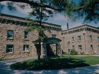
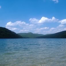
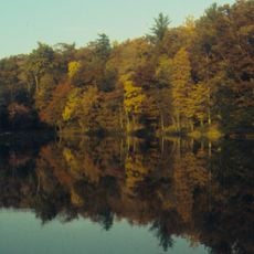
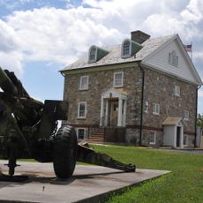
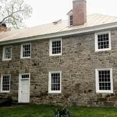
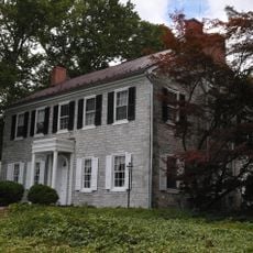
Kings Gap Environmental Education and Training Center is a nature preserve spanning 1,027 acres with an Italian-style mansion and about 40 kilometers of walking paths. The property sits on South Mountain and offers trails suited to different fitness levels.

The state government designated this land as a park in 1973 to serve as an environmental education center. This decision transformed the property into a hub for nature-focused learning in the region.

The mansion serves as a hub for learning programs and gatherings, offering views across the Cumberland Valley. Visitors come here to understand the region's heritage through structured activities and informal exploration of the grounds.

Trails are clearly marked and suited to different difficulty levels, from easy walks to challenging mountain hikes. Certain areas are active during hunting season, so visitors should watch for posted notices.

The property features a permanent orienteering course where visitors practice navigation using maps and compasses across the mountainous terrain. This hands-on course allows people to build navigation skills while exploring the landscape.

The community of curious travelers

AroundUs brings together thousands of curated places, local tips, and hidden gems, enriched daily by 60,000 contributors worldwide.

Start exploring
Inception
1973
GPS coordinates
40.09500,-77.28810
Latest update
December 14, 2025 11:25
Around this place
Pine Grove Furnace State Park
United States of America

Pine Grove Furnace State Park

7.3 km
Michaux State Forest
United States of America

Michaux State Forest

13.1 km
U.S. Army Heritage and Education Center
United States of America

U.S. Army Heritage and Education Center

16.6 km
Colonel Denning State Park
United States of America

Colonel Denning State Park

22.7 km
Shippen House
United States of America

Shippen House

20.5 km
Appalachian Trail Museum
United States of America

Appalachian Trail Museum

7.1 km
Cumberland Drive-In
United States of America

Cumberland Drive-In

8.1 km
Middle Spring Presbyterian Church
United States of America

Middle Spring Presbyterian Church

21.5 km
Old West, Dickinson College
United States of America

Old West, Dickinson College

14.4 km
Hessian Powder Magazine
United States of America

Hessian Powder Magazine

14.8 km
LeTort Spring Run Nature Trail
United States of America

LeTort Spring Run Nature Trail

13 km
Amelia S. Givin Free Library
United States of America

Amelia S. Givin Free Library

8.8 km
Thomas Brothers Store
United States of America

Thomas Brothers Store

18.6 km
Dykeman's Spring
United States of America

Dykeman's Spring

20.3 km
Carlisle Historic District
United States of America

Carlisle Historic District

14.8 km
Ramp Covered Bridge
United States of America

Ramp Covered Bridge

20.6 km
John Williams House
United States of America

John Williams House

22.7 km
Carlisle Armory
United States of America

Carlisle Armory

16.8 km
Boiling Springs Historic District
United States of America

Boiling Springs Historic District

14.9 km
Wirts House
United States of America

Wirts House

23.4 km
Shippensburg Historic District
United States of America

Shippensburg Historic District

20.3 km
Heikes Covered Bridge
United States of America

Heikes Covered Bridge

17.3 km
Newville Historic District
United States of America

Newville Historic District

12.8 km
Cline's Church of the United Brethren in Christ
United States of America

Cline's Church of the United Brethren in Christ

12 km
Pond Mill Bridge
United States of America

Pond Mill Bridge

22.2 km
Rev. Anderson B. Quay House
United States of America

Rev. Anderson B. Quay House

21.6 km
Dill's Tavern
United States of America

Dill's Tavern

21.5 km
James Given Tavern
United States of America

James Given Tavern

11.2 km
Show the full map
Reviews
Share your experience

No review yet

Discussions
Start a discussion...

No discussion yet

« Kings Gap Environmental Education and Training Center - Environmental education center in Cumberland County, United States » is provided by Around Us (aroundus.com). Images and texts are derived from Wikimedia project under a Creative Commons license. You are allowed to copy, distribute, and modify copies of this page, under the conditions set by the license, as long as this note is clearly visible.

Discover hidden gems everywhere you go!

From secret cafés to breathtaking viewpoints, skip the crowded tourist spots and find places that match your style. Our app makes it easy with voice search, smart filtering, route optimization, and insider tips from travelers worldwide. Download now for the complete mobile experience.

Around Us App Screenshot

A unique approach to discovering new places

Le Figaro

All the places worth exploring

France Info

A tailor-made excursion in just a few clicks

20 Minutes

Around Us
Travel Guide & Maps
Download

Send to your phone

QR Code
1

Open the camera app on your mobile.

2

Point at the QR code with your camera. A notification will appear.

3

Tap the notification to open the link.