Enable Location

We need your location to show you interesting places around you

Discover nearby places

Find interesting locations and hidden gems around you

Precise directions

Get accurate directions and distances to places

Your location is never shared with other users. It's only used when you tap the location button.

Fort Point Channel Historic District

Log in to your account

Start exploring — it's free

Trusted by 62,525 travelers worldwide

Continue with Google
Continue with Apple
or

We will send you a code to connect

By continuing, you accept our Terms and Conditions and our Privacy Policy

Check your inbox

We've sent a pincode in your inbox. Please enter the code below.

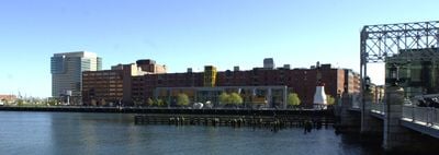
Fort Point Channel Historic District, Historic district in South Boston, Massachusetts.

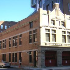
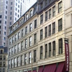
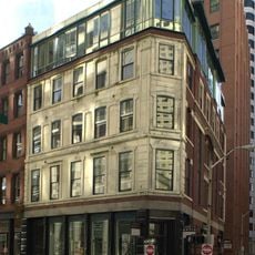
The Fort Point Channel Historic District consists of warehouse and industrial brick buildings situated south of the Fort Point Channel along several main streets. The structures date to Boston's early industrial era and today house diverse uses from studios to offices.

The Boston Wharf Company developed this industrial area beginning in the 1830s through the 1880s. Factory buildings and warehouses rose during this period to support sugar refining, wool storage, and other trade activities.

Artists have moved into the former warehouse spaces and established studios and workshops throughout the district. Today it serves as a major gathering place for Boston's creative community.

The area is best explored on foot with good sightlines of building facades from public pathways along the channel. Walking routes allow visitors to observe the architecture and current activities within the district.

Many buildings display a circular copper crest bearing the mark of the Boston Wharf Company. These badges remain a visible trace of the district's origins and ownership from the 1800s.

The community of curious travelers

AroundUs brings together thousands of curated places, local tips, and hidden gems, enriched daily by 60,000 contributors worldwide.

Start exploring
Location
GPS coordinates
42.35111,-71.05056
Latest update
December 14, 2025 09:47
Around this place
Rose Fitzgerald Kennedy Greenway
United States of America

Rose Fitzgerald Kennedy Greenway

681 m
Institute of Contemporary Art, Boston
United States of America

Institute of Contemporary Art, Boston

657 m
Boston Children's Museum
United States of America

Boston Children's Museum

119 m
John Joseph Moakley United States Courthouse
United States of America

John Joseph Moakley United States Courthouse

429 m
One Lincoln Street
United States of America

One Lincoln Street

640 m
Federal Reserve Bank Building
United States of America

Federal Reserve Bank Building

325 m
The Computer Museum, Boston
United States of America

The Computer Museum, Boston

94 m
One International Place
United States of America

One International Place

537 m
One Financial Center
United States of America

One Financial Center

479 m
100 Federal Street
United States of America

100 Federal Street

635 m
Boston Tea Party Ships and Museum
United States of America

Boston Tea Party Ships and Museum

136 m
State Street Bank Building
United States of America

State Street Bank Building

641 m
100 Summer Street
United States of America

100 Summer Street

638 m
Two International Place
United States of America

Two International Place

609 m
125 High Street
United States of America

125 High Street

532 m
Northern Avenue Bridge
United States of America

Northern Avenue Bridge

389 m
Russia Wharf
United States of America

Russia Wharf

311 m
Keystone Building
United States of America

Keystone Building

465 m
United Shoe Machinery Corporation Building
United States of America

United Shoe Machinery Corporation Building

571 m
101 Federal Street
United States of America

101 Federal Street

678 m
Federal Street Church
United States of America

Federal Street Church

693 m
New South Church
United States of America

New South Church

663 m
Summer Street Bridge
United States of America

Summer Street Bridge

119 m
Congress Street Fire Station
United States of America

Congress Street Fire Station

147 m
United States of America

Odeon

691 m
Richardson Block
United States of America

Richardson Block

526 m
Church Green Buildings Historic District
United States of America

Church Green Buildings Historic District

662 m
Gridley Street Historic District
United States of America

Gridley Street Historic District

485 m
Show the full map
« Fort Point Channel Historic District - Historic district in South Boston, Massachusetts » is provided by Around Us (aroundus.com). Images and texts are derived from Wikimedia project under a Creative Commons license. You are allowed to copy, distribute, and modify copies of this page, under the conditions set by the license, as long as this note is clearly visible.

Discover hidden gems everywhere you go!

From secret cafés to breathtaking viewpoints, skip the crowded tourist spots and find places that match your style. Our app makes it easy with voice search, smart filtering, route optimization, and insider tips from travelers worldwide. Download now for the complete mobile experience.

Around Us App Screenshot

A unique approach to discovering new places

Le Figaro

All the places worth exploring

France Info

A tailor-made excursion in just a few clicks

20 Minutes

Around Us
Travel Guide & Maps
Download

Send to your phone

QR Code
1

Open the camera app on your mobile.

2

Point at the QR code with your camera. A notification will appear.

3

Tap the notification to open the link.