Fort Harker

Log in to your account

AroundUs is a community-driven map of interesting places, built by curious explorers like you. It grows with every review, story, and photo you share.
Connect to save your favorite spots, contribute locations, and create personalized routes.
Continue with Google
Continue with Apple
Continue with X
Continue with Facebook
Continue with email
By continuing, you accept our Terms and Conditions and our Privacy Policy
Create an account
Add to collection
Map
Suggest a change
Share

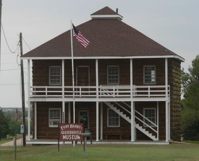
Fort Harker, Military fort in Kanopolis, United States.

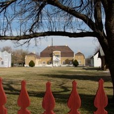
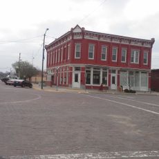
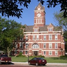
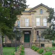
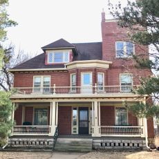
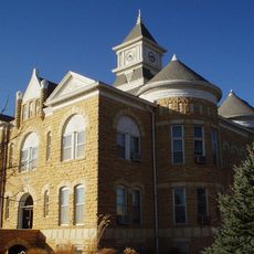
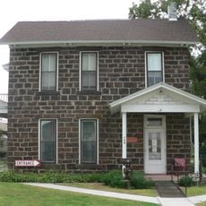
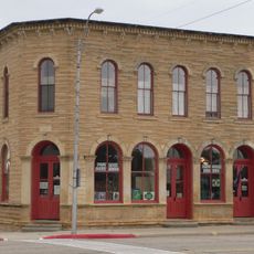
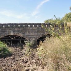
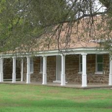
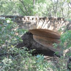
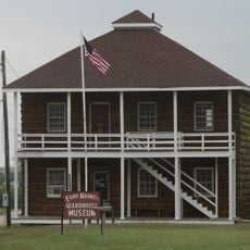
Fort Harker is a former military post in Kanopolis that operated as a supply center and now functions as a museum open to visitors. The site contains four surviving buildings constructed from local sandstone, including a guardhouse and officer quarters, which showcase the daily operations and living conditions of this frontier station.

The post was established in 1866 and served as a major supply distribution point west of the Missouri River during regional conflicts with Native American tribes. Its closure in 1873 marked the end of military operations and allowed the surrounding settlement to shift its focus elsewhere.

The fort's role as a supply hub shaped the growth of the nearby settlement, and visitors can see how military operations influenced commerce and daily life in this remote frontier region. The buildings themselves tell stories through their layout and construction, showing how soldiers organized their work and lived in isolated outposts.

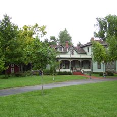
The site is accessible for daytime visits, and the sandstone buildings are spread across the grounds, so comfortable footwear is helpful for exploring. Signage and museum materials help visitors understand the history and identify the different structures.

In 1867 the site was struck by a cholera epidemic that affected over 800 soldiers and civilians, resulting in approximately 50 deaths. This tragedy reveals the harsh and unpredictable dangers people faced at isolated military stations.

Location: Kanopolis

GPS coordinates: 38.70972,-98.15694

Latest update: December 11, 2025 18:10

Photos
Around this place
Wilson Lake
United States of America

Wilson Lake

43.1 km
Mushroom Rock State Park
United States of America

Mushroom Rock State Park

11.1 km
Kanopolis State Park
United States of America

Kanopolis State Park

14.9 km
Rolling Hills Zoo
United States of America

Rolling Hills Zoo

37.6 km
Wilson State Park
United States of America

Wilson State Park

37.9 km
Kansas Motorcycle Museum
United States of America

Kansas Motorcycle Museum

33 km
Swedish Pavilion
United States of America

Swedish Pavilion

44.9 km
Hans Hanson House
United States of America

Hans Hanson House

33 km
Farmers State Bank
United States of America

Farmers State Bank

44.5 km
Johnson House
United States of America

Johnson House

44 km
Bridge 650
United States of America

Bridge 650

44.2 km
Danske Evangelist Lutheran Kirke
United States of America

Danske Evangelist Lutheran Kirke

43.5 km
Rice County Courthouse
United States of America

Rice County Courthouse

40.6 km
United States of America

Rosberg-Holmgren-Clareen Block

44.5 km
United States of America

Berquist & Nelson Drugstore Building

44.5 km
Arthur Larkin House
United States of America

Arthur Larkin House

7.1 km
Teichgraeber–Runbeck House
United States of America

Teichgraeber–Runbeck House

44.9 km
Ellsworth Downtown Historic District
United States of America

Ellsworth Downtown Historic District

6.8 km
Lincoln County Courthouse
United States of America

Lincoln County Courthouse

36.9 km
Perry Hodgden House
United States of America

Perry Hodgden House

6.9 km
Cummins Block Building
United States of America

Cummins Block Building

36.8 km
Insurance Building
United States of America

Insurance Building

6.8 km
The Museum at Rolling Hills Zoo
United States of America

The Museum at Rolling Hills Zoo

37.6 km
Ft Harker Museum
United States of America

Ft Harker Museum

394 m
Spring Creek Tributary Bridge
United States of America

Spring Creek Tributary Bridge

23.4 km
Fort Harker Officers' Quarters
United States of America

Fort Harker Officers' Quarters

192 m
Bullfoot Creek Bridge
United States of America

Bullfoot Creek Bridge

30.7 km
Fort Harker Guardhouse
United States of America

Fort Harker Guardhouse

387 m
Show the full map
Reviews

Visited this place? Tap the stars to rate it and share your experience / photos with the community! Try now! You can cancel it anytime.

« Fort Harker - Military fort in Kanopolis, United States » is provided by Around Us (aroundus.com). Images and texts are derived from Wikimedia project under a Creative Commons license. You are allowed to copy, distribute, and modify copies of this page, under the conditions set by the license, as long as this note is clearly visible.

Discover hidden gems everywhere you go!

From secret cafés to breathtaking viewpoints, skip the crowded tourist spots and find places that match your style. Our app makes it easy with voice search, smart filtering, route optimization, and insider tips from travelers worldwide. Download now for the complete mobile experience.

Around Us App Screenshot

A unique approach to discovering new places

Le Figaro

All the places worth exploring

France Info

A tailor-made excursion in just a few clicks

20 Minutes