Enable Location

We need your location to show you interesting places around you

Discover nearby places

Find interesting locations and hidden gems around you

Precise directions

Get accurate directions and distances to places

Your location is never shared with other users. It's only used when you tap the location button.

Fort Hill Rural Historic District

Log in to your account

Start exploring — it's free

Trusted by 62,564 travelers worldwide

Continue with Google
Continue with Apple
or

We will send you a code to connect

By continuing, you accept our Terms and Conditions and our Privacy Policy

Check your inbox

We've sent a pincode in your inbox. Please enter the code below.

Fort Hill Rural Historic District, Historic district in Eastham, Massachusetts.

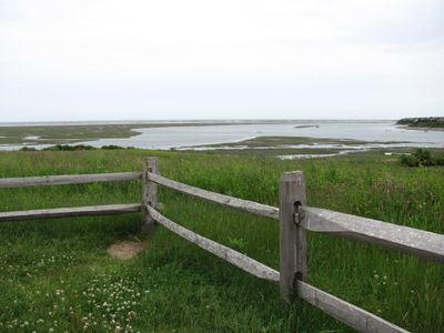
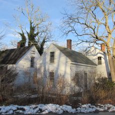
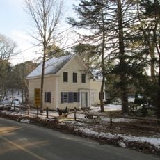
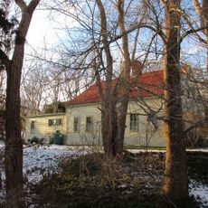
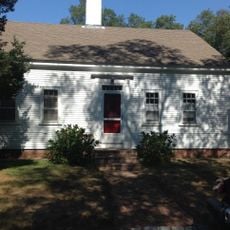
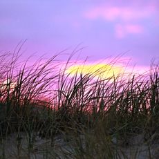
Fort Hill Rural Historic District is a historic district in Eastham on the Massachusetts coast that spans 100 acres of forests, fields, and salt marshes. The area contains two preserved farmsteads from different periods and offers multiple walking trails through the historical lands and natural environments.

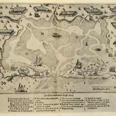
The Knowles and Penniman families owned this land from 1742 to 1941 and developed agricultural practices that shaped the Massachusetts coastal landscape. The area became part of the Cape Cod National Seashore in 1961, preserving these farmlands and their agricultural heritage.

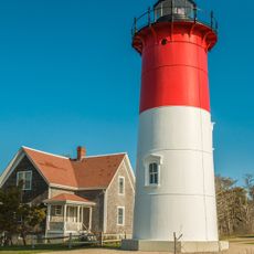
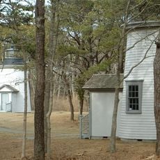
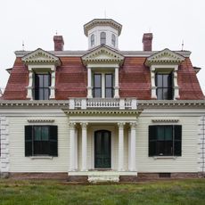
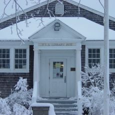
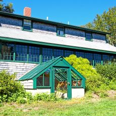
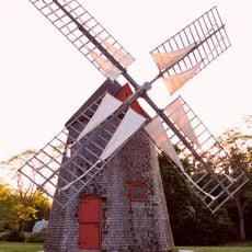
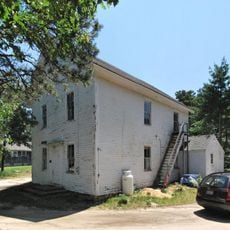
The district displays architectural styles typical of New England, including the Second Empire design of the Edward Penniman House and Greek Revival features found elsewhere throughout the area. Visitors can observe these building styles directly while walking through the historic farmsteads.

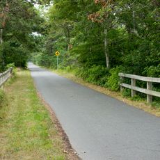
The grounds are easily accessible with several marked trails suited for different skill levels. It helps to wear sturdy shoes and exercise caution in marshy areas, especially during wet weather.

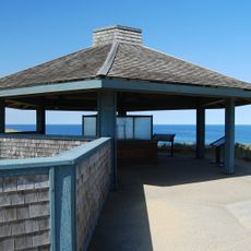
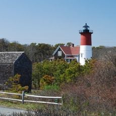
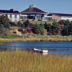
The hilltop offers views across Cape Cod Bay, Nauset Marsh, and the Atlantic Ocean, showing how coastal and agricultural landscapes blend together. This elevated position makes it a valuable vantage point for observing the area's different ecosystems.

The community of curious travelers

AroundUs brings together thousands of curated places, local tips, and hidden gems, enriched daily by 60,000 contributors worldwide.

Start exploring
Location
GPS coordinates
41.81944,-69.96556
Latest update
December 14, 2025 14:43
Around this place
CG 36500
United States of America

CG 36500

4.2 km
Cape Cod Rail Trail
United States of America

Cape Cod Rail Trail

11.7 km
Nickerson State Park
United States of America

Nickerson State Park

8.6 km
Nauset Light
United States of America

Nauset Light

4.6 km
Marconi Wireless Station Site
United States of America

Marconi Wireless Station Site

10.5 km
Wellfleet Drive-In Theater
United States of America

Wellfleet Drive-In Theater

6.8 km
Three Sisters of Nauset
United States of America

Three Sisters of Nauset

4.6 km
Eldredge Park
United States of America

Eldredge Park

4.5 km
Eastham Windmill
United States of America

Eastham Windmill

1.4 km
Stony Brook Field
United States of America

Stony Brook Field

11 km
Nickerson Mansion
United States of America

Nickerson Mansion

8.9 km
Billingsgate Island Light
United States of America

Billingsgate Island Light

10.4 km
French Cable Station
United States of America

French Cable Station

4 km
Edward Penniman House and Barn
United States of America

Edward Penniman House and Barn

109 m
Nauset Archeological District
United States of America

Nauset Archeological District

229 m
French Cable Hut
United States of America

French Cable Hut

4.6 km
Eastham Public Library
United States of America

Eastham Public Library

2.1 km
Sea Call Farm
United States of America

Sea Call Farm

3.8 km
Universalist Society Meetinghouse
United States of America

Universalist Society Meetinghouse

4.2 km
Eastham Center Historic District
United States of America

Eastham Center Historic District

1.1 km
Hinckley's Corner Historic District
United States of America

Hinckley's Corner Historic District

11.3 km
Paine Hollow Road South Historic District
United States of America

Paine Hollow Road South Historic District

11.1 km
Pond Hill School
United States of America

Pond Hill School

11.2 km
Townsend House
United States of America

Townsend House

10.9 km
Saunders-Paine House
United States of America

Saunders-Paine House

11 km
Collins Cottages Historic District
United States of America

Collins Cottages Historic District

2.6 km
First Encounter Beach
United States of America

First Encounter Beach

3.2 km
Salt Pond Visitor Center
United States of America

Salt Pond Visitor Center

2.1 km
Show the full map
« Fort Hill Rural Historic District - Historic district in Eastham, Massachusetts » is provided by Around Us (aroundus.com). Images and texts are derived from Wikimedia project under a Creative Commons license. You are allowed to copy, distribute, and modify copies of this page, under the conditions set by the license, as long as this note is clearly visible.

Discover hidden gems everywhere you go!

From secret cafés to breathtaking viewpoints, skip the crowded tourist spots and find places that match your style. Our app makes it easy with voice search, smart filtering, route optimization, and insider tips from travelers worldwide. Download now for the complete mobile experience.

Around Us App Screenshot

A unique approach to discovering new places

Le Figaro

All the places worth exploring

France Info

A tailor-made excursion in just a few clicks

20 Minutes

Around Us
Travel Guide & Maps
Download

Send to your phone

QR Code
1

Open the camera app on your mobile.

2

Point at the QR code with your camera. A notification will appear.

3

Tap the notification to open the link.