Enable Location

We need your location to show you interesting places around you

Discover nearby places

Find interesting locations and hidden gems around you

Precise directions

Get accurate directions and distances to places

Your location is never shared with other users. It's only used when you tap the location button.

Gay Farm

Log in to your account

Start exploring — it's free

Trusted by 61,422 travelers worldwide

Continue with Google
Continue with Apple
or

We will send you a code to connect

By continuing, you accept our Terms and Conditions and our Privacy Policy

Check your inbox

We've sent a pincode in your inbox. Please enter the code below.

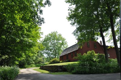
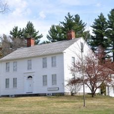
Gay Farm, Colonial residence in Petersham, Massachusetts

Description

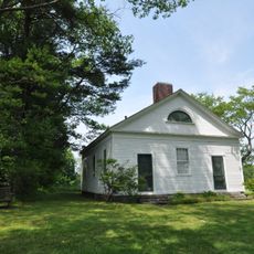
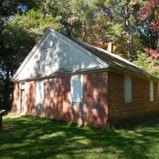
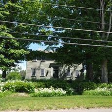
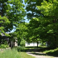
Gay Farm is an eighteenth century farmhouse situated on the north side of Nichewaug Hill in Petersham, Massachusetts, with wooden frame construction typical of its era. The building preserves original colonial details including its simple functional design and period architectural elements.

History

William Negus built this farmhouse in 1740, making it one of Petersham's oldest surviving structures from the early colonial period. The property changed hands through several owners before acquiring its current name from the last resident, Charles M. Gay.

Culture

The property changed ownership through several generations, from the Negus family to Joel Stearns, then to Thomas Stevens Howe, and finally to Charles M. Gay.

Practical

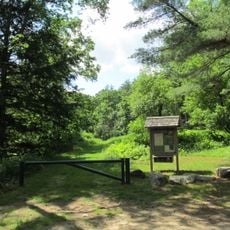
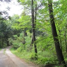
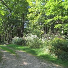
The property sits prominently on a hillside making it easy to locate from the main road through the area. Visitors should wear sturdy footwear since the terrain is hilly and access requires walking to reach the structure.

Did you know?

The farm earned inclusion on the National Register of Historic Places in 1977 and stands as one of the region's best preserved farmhouses from the colonial era. Its survival in good condition offers a rare glimpse into how people actually lived on the land during that time period.

Location
GPS coordinates
42.46389,-72.18500
Latest update
December 14, 2025 18:20

AroundUs brings together thousands of curated places, local tips, and hidden gems, enriched daily by 60,000 contributors worldwide. Discover all places nearby (Massachusetts).

Around this place
Quabbin Reservoir
United States of America

Quabbin Reservoir

15 km
Harvard Forest
United States of America

Harvard Forest

7.5 km
Bear's Den
United States of America

Bear's Den

14.5 km
Swift River Reservation
United States of America

Swift River Reservation

2 km
Federated Women's Club State Forest
United States of America

Federated Women's Club State Forest

6.4 km
Brooks Woodland Preserve
United States of America

Brooks Woodland Preserve

3.5 km
North Common Meadow
United States of America

North Common Meadow

3.5 km
Elliott Laurel
United States of America

Elliott Laurel

3.5 km
Ware River Diversion
United States of America

Ware River Diversion

13.1 km
Whitaker-Clary House
United States of America

Whitaker-Clary House

13.7 km
Petersham Common Historic District
United States of America

Petersham Common Historic District

2.9 km
Hubbardston Public Library
United States of America

Hubbardston Public Library

14.6 km
Old Town Hall
United States of America

Old Town Hall

14.5 km
Fobes-O'Donnell House
United States of America

Fobes-O'Donnell House

14.4 km
Hubbardston Town Common Historic District
United States of America

Hubbardston Town Common Historic District

14.7 km
District No. 5 School
United States of America

District No. 5 School

4.9 km
Kensington Park Historic District
United States of America

Kensington Park Historic District

11.3 km
New Salem Common Historic District
United States of America

New Salem Common Historic District

12.6 km
Barre Common District
United States of America

Barre Common District

8 km
Prescott Town House
United States of America

Prescott Town House

3.9 km
Phillipston Center Historic District
United States of America

Phillipston Center Historic District

10.5 km
Templeton Common Historic District
United States of America

Templeton Common Historic District

14 km
No. 4 Schoolhouse
United States of America

No. 4 Schoolhouse

8.5 km
West Brick School
United States of America

West Brick School

14.2 km
Rev. Samuel Gay House
United States of America

Rev. Samuel Gay House

14 km
Hardwick Village Historic District
United States of America

Hardwick Village Historic District

12.9 km
District No. 4 School
United States of America

District No. 4 School

3.8 km
Holland-Towne House
United States of America

Holland-Towne House

4.1 km
Show the full map
« Gay Farm - Colonial residence in Petersham, Massachusetts » is provided by Around Us (aroundus.com). Images and texts are derived from Wikimedia project under a Creative Commons license. You are allowed to copy, distribute, and modify copies of this page, under the conditions set by the license, as long as this note is clearly visible.

Discover hidden gems everywhere you go!

From secret cafés to breathtaking viewpoints, skip the crowded tourist spots and find places that match your style. Our app makes it easy with voice search, smart filtering, route optimization, and insider tips from travelers worldwide. Download now for the complete mobile experience.

Around Us App Screenshot

A unique approach to discovering new places

Le Figaro

All the places worth exploring

France Info

A tailor-made excursion in just a few clicks

20 Minutes

Around Us
Travel Guide & Maps
Download

Send to your phone

QR Code
1

Open the camera app on your mobile.

2

Point at the QR code with your camera. A notification will appear.

3

Tap the notification to open the link.