Enable Location

We need your location to show you interesting places around you

Discover nearby places

Find interesting locations and hidden gems around you

Precise directions

Get accurate directions and distances to places

Your location is never shared with other users. It's only used when you tap the location button.

Indian Lake

Log in to your account

Start exploring — it's free

Trusted by 66,550 travelers worldwide

Continue with Google
Continue with Apple
or

We will send you a code to connect

By continuing, you accept our Terms and Conditions and our Privacy Policy

Check your inbox

We've sent a pincode in your inbox. Please enter the code below.

Indian Lake
Discussion Reviews 1 Photos
3.3k Popularity

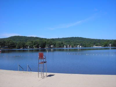
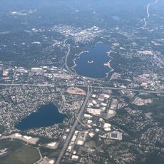
Indian Lake, reservoir and unincorporated community situated 509 feet (155 m) above sea level in Denville, New Jersey

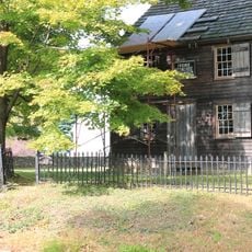
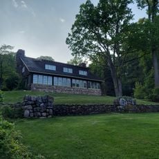
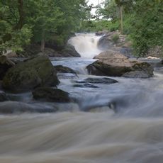
Indian Lake is a reservoir in Denville Township, New Jersey, set among wooded hills with homes lining much of its shore. The lake contains a small island called Lenape Island, and its waters are fed by Den Brook, a stream that once ran freely through the area.

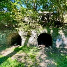
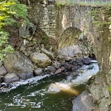
The lake was created around 1920 when Joseph Righter built a dam on Den Brook to develop a new residential community. After Righter died in 1922, a company took over the land and gave the lake its current name.

The lake's name recalls the Lenni Lenape, who lived in this region long before European settlement. Lenape Island, a small island within the lake, still carries that name today and keeps the connection to the area's past visible to visitors.

The lake sits close to Interstate 80 and US Route 46, making it easy to reach by car from many parts of the region. Access is reserved for members of the Indian Lake Community Club, so it is worth checking membership conditions before planning a visit.

Since 1927, the community has chosen a king and queen each summer from among local teenagers, with a weekend of celebrations and a parade around the lake. During World War II, the titles were temporarily changed to Mr. Victory and Miss Liberty, but the tradition itself never stopped.

The community of curious travelers

AroundUs brings together thousands of curated places, local tips, and hidden gems, enriched daily by 60,000 contributors worldwide.

Start exploring
Location
GPS coordinates
40.88860,-74.48860
Latest update
March 3, 2026 13:58
Around this place
Craftsman Farms
United States of America

Craftsman Farms

3.7 km
Blackwell Street Historic District
United States of America

Blackwell Street Historic District

6 km
Grimes Homestead
United States of America

Grimes Homestead

4.5 km
Boonton Ironworks
United States of America

Boonton Ironworks

6.6 km
United States of America

Boonton Gorge

6.3 km
Boonton Formation
United States of America

Boonton Formation

7.6 km
Friends Meetinghouse
United States of America

Friends Meetinghouse

7.3 km
Arch Bridge from the Boonton Ironworks
United States of America

Arch Bridge from the Boonton Ironworks

6.4 km
Baker Building
United States of America

Baker Building

6 km
Boonton Historic District
United States of America

Boonton Historic District

6.9 km
Boonton Historical Society and Museum
United States of America

Boonton Historical Society and Museum

7 km
Boonton Public Library
United States of America

Boonton Public Library

6.8 km
Mount Hope Miners' Church
United States of America

Mount Hope Miners' Church

6.4 km
Bowers-Livingston-Osborn House
United States of America

Bowers-Livingston-Osborn House

5.9 km
James Dixon Farm
United States of America

James Dixon Farm

6.8 km
Rockaway Valley Methodist Church
United States of America

Rockaway Valley Methodist Church

6.2 km
Methodist Episcopal Church
United States of America

Methodist Episcopal Church

6.4 km
First United Methodist Church
United States of America

First United Methodist Church

5.7 km
Bowlsby-Degelleke House
United States of America

Bowlsby-Degelleke House

8.1 km
First Presbyterian Church
United States of America

First Presbyterian Church

2.6 km
St John's Episcopal Church
United States of America

St John's Episcopal Church

5.7 km
First Memorial Presbyterian Church
United States of America

First Memorial Presbyterian Church

6.1 km
St. Mary's Church Historic District
United States of America

St. Mary's Church Historic District

7.7 km
St. Mary's Church
United States of America

St. Mary's Church

7.6 km
The Stickley Museum at Craftsman Farms
United States of America

The Stickley Museum at Craftsman Farms

3.6 km
Boonton Falls
United States of America

Boonton Falls

6.3 km
Mountain Lakes Historic District
United States of America

Mountain Lakes Historic District

4.2 km
Boonton Reservoir
United States of America

Boonton Reservoir

6.8 km
Show the full map
Reviews
Share your experience

No review yet

Discussions
Start a discussion...

No discussion yet

« Indian Lake - reservoir and unincorporated community situated 509 feet (155 m) above sea level in Denville, New Jersey » is provided by Around Us (aroundus.com). Images and texts are derived from Wikimedia project under a Creative Commons license. You are allowed to copy, distribute, and modify copies of this page, under the conditions set by the license, as long as this note is clearly visible.

Discover hidden gems everywhere you go!

From secret cafés to breathtaking viewpoints, skip the crowded tourist spots and find places that match your style. Our app makes it easy with voice search, smart filtering, route optimization, and insider tips from travelers worldwide. Download now for the complete mobile experience.

Around Us App Screenshot

A unique approach to discovering new places

Le Figaro

All the places worth exploring

France Info

A tailor-made excursion in just a few clicks

20 Minutes

Around Us
Travel Guide & Maps
Download

Send to your phone

QR Code
1

Open the camera app on your mobile.

2

Point at the QR code with your camera. A notification will appear.

3

Tap the notification to open the link.