Enable Location

We need your location to show you interesting places around you

Discover nearby places

Find interesting locations and hidden gems around you

Precise directions

Get accurate directions and distances to places

Your location is never shared with other users. It's only used when you tap the location button.

Laurel Ridge State Park

Log in to your account

Start exploring — it's free

Trusted by 62,813 travelers worldwide

Continue with Google
Continue with Apple
or

We will send you a code to connect

By continuing, you accept our Terms and Conditions and our Privacy Policy

Check your inbox

We've sent a pincode in your inbox. Please enter the code below.

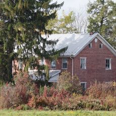
Laurel Ridge State Park, Nature reserve in western Pennsylvania, United States.

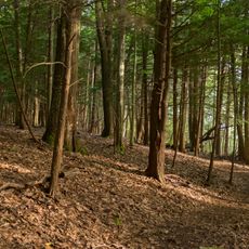
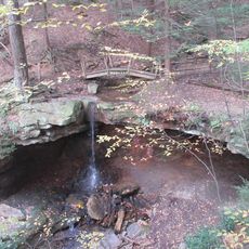
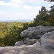
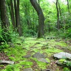
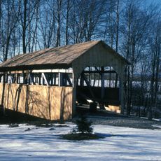
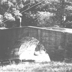
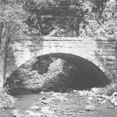
Laurel Ridge State Park is a large nature reserve in western Pennsylvania that spans several counties and contains various forest types and natural habitats. A well-known 70-mile hiking trail guides visitors through the grounds and connects multiple landscape areas together.

The area was officially protected in 1967 to preserve the region's natural resources for future generations. This creation was part of a broader effort to shield Pennsylvania's wilderness areas from development and overuse.

The Laurel Highlands Hiking Trail is a major outdoor route for Pennsylvania nature lovers, connecting several landscapes across the region. Walkers pass through different plant zones and experience the state's natural diversity firsthand.

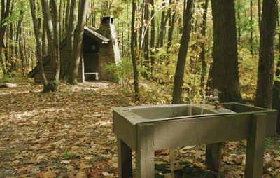
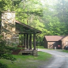
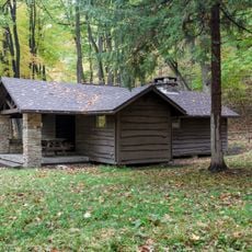
The grounds offer eight shelter areas along the hiking trail where overnight stays are possible and bathroom facilities are available. Visitors should note that distances between shelters vary and good planning is needed.

The park becomes a popular winter sports destination, with areas reserved for cross-country skiing and snowmobile riding on separate paths. This seasonal use shows how the grounds transform completely depending on the time of year.

The community of curious travelers

AroundUs brings together thousands of curated places, local tips, and hidden gems, enriched daily by 60,000 contributors worldwide.

Start exploring
Location
Inception
1967
Operator
Pennsylvania Bureau of State Parks
GPS coordinates
39.95580,-79.36890
Latest update
December 10, 2025 20:02
Around this place
United States of America

Idlewild and Soak Zone

34.8 km
Laurel Hill State Park
United States of America

Laurel Hill State Park

11.4 km
Linn Run State Park
United States of America

Linn Run State Park

25.2 km
Forbes State Forest
United States of America

Forbes State Forest

32 km
Pennsylvania Railroad 3750
United States of America

Pennsylvania Railroad 3750

18 km
Rollo Coaster
United States of America

Rollo Coaster

34.7 km
Kooser State Park
United States of America

Kooser State Park

16.6 km
Laurel Summit State Park
United States of America

Laurel Summit State Park

24.5 km
Wild Mouse
United States of America

Wild Mouse

34.7 km
Somerset County Courthouse
United States of America

Somerset County Courthouse

25.5 km
Daniel B. Zimmerman Mansion
United States of America

Daniel B. Zimmerman Mansion

26.1 km
Somerset Historical Center
United States of America

Somerset Historical Center

27.6 km
Barronvale Bridge
United States of America

Barronvale Bridge

8.4 km
Uptown Somerset Historic District
United States of America

Uptown Somerset Historic District

25.4 km
Matthew Hair Farm
United States of America

Matthew Hair Farm

40.3 km
Laurel Hill Furnace
United States of America

Laurel Hill Furnace

52.8 km
Shaffer's Bridge
United States of America

Shaffer's Bridge

50 km
King's Bridge
United States of America

King's Bridge

8.6 km
Fort Ligonier
United States of America

Fort Ligonier

33.6 km
Boswell Historic District
United States of America

Boswell Historic District

37.1 km
Ligonier Historic District
United States of America

Ligonier Historic District

33.9 km
Stoystown Historic District
United States of America

Stoystown Historic District

38.9 km
Walter's Mill Bridge
United States of America

Walter's Mill Bridge

27.7 km
Bridge in West Wheatfield Township
United States of America

Bridge in West Wheatfield Township

53.8 km
Bridge in Jenner Township
United States of America

Bridge in Jenner Township

38.7 km
Ross Furnace
United States of America

Ross Furnace

47.5 km
Kooser State Park Family Cabin District
United States of America

Kooser State Park Family Cabin District

16.2 km
Linn Run State Park Family Cabin District
United States of America

Linn Run State Park Family Cabin District

25.6 km
Show the full map
« Laurel Ridge State Park - Nature reserve in western Pennsylvania, United States » is provided by Around Us (aroundus.com). Images and texts are derived from Wikimedia project under a Creative Commons license. You are allowed to copy, distribute, and modify copies of this page, under the conditions set by the license, as long as this note is clearly visible.

Discover hidden gems everywhere you go!

From secret cafés to breathtaking viewpoints, skip the crowded tourist spots and find places that match your style. Our app makes it easy with voice search, smart filtering, route optimization, and insider tips from travelers worldwide. Download now for the complete mobile experience.

Around Us App Screenshot

A unique approach to discovering new places

Le Figaro

All the places worth exploring

France Info

A tailor-made excursion in just a few clicks

20 Minutes

Around Us
Travel Guide & Maps
Download

Send to your phone

QR Code
1

Open the camera app on your mobile.

2

Point at the QR code with your camera. A notification will appear.

3

Tap the notification to open the link.