Enable Location

We need your location to show you interesting places around you

Discover nearby places

Find interesting locations and hidden gems around you

Precise directions

Get accurate directions and distances to places

Your location is never shared with other users. It's only used when you tap the location button.

Laurel Summit State Park

Log in to your account

Start exploring — it's free

Trusted by 64,787 travelers worldwide

Continue with Google
Continue with Apple
or

We will send you a code to connect

By continuing, you accept our Terms and Conditions and our Privacy Policy

Check your inbox

We've sent a pincode in your inbox. Please enter the code below.

Laurel Summit State Park
Discussion Reviews 1 Photos
3.1k Popularity

Laurel Summit State Park, Mountain state park in Cook Township, Pennsylvania, United States

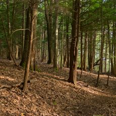
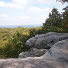
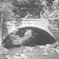
Laurel Summit State Park is a mountaintop park in Pennsylvania, sitting at around 835 meters above sea level on a forested peak in the Laurel Highlands. Narrow trails wind through the woods and lead to open overlooks where visitors can see across the valley below.

The land was heavily logged in the 1800s, and sparks from steam locomotives triggered repeated wildfires that left the hillsides bare for decades. The area was officially designated a state park in 1964, which marked the start of its recovery.

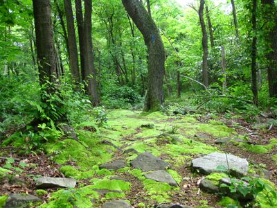
The area takes its name from the wild laurel shrubs that grow here in thick stands and give the mountain its distinctive character. These dense plants form a natural backdrop that surrounds visitors as they move through the park.

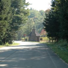
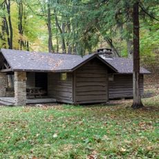
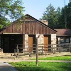
The park has picnic tables, restrooms, and a parking area at the junction of Linn Run Road and Laurel Summit Road, which makes it easy to find. Weather on the summit can shift quickly, and the trails are steep in places, so solid footwear is a good idea.

The elevation creates a pocket of cooler air year-round that draws in plants not found in the valleys below, packing several different habitats into a short walk. Visitors who come in summer may notice the temperature drop noticeably as they climb toward the summit.

The community of curious travelers

AroundUs brings together thousands of curated places, local tips, and hidden gems, enriched daily by 60,000 contributors worldwide.

Start exploring
Location
Inception
1964
GPS coordinates
40.11780,-79.17500
Latest update
March 3, 2026 13:53
Around this place
United States of America

Idlewild and Soak Zone

18.3 km
Laurel Hill State Park
United States of America

Laurel Hill State Park

13.7 km
Linn Run State Park
United States of America

Linn Run State Park

6.4 km
Forbes State Forest
United States of America

Forbes State Forest

10.7 km
Pennsylvania Railroad 3750
United States of America

Pennsylvania Railroad 3750

15.1 km
Rollo Coaster
United States of America

Rollo Coaster

18.3 km
Kooser State Park
United States of America

Kooser State Park

7.9 km
Wild Mouse
United States of America

Wild Mouse

18.2 km
Somerset County Courthouse
United States of America

Somerset County Courthouse

14.6 km
Daniel B. Zimmerman Mansion
United States of America

Daniel B. Zimmerman Mansion

13.7 km
Somerset Historical Center
United States of America

Somerset Historical Center

9.5 km
Trostletown Bridge
United States of America

Trostletown Bridge

19.7 km
Barronvale Bridge
United States of America

Barronvale Bridge

20.1 km
Uptown Somerset Historic District
United States of America

Uptown Somerset Historic District

14.4 km
Matthew Hair Farm
United States of America

Matthew Hair Farm

16.5 km
King's Bridge
United States of America

King's Bridge

21.7 km
Fort Ligonier
United States of America

Fort Ligonier

14.7 km
Boswell Historic District
United States of America

Boswell Historic District

13.5 km
Ligonier Historic District
United States of America

Ligonier Historic District

14.9 km
Stoystown Historic District
United States of America

Stoystown Historic District

18.9 km
Walter's Mill Bridge
United States of America

Walter's Mill Bridge

10.1 km
Bridge in Jenner Township
United States of America

Bridge in Jenner Township

15 km
Kooser State Park Family Cabin District
United States of America

Kooser State Park Family Cabin District

8.2 km
Laurel Mountain State Park
United States of America

Laurel Mountain State Park

5.3 km
Linn Run State Park Family Cabin District
United States of America

Linn Run State Park Family Cabin District

5.4 km
Antiochian Village Conference Center
United States of America

Antiochian Village Conference Center

20.4 km
Laurel Hill RDA
United States of America

Laurel Hill RDA

14.1 km
Ligonier Valley Library
United States of America

Ligonier Valley Library

15 km
Show the full map
Reviews
Share your experience

No review yet

Discussions
Start a discussion...

No discussion yet

« Laurel Summit State Park - Mountain state park in Cook Township, Pennsylvania, United States » is provided by Around Us (aroundus.com). Images and texts are derived from Wikimedia project under a Creative Commons license. You are allowed to copy, distribute, and modify copies of this page, under the conditions set by the license, as long as this note is clearly visible.

Discover hidden gems everywhere you go!

From secret cafés to breathtaking viewpoints, skip the crowded tourist spots and find places that match your style. Our app makes it easy with voice search, smart filtering, route optimization, and insider tips from travelers worldwide. Download now for the complete mobile experience.

Around Us App Screenshot

A unique approach to discovering new places

Le Figaro

All the places worth exploring

France Info

A tailor-made excursion in just a few clicks

20 Minutes

Around Us
Travel Guide & Maps
Download

Send to your phone

QR Code
1

Open the camera app on your mobile.

2

Point at the QR code with your camera. A notification will appear.

3

Tap the notification to open the link.