Enable Location

We need your location to show you interesting places around you

Discover nearby places

Find interesting locations and hidden gems around you

Precise directions

Get accurate directions and distances to places

Your location is never shared with other users. It's only used when you tap the location button.

Lenape Bridge

Log in to your account

Start exploring — it's free

Trusted by 62,783 travelers worldwide

Continue with Google
Continue with Apple
or

We will send you a code to connect

By continuing, you accept our Terms and Conditions and our Privacy Policy

Check your inbox

We've sent a pincode in your inbox. Please enter the code below.

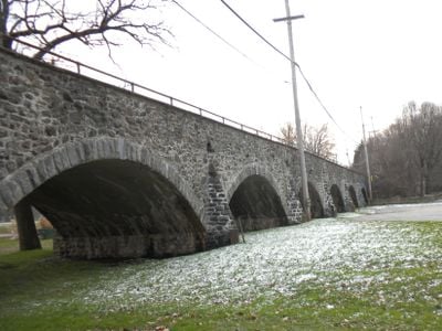
Lenape Bridge, bridge in United States of America

The Lenape Bridge is a stone arch bridge in Pennsylvania completed in 1912 that spans over a floodplain section of Brandywine Creek. The structure features seven arches, measures approximately 308 feet long and 21 feet wide, with the main span extending about 44 feet.

The bridge was constructed between 1911 and 1912 by Corcoran Construction Company under engineer Nathan R. Rambo, using stone salvaged from a demolished nearby mill and local structures. It replaced an earlier wooden bridge and was added to the National Register of Historic Places in 1988.

The bridge takes its name from the Lenape people who originally inhabited the region. Today it serves as a visual landmark in the rural landscape, connecting generations of travelers and offering a tangible link to the area's past.

The bridge is accessible from Pennsylvania Route 52 and remains open to vehicle traffic, though the two lanes are narrow enough to require caution when meeting oncoming cars. The location near Brandywine Picnic Park allows you to combine a visit with exploring the surrounding creek area.

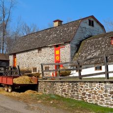
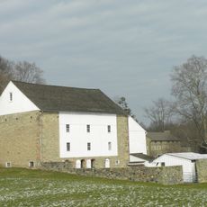
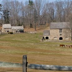
Some of the stone used to build the bridge came from a historic mill that was demolished to make room for the new structure. This recycling of local materials shows how older buildings contributed to new infrastructure projects.

The community of curious travelers

AroundUs brings together thousands of curated places, local tips, and hidden gems, enriched daily by 60,000 contributors worldwide.

Start exploring
Location
GPS coordinates
39.91500,-75.62970
Latest update
February 9, 2026 07:44
Around this place
Birmingham Friends Meeting
United States of America

Birmingham Friends Meeting

3.2 km
Butler House
United States of America

Butler House

4.7 km
Brinton's Mill
United States of America

Brinton's Mill

4 km
Philips Memorial Building
United States of America

Philips Memorial Building

4.9 km
West Chester State College Quadrangle Historic District
United States of America

West Chester State College Quadrangle Historic District

4.9 km
Trimbleville Historic District
United States of America

Trimbleville Historic District

4.9 km
Edgewood
United States of America

Edgewood

3.7 km
Barns-Brinton House
United States of America

Barns-Brinton House

4.7 km
William Harvey House
United States of America

William Harvey House

4.4 km
Sharples Homestead
United States of America

Sharples Homestead

5.1 km
Birmingham Orthodox Friends Meetinghouse
United States of America

Birmingham Orthodox Friends Meetinghouse

3.3 km
Old Library
United States of America

Old Library

4.9 km
George Brinton House
United States of America

George Brinton House

4.6 km
Strode's Mill
United States of America

Strode's Mill

1.8 km
New Century Clubhouse
United States of America

New Century Clubhouse

5.2 km
Sharpless Homestead
United States of America

Sharpless Homestead

2.1 km
Parkersville Friends Meetinghouse
United States of America

Parkersville Friends Meetinghouse

3.5 km
Brinton-King Farmstead
United States of America

Brinton-King Farmstead

4.6 km
Hance House and Barn
United States of America

Hance House and Barn

2.4 km
Wilkinson House
United States of America

Wilkinson House

3.3 km
Edward Brinton House
United States of America

Edward Brinton House

3.5 km
Derbydown Homestead
United States of America

Derbydown Homestead

5 km
East Bradford Boarding School for Boys
United States of America

East Bradford Boarding School for Boys

1.9 km
Strode's Mill Historic District
United States of America

Strode's Mill Historic District

1.8 km
Daniel Davis House and Barn
United States of America

Daniel Davis House and Barn

2.5 km
Taylor-Cope Historic District
United States of America

Taylor-Cope Historic District

5.1 km
Worth-Jefferis Rural Historic District
United States of America

Worth-Jefferis Rural Historic District

3.2 km
Carter-Worth House and Farm
United States of America

Carter-Worth House and Farm

4.7 km
Show the full map
« Lenape Bridge - bridge in United States of America » is provided by Around Us (aroundus.com). Images and texts are derived from Wikimedia project under a Creative Commons license. You are allowed to copy, distribute, and modify copies of this page, under the conditions set by the license, as long as this note is clearly visible.

Discover hidden gems everywhere you go!

From secret cafés to breathtaking viewpoints, skip the crowded tourist spots and find places that match your style. Our app makes it easy with voice search, smart filtering, route optimization, and insider tips from travelers worldwide. Download now for the complete mobile experience.

Around Us App Screenshot

A unique approach to discovering new places

Le Figaro

All the places worth exploring

France Info

A tailor-made excursion in just a few clicks

20 Minutes

Around Us
Travel Guide & Maps
Download

Send to your phone

QR Code
1

Open the camera app on your mobile.

2

Point at the QR code with your camera. A notification will appear.

3

Tap the notification to open the link.