Enable Location

We need your location to show you interesting places around you

Discover nearby places

Find interesting locations and hidden gems around you

Precise directions

Get accurate directions and distances to places

Your location is never shared with other users. It's only used when you tap the location button.

Trimbleville Historic District

Log in to your account

Start exploring — it's free

Trusted by 62,791 travelers worldwide

Continue with Google
Continue with Apple
or

We will send you a code to connect

By continuing, you accept our Terms and Conditions and our Privacy Policy

Check your inbox

We've sent a pincode in your inbox. Please enter the code below.

Trimbleville Historic District, National Register Historic District in Chester County, US.

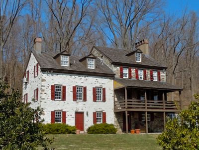
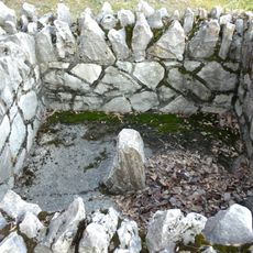
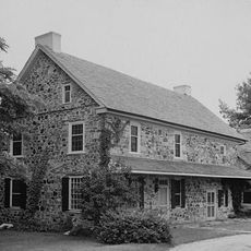
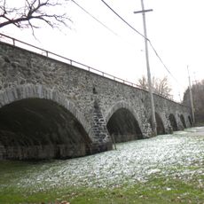
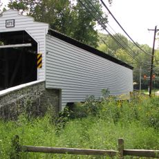
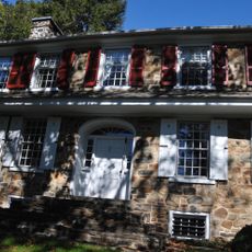
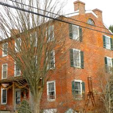
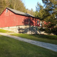
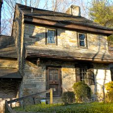
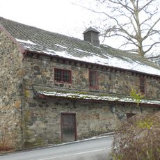
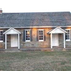
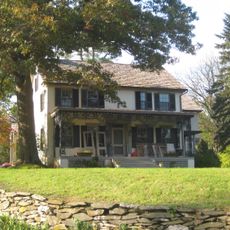
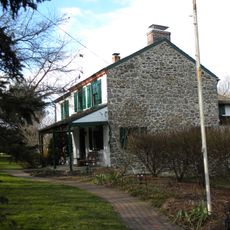
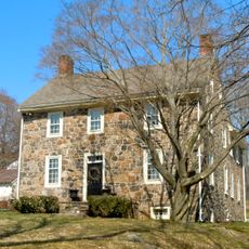
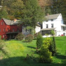
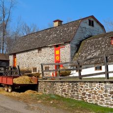
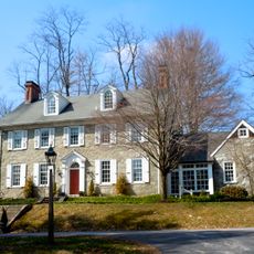
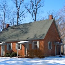
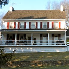
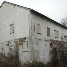
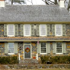
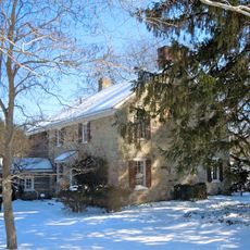
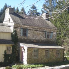
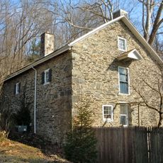
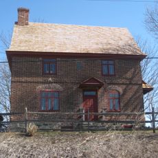
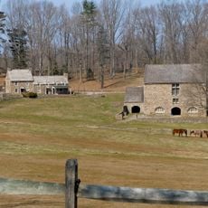
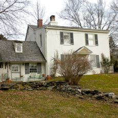
Trimbleville Historic District is an area along the Brandywine River with buildings from the Colonial and Federal periods. The district covers several hundred acres of land with farmhouses, a mill, a blacksmith shop, and other structures from rural America in the 18th century.

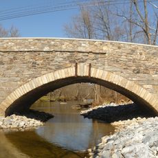
The area was established in 1744 and played a role during the American Revolution. In 1777, British troops crossed the river nearby during the Battle of Brandywine.

The buildings here date from the 18th century and show how rural communities were organized back then. You can still see farms, a mill, and craft workshops that reflect how people lived and worked in early America.

The best way to explore the area is on foot or by car along local roads. There are several routes and paths that lead through the historic grounds, letting visitors see the various structures at their own pace.

One family owned this place for over 200 years and shaped its development from the 18th century until the mid-20th century. This long continuity is rare and helped the area keep its original structure intact.

The community of curious travelers

AroundUs brings together thousands of curated places, local tips, and hidden gems, enriched daily by 60,000 contributors worldwide.

Start exploring
Location
GPS coordinates
39.93194,-75.68222
Latest update
December 14, 2025 15:00
Around this place
Star Gazers' Stone
United States of America

Star Gazers' Stone

4.3 km
Cope's Bridge
United States of America

Cope's Bridge

3.8 km
Humphry Marshall House
United States of America

Humphry Marshall House

2.1 km
Lenape Bridge
United States of America

Lenape Bridge

4.9 km
Gibson's Covered Bridge
United States of America

Gibson's Covered Bridge

4.9 km
Col. John Hannum House
United States of America

Col. John Hannum House

4.5 km
Unionville Village Historic District
United States of America

Unionville Village Historic District

6.2 km
Mountain Meadow Farm
United States of America

Mountain Meadow Farm

5.5 km
Temple-Webster-Stoner House
United States of America

Temple-Webster-Stoner House

2.2 km
Strode's Mill
United States of America

Strode's Mill

5.5 km
Parkersville Friends Meetinghouse
United States of America

Parkersville Friends Meetinghouse

6 km
Jacob Hayes House
United States of America

Jacob Hayes House

4.6 km
Northbrook Historic District
United States of America

Northbrook Historic District

1.4 km
Hance House and Barn
United States of America

Hance House and Barn

2.5 km
Wilkinson House
United States of America

Wilkinson House

1.6 km
Embreeville Historic District
United States of America

Embreeville Historic District

6.2 km
Derbydown Homestead
United States of America

Derbydown Homestead

833 m
East Bradford Boarding School for Boys
United States of America

East Bradford Boarding School for Boys

5.4 km
Marlborough Village Historic District
United States of America

Marlborough Village Historic District

4 km
Baily Farm
United States of America

Baily Farm

2.6 km
Strode's Mill Historic District
United States of America

Strode's Mill Historic District

5.5 km
Taylor House
United States of America

Taylor House

3.4 km
Gideon Wickersham Farmstead
United States of America

Gideon Wickersham Farmstead

4.9 km
Hayes Mill House
United States of America

Hayes Mill House

4.5 km
Paradise Valley Historic District
United States of America

Paradise Valley Historic District

6 km
Taylor-Cope Historic District
United States of America

Taylor-Cope Historic District

4.2 km
Worth-Jefferis Rural Historic District
United States of America

Worth-Jefferis Rural Historic District

2.5 km
Hayes Homestead
United States of America

Hayes Homestead

4.6 km
Show the full map
« Trimbleville Historic District - National Register Historic District in Chester County, US » is provided by Around Us (aroundus.com). Images and texts are derived from Wikimedia project under a Creative Commons license. You are allowed to copy, distribute, and modify copies of this page, under the conditions set by the license, as long as this note is clearly visible.

Discover hidden gems everywhere you go!

From secret cafés to breathtaking viewpoints, skip the crowded tourist spots and find places that match your style. Our app makes it easy with voice search, smart filtering, route optimization, and insider tips from travelers worldwide. Download now for the complete mobile experience.

Around Us App Screenshot

A unique approach to discovering new places

Le Figaro

All the places worth exploring

France Info

A tailor-made excursion in just a few clicks

20 Minutes

Around Us
Travel Guide & Maps
Download

Send to your phone

QR Code
1

Open the camera app on your mobile.

2

Point at the QR code with your camera. A notification will appear.

3

Tap the notification to open the link.