Chest opened
+${chestReward.xp} XP
Explorer
NOUVEAU ×${chestReward.collectible.quantity}
tapez pour fermer
Chest locked

Open chests in the app

Around Us is built for your phone — chests unlock when you walk, explore and capture nearby places.

Enable Location

We need your location to show you interesting places around you

Discover nearby places

Find interesting locations and hidden gems around you

Precise directions

Get accurate directions and distances to places

Your location is never shared with other users. It's only used when you tap the location button.

Log in to your account

Start exploring — it's free

Trusted by 72,978 travelers worldwide

Continue with Google
Continue with Apple
or

We will send you a code to connect

By continuing, you accept our Terms and Conditions and our Privacy Policy

Check your inbox

We've sent a pincode in your inbox. Please enter the code below.

Lincoln Hills
Discussion Reviews Photo
4.4k Popularity

Lincoln Hills, Hill group near Mississippi River in Missouri, US

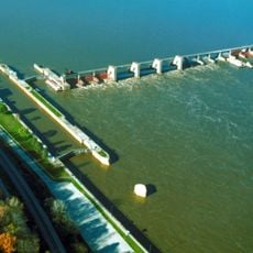
Lincoln Hills is a hill group extending along the Mississippi River across Lincoln, Pike, Ralls, and Marion counties in Missouri. The landscape features limestone-based formations that have created natural bluffs, glades, caves, springs, and sinkholes throughout the region.

These hills formed over millions of years through geological processes and contain rock layers from the Ordovician through Mississippian periods. During glaciation, the region survived as isolated high points while surrounding northern Missouri plains were covered by ice.

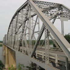
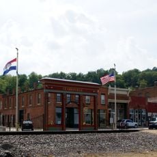
The Cuivre River State Park, located within Lincoln Hills northeast of Troy, provides numerous opportunities for outdoor recreation and nature exploration.

Access is best gained through nearby parks and natural entry points where you can hike along the river or explore the bluffs. Wear sturdy shoes, as limestone surfaces are uneven and can be slippery in places.

The rock exposures here display multiple geological layers stacked together from different periods of Earth history. Visitors can see these different materials and colors clearly and experience a direct view into ancient geology.

The community of curious travelers

AroundUs brings together thousands of curated places, local tips, and hidden gems, enriched daily by 60,000 contributors worldwide.

Start exploring
GPS coordinates
39.40000,-91.10000
Latest update
December 11, 2025 11:02
Around this place
Lock and Dam No. 22
United States of America

Lock and Dam No. 22

29.4 km
Champ Clark Bridge
United States of America

Champ Clark Bridge

7.7 km
Lock and Dam No. 24
United States of America

Lock and Dam No. 24

16.7 km
Clarence Cannon National Wildlife Refuge
United States of America

Clarence Cannon National Wildlife Refuge

31 km
North Third Street Historic District
United States of America

North Third Street Historic District

7.4 km
James Beauchamp Clark House
United States of America

James Beauchamp Clark House

10.2 km
Ralls County Courthouse and Jail-Sheriff's House
United States of America

Ralls County Courthouse and Jail-Sheriff's House

33.1 km
Gov. Lloyd Crow Stark House and Carriage House
United States of America

Gov. Lloyd Crow Stark House and Carriage House

6.1 km
John Shastid House
United States of America

John Shastid House

34.2 km
Louisiana Public Library
United States of America

Louisiana Public Library

7.2 km
Bethel Chapel AME Church
United States of America

Bethel Chapel AME Church

7 km
Georgia Street Historic District
United States of America

Georgia Street Historic District

7 km
Clarksville Historic District
United States of America

Clarksville Historic District

17.2 km
Pittsfield East School
United States of America

Pittsfield East School

34.2 km
St. John's Episcopal Church
United States of America

St. John's Episcopal Church

18.5 km
Pike County Hospital
United States of America

Pike County Hospital

5.6 km
Charles Bacon House
United States of America

Charles Bacon House

6.8 km
Clifford-Wyrick House
United States of America

Clifford-Wyrick House

17.1 km
Turner-Pharr House
United States of America

Turner-Pharr House

16.9 km
Capt. George and Attella Barnard House
United States of America

Capt. George and Attella Barnard House

5.6 km
United States of America

Northern Methodist Episcopal Church of Clarksville

17.3 km
Luce-Dyer House
United States of America

Luce-Dyer House

7.2 km
Barry Historic District
United States of America

Barry Historic District

33.2 km
Lyman Scott House
United States of America

Lyman Scott House

22.5 km
Goodman–Stark House
United States of America

Goodman–Stark House

7.4 km
Meloan, Cummins & Co., General Store
United States of America

Meloan, Cummins & Co., General Store

23 km
Saverton School
United States of America

Saverton School

30.5 km
Star Theatre
United States of America

Star Theatre

33 km
Show the full map
Reviews
Share your experience

No review yet

Discussions
Start a discussion...

No discussion yet

« Lincoln Hills - Hill group near Mississippi River in Missouri, US » is provided by Around Us (aroundus.com). Images and texts are derived from Wikimedia project under a Creative Commons license. You are allowed to copy, distribute, and modify copies of this page, under the conditions set by the license, as long as this note is clearly visible.

Discover hidden gems everywhere you go!

From secret cafés to breathtaking viewpoints, skip the crowded tourist spots and find places that match your style. Our app makes it easy with voice search, smart filtering, route optimization, and insider tips from travelers worldwide. Download now for the complete mobile experience.

Around Us App Screenshot

A unique approach to discovering new places

Le Figaro

All the places worth exploring

France Info

A tailor-made excursion in just a few clicks

20 Minutes

Around Us
Travel Guide & Maps
Download

Send to your phone

QR Code
1

Open the camera app on your mobile.

2

Point at the QR code with your camera. A notification will appear.

3

Tap the notification to open the link.