Enable Location

We need your location to show you interesting places around you

Discover nearby places

Find interesting locations and hidden gems around you

Precise directions

Get accurate directions and distances to places

Your location is never shared with other users. It's only used when you tap the location button.

Midtown Greenway

Log in to your account

Start exploring — it's free

Trusted by 63,488 travelers worldwide

Continue with Google
Continue with Apple
or

We will send you a code to connect

By continuing, you accept our Terms and Conditions and our Privacy Policy

Check your inbox

We've sent a pincode in your inbox. Please enter the code below.

Discussion Reviews 2 Photos
6k Popularity

Midtown Greenway, historic place and shared-use path in Minneapolis

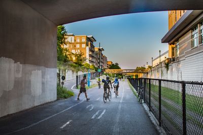
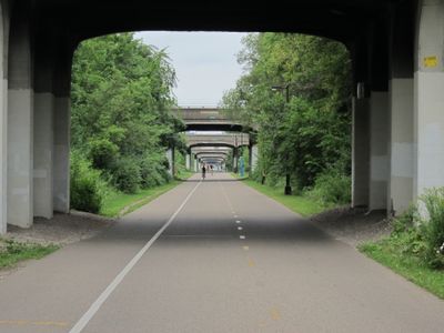
The Midtown Greenway is a shared-use trail about 5.7 miles long that runs through Minneapolis along a former railroad corridor. The flat path features bridges, tunnels, and trenches that allow safe travel without car traffic and connects parks, lakes, and neighborhoods from the Uptown area to the Mississippi River.

The railroad line was built between 1879 and 1881 to carry goods and passengers, and in 1910 Minneapolis buried it between certain streets to improve safety. The trail opened in stages starting in 2000 and became a continuous route by 2006, with historic bridges and structures over 100 years old preserved and recognized in 1989.

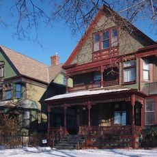
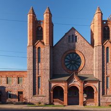
The trail runs alongside Lake Street, where shops and restaurants reflect the neighborhood's diverse communities. Daily use by people from many backgrounds makes it a shared space where different parts of the city come together.

The trail is open year-round and lit at night, with safe passages under bridges or on raised paths above traffic. Users should stay on their side, use hand signals, and watch for others, especially when crossing streets, to prevent accidents.

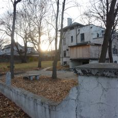
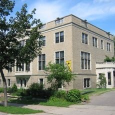
Historic railroad bridges and structures still stand along the route, dating back over 100 years and serving as reminders of the city's past transportation system. These preserved structures are a rare example of urban infrastructure being repurposed while maintaining its historical character.

The community of curious travelers

AroundUs brings together thousands of curated places, local tips, and hidden gems, enriched daily by 60,000 contributors worldwide.

Start exploring
Location
GPS coordinates
44.95000,-93.28610
Latest update
February 7, 2026 11:01
Around this place
Minneapolis Institute of Art
United States of America

Minneapolis Institute of Art

1.3 km
White Castle Building No. 8
United States of America

White Castle Building No. 8

760 m
American Swedish Institute
United States of America

American Swedish Institute

1.7 km
Temple Israel
United States of America

Temple Israel

1.3 km
George W. and Nancy B. Van Dusen House
United States of America

George W. and Nancy B. Van Dusen House

1.6 km
Purcell-Cutts House
United States of America

Purcell-Cutts House

1.5 km
Purcell-Cutts House
United States of America

Purcell-Cutts House

1.6 km
Washburn-Fair Oaks Mansion District
United States of America

Washburn-Fair Oaks Mansion District

1.5 km
Walker Library
United States of America

Walker Library

921 m
Minneapolis Scottish Rite Temple
United States of America

Minneapolis Scottish Rite Temple

1.5 km
Minnesota Zen Center
United States of America

Minnesota Zen Center

1.6 km
George R. Newell House
United States of America

George R. Newell House

1.7 km
John G. and Minnie Gluek House and Carriage House
United States of America

John G. and Minnie Gluek House and Carriage House

908 m
Buzza Company Building
United States of America

Buzza Company Building

501 m
Healy Block Residential Historic District
United States of America

Healy Block Residential Historic District

1.1 km
Children's Theatre Company
United States of America

Children's Theatre Company

1.3 km
Bardwell–Ferrant House
United States of America

Bardwell–Ferrant House

1.7 km
Redeemer Missionary Baptist Church
United States of America

Redeemer Missionary Baptist Church

983 m
Anne C. and Frank B. Semple House
United States of America

Anne C. and Frank B. Semple House

1.5 km
Edwin H. Hewitt House
United States of America

Edwin H. Hewitt House

1.7 km
Elisha and Lizzie Morse Jr. House
United States of America

Elisha and Lizzie Morse Jr. House

1.3 km
Bennett–McBride House
United States of America

Bennett–McBride House

1.1 km
圣斯德望堂 (明尼阿波利斯)
United States of America

圣斯德望堂 (明尼阿波利斯)

1.7 km
卫理公会福勒堂
United States of America

卫理公会福勒堂

1.5 km
Hennepin History Museum
United States of America

Hennepin History Museum

1.6 km
Clinton Field Park
United States of America

Clinton Field Park

1.5 km
Lagoon Cinema
United States of America

Lagoon Cinema

835 m
Suburban World Theatre
United States of America

Suburban World Theatre

1 km
Show the full map
Reviews
Share your experience

No review yet

Discussions
Start a discussion...

No discussion yet

« Midtown Greenway - historic place and shared-use path in Minneapolis » is provided by Around Us (aroundus.com). Images and texts are derived from Wikimedia project under a Creative Commons license. You are allowed to copy, distribute, and modify copies of this page, under the conditions set by the license, as long as this note is clearly visible.

Discover hidden gems everywhere you go!

From secret cafés to breathtaking viewpoints, skip the crowded tourist spots and find places that match your style. Our app makes it easy with voice search, smart filtering, route optimization, and insider tips from travelers worldwide. Download now for the complete mobile experience.

Around Us App Screenshot

A unique approach to discovering new places

Le Figaro

All the places worth exploring

France Info

A tailor-made excursion in just a few clicks

20 Minutes

Around Us
Travel Guide & Maps
Download

Send to your phone

QR Code
1

Open the camera app on your mobile.

2

Point at the QR code with your camera. A notification will appear.

3

Tap the notification to open the link.