Enable Location

We need your location to show you interesting places around you

Discover nearby places

Find interesting locations and hidden gems around you

Precise directions

Get accurate directions and distances to places

Your location is never shared with other users. It's only used when you tap the location button.

Oliver High School

Log in to your account

Start exploring — it's free

Trusted by 62,374 travelers worldwide

Continue with Google
Continue with Apple
or

We will send you a code to connect

By continuing, you accept our Terms and Conditions and our Privacy Policy

Check your inbox

We've sent a pincode in your inbox. Please enter the code below.

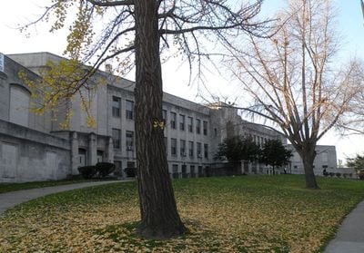
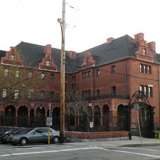
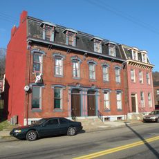
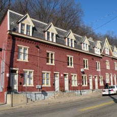
Oliver High School, public school in the United States

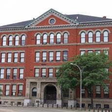
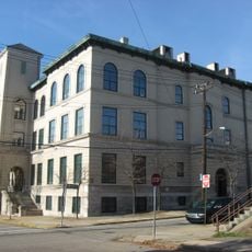
Oliver High School is a large brick building with Art Deco style features on its exterior in Pittsburgh's Northside area. The sturdy entrance, multiple windows, and detailed stonework show traditional craftsmanship typical of school buildings from the early 1900s.

The building was constructed in 1924 and opened in 1925 on land that was formerly a landfill. It was named after David B. Oliver, the school administrator who expanded Pittsburgh's education system in the early 1900s.

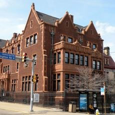
The school was named after David B. Oliver, an education leader who shaped Pittsburgh's school system in the early 1900s. This name carries meaning for former students and neighbors who remember how the building served as a gathering place for generations of families in the Northside community.

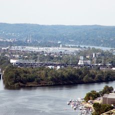
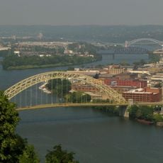
The building is located in Pittsburgh's Northside area surrounded by shops and parks. Visitors can view the exterior architecture and stonework details from the street, as the structure is no longer in daily school operation.

The school was built in 1924 on land that was previously a landfill, connecting its founding to local change and urban renewal. This unexpected history shows how the city transformed an old dumping site into a place for education.

The community of curious travelers

AroundUs brings together thousands of curated places, local tips, and hidden gems, enriched daily by 60,000 contributors worldwide.

Start exploring
Location
Inception
1925
GPS coordinates
40.46389,-80.02583
Latest update
February 7, 2026 11:00
Around this place
Mattress Factory
United States of America

Mattress Factory

1.4 km
Randyland
United States of America

Randyland

1.5 km
National Aviary
United States of America

National Aviary

1.8 km
State Correctional Institution – Pittsburgh
United States of America

State Correctional Institution – Pittsburgh

1.5 km
Brunot Island
United States of America

Brunot Island

1.5 km
West End Bridge
United States of America

West End Bridge

2 km
Bicycle Heaven
United States of America

Bicycle Heaven

1 km
Allegheny High School
United States of America

Allegheny High School

1.9 km
Emmanuel Episcopal Church
United States of America

Emmanuel Episcopal Church

1.3 km
Ohio Connecting Railroad Bridge
United States of America

Ohio Connecting Railroad Bridge

1.5 km
Conroy Education Center
United States of America

Conroy Education Center

360 m
Calvary United Methodist Church
United States of America

Calvary United Methodist Church

1.4 km
Ferris House
United States of America

Ferris House

1.6 km
Byers-Lyons House
United States of America

Byers-Lyons House

1.8 km
William Penn Snyder House
United States of America

William Penn Snyder House

1.7 km
B. F. Jones House
United States of America

B. F. Jones House

1.8 km
Anderson Manor
United States of America

Anderson Manor

1 km
Heathside Cottage
United States of America

Heathside Cottage

1.9 km
841 North Lincoln Avenue
United States of America

841 North Lincoln Avenue

1.7 km
John A. Brashear House and Factory
United States of America

John A. Brashear House and Factory

1.1 km
Swindell Bridge
United States of America

Swindell Bridge

2 km
Malta Temple
United States of America

Malta Temple

1.8 km
Houses at 838–862 Brightridge Street
United States of America

Houses at 838–862 Brightridge Street

639 m
Engine Company No. 3
United States of America

Engine Company No. 3

1.5 km
House at 200 West North Avenue
United States of America

House at 200 West North Avenue

1.6 km
Hoene-Werle House
United States of America

Hoene-Werle House

1.6 km
Old Allegheny Rows Historic District
United States of America

Old Allegheny Rows Historic District

758 m
Houses at 2501–2531 Charles Street
United States of America

Houses at 2501–2531 Charles Street

715 m
Show the full map
« Oliver High School - public school in the United States » is provided by Around Us (aroundus.com). Images and texts are derived from Wikimedia project under a Creative Commons license. You are allowed to copy, distribute, and modify copies of this page, under the conditions set by the license, as long as this note is clearly visible.

Discover hidden gems everywhere you go!

From secret cafés to breathtaking viewpoints, skip the crowded tourist spots and find places that match your style. Our app makes it easy with voice search, smart filtering, route optimization, and insider tips from travelers worldwide. Download now for the complete mobile experience.

Around Us App Screenshot

A unique approach to discovering new places

Le Figaro

All the places worth exploring

France Info

A tailor-made excursion in just a few clicks

20 Minutes

Around Us
Travel Guide & Maps
Download

Send to your phone

QR Code
1

Open the camera app on your mobile.

2

Point at the QR code with your camera. A notification will appear.

3

Tap the notification to open the link.