Enable Location

We need your location to show you interesting places around you

Discover nearby places

Find interesting locations and hidden gems around you

Precise directions

Get accurate directions and distances to places

Your location is never shared with other users. It's only used when you tap the location button.

Ohio Connecting Railroad Bridge

Log in to your account

Start exploring — it's free

Trusted by 62,892 travelers worldwide

Continue with Google
Continue with Apple
or

We will send you a code to connect

By continuing, you accept our Terms and Conditions and our Privacy Policy

Check your inbox

We've sent a pincode in your inbox. Please enter the code below.

Ohio Connecting Railroad Bridge
Discussion Reviews 1 Photos
2.2k Popularity

Ohio Connecting Railroad Bridge, Railway bridge in Pittsburgh, United States

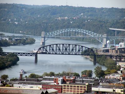
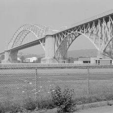
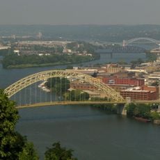
The Ohio Connecting Railroad Bridge is a railway crossing spanning the Ohio River near Brunot's Island in Pittsburgh. Two large steel truss spans support freight trains moving through the region today.

An original single-track structure built in 1890 gave way to a new design in 1915 as freight traffic through Pittsburgh increased significantly. This replacement reflected the region's growing industrial demands.

The bridge represents Pennsylvania's industrial evolution, connecting various regional railway routes that supported manufacturing and commercial development throughout the 20th century.

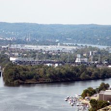
The bridge is visible from public areas near Brunot's Island, though direct access is restricted to railway property. Visitors can best view the structure from riverbanks or nearby roads.

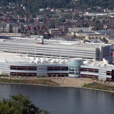
The original structure included a central car lift system designed specifically to deliver coal to the power plant on Brunot's Island. This mechanical solution allowed heavy loads to move efficiently across the river.

The community of curious travelers

AroundUs brings together thousands of curated places, local tips, and hidden gems, enriched daily by 60,000 contributors worldwide.

Start exploring
Location
Official opening
1915
GPS coordinates
40.46280,-80.04290
Latest update
December 13, 2025 17:08
Around this place
Acrisure Stadium
United States of America

Acrisure Stadium

2.9 km
Mattress Factory
United States of America

Mattress Factory

2.7 km
Rivers Casino
United States of America

Rivers Casino

2.5 km
Carnegie Science Center
United States of America

Carnegie Science Center

2.8 km
Randyland
United States of America

Randyland

2.9 km
Allegheny Observatory
United States of America

Allegheny Observatory

2.9 km
Brunot Island
United States of America

Brunot Island

46 m
McKees Rocks Bridge
United States of America

McKees Rocks Bridge

1.7 km
West End Bridge
United States of America

West End Bridge

2.3 km
Riverview Park
United States of America

Riverview Park

2.8 km
West End Overlook
United States of America

West End Overlook

2 km
Bicycle Heaven
United States of America

Bicycle Heaven

1.2 km
Emmanuel Episcopal Church
United States of America

Emmanuel Episcopal Church

2.3 km
Calvary United Methodist Church
United States of America

Calvary United Methodist Church

2.4 km
Byers-Lyons House
United States of America

Byers-Lyons House

2.7 km
William Penn Snyder House
United States of America

William Penn Snyder House

2.7 km
B. F. Jones House
United States of America

B. F. Jones House

2.8 km
Anderson Manor
United States of America

Anderson Manor

1.6 km
841 North Lincoln Avenue
United States of America

841 North Lincoln Avenue

2.7 km
West End Branch of the Carnegie Library of Pittsburgh
United States of America

West End Branch of the Carnegie Library of Pittsburgh

2.6 km
John A. Brashear House and Factory
United States of America

John A. Brashear House and Factory

2.5 km
Houses at 838–862 Brightridge Street
United States of America

Houses at 838–862 Brightridge Street

2 km
Engine Company No. 3
United States of America

Engine Company No. 3

2.9 km
USS Requin
United States of America

USS Requin

2.9 km
Hoene-Werle House
United States of America

Hoene-Werle House

2.6 km
Team Pittsburgh Dekhockey
United States of America

Team Pittsburgh Dekhockey

2.4 km
Old Allegheny Rows Historic District
United States of America

Old Allegheny Rows Historic District

2.1 km
Houses at 2501–2531 Charles Street
United States of America

Houses at 2501–2531 Charles Street

2.1 km
Show the full map
« Ohio Connecting Railroad Bridge - Railway bridge in Pittsburgh, United States » is provided by Around Us (aroundus.com). Images and texts are derived from Wikimedia project under a Creative Commons license. You are allowed to copy, distribute, and modify copies of this page, under the conditions set by the license, as long as this note is clearly visible.

Discover hidden gems everywhere you go!

From secret cafés to breathtaking viewpoints, skip the crowded tourist spots and find places that match your style. Our app makes it easy with voice search, smart filtering, route optimization, and insider tips from travelers worldwide. Download now for the complete mobile experience.

Around Us App Screenshot

A unique approach to discovering new places

Le Figaro

All the places worth exploring

France Info

A tailor-made excursion in just a few clicks

20 Minutes

Around Us
Travel Guide & Maps
Download

Send to your phone

QR Code
1

Open the camera app on your mobile.

2

Point at the QR code with your camera. A notification will appear.

3

Tap the notification to open the link.