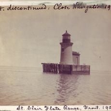
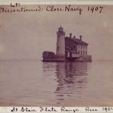
Peche Island Rear Range Light, Cast iron lighthouse in St. Clair County, United States.
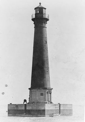
Peche Island Rear Range Light is a cast iron lighthouse with a conical tower rising about 20 meters above the water at the entrance to the Detroit River from Lake St. Clair. The structure was equipped with a Fresnel lens to guide ships safely through this section of the Great Lakes.
The lighthouse was built in 1908 to guide vessels through a newly dredged channel north of Peche Island. It remained active until 1983, marking an important era in improving shipping routes through this part of the Great Lakes.
The lighthouse reflects how people in the early 1900s worked to make the Great Lakes safer for ships passing through narrow channels. Today it serves as a reminder of the role such structures played in supporting water traffic through this busy region.
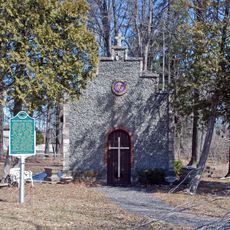
The tower now sits in Lighthouse Park in Marine City, Michigan, where it can be easily visited and observed. The location provides good insight into why lighthouses were essential for shipping on the Great Lakes.
The lighthouse suffered repeated damage from ice and ship collisions before receiving its permanent steel tower design on a concrete pier. These rebuilds reveal how harsh the conditions were on this section of the Great Lakes.
The community of curious travelers
AroundUs brings together thousands of curated places, local tips, and hidden gems, enriched daily by 60,000 contributors worldwide.